Green Country Under Winter Storm Warning Ahead Of Potential Snow & Ice
It will be another mild day across Green Country, but big changes are on the horizon.Tuesday, February 1st 2022, 5:19 pm
TULSA, Oklahoma -
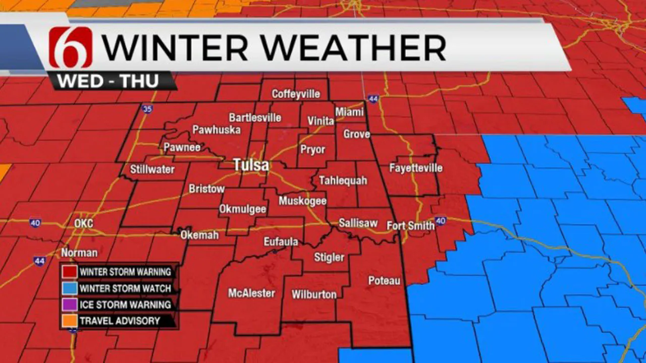
National Weather Service (NWS) Winter Storm Warning issued for Osage, Washington, Nowata, Craig, Ottawa, Pawnee, Tulsa, Rogers, Mayes, Delaware, Creek, Okfuskee, Okmulgee, Wagoner, Cherokee, Adair, Muskogee, and McIntosh counties until 12 a.m. Friday.
It's been another mild day across Oklahoma but big changes are coming overnight.
Here are the details from News On 6 Chief Meteorologist Travis Meyer:
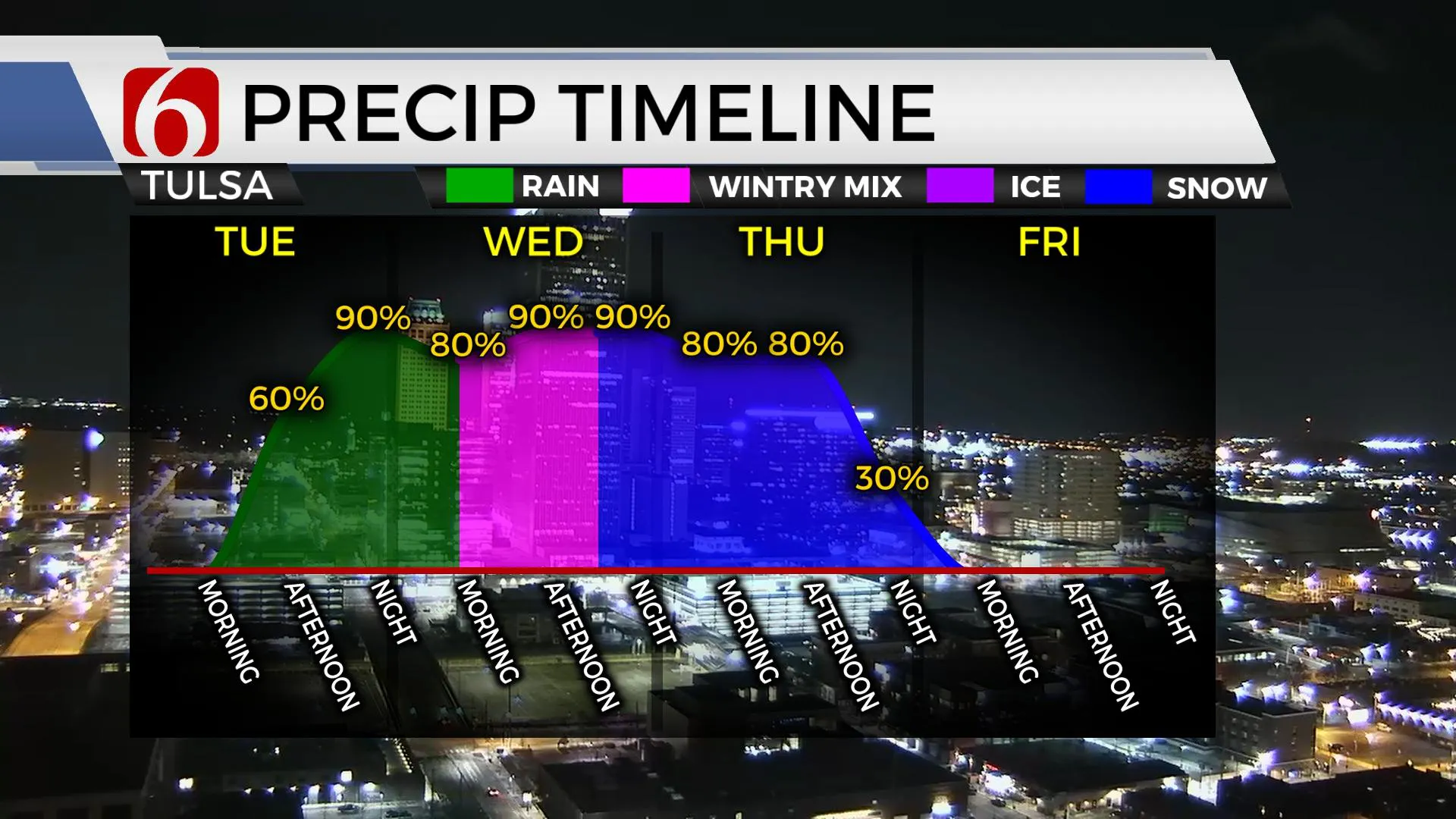
All the new data continues to support our developing storm system will produce a lot of snow for the area starting late Wednesday afternoon. Before the ice, much-needed rain will form Wednesday afternoon & continue off & on
through the night, especially in the NW DMA. Most of this will be showers & maybe a rumble of thunder.
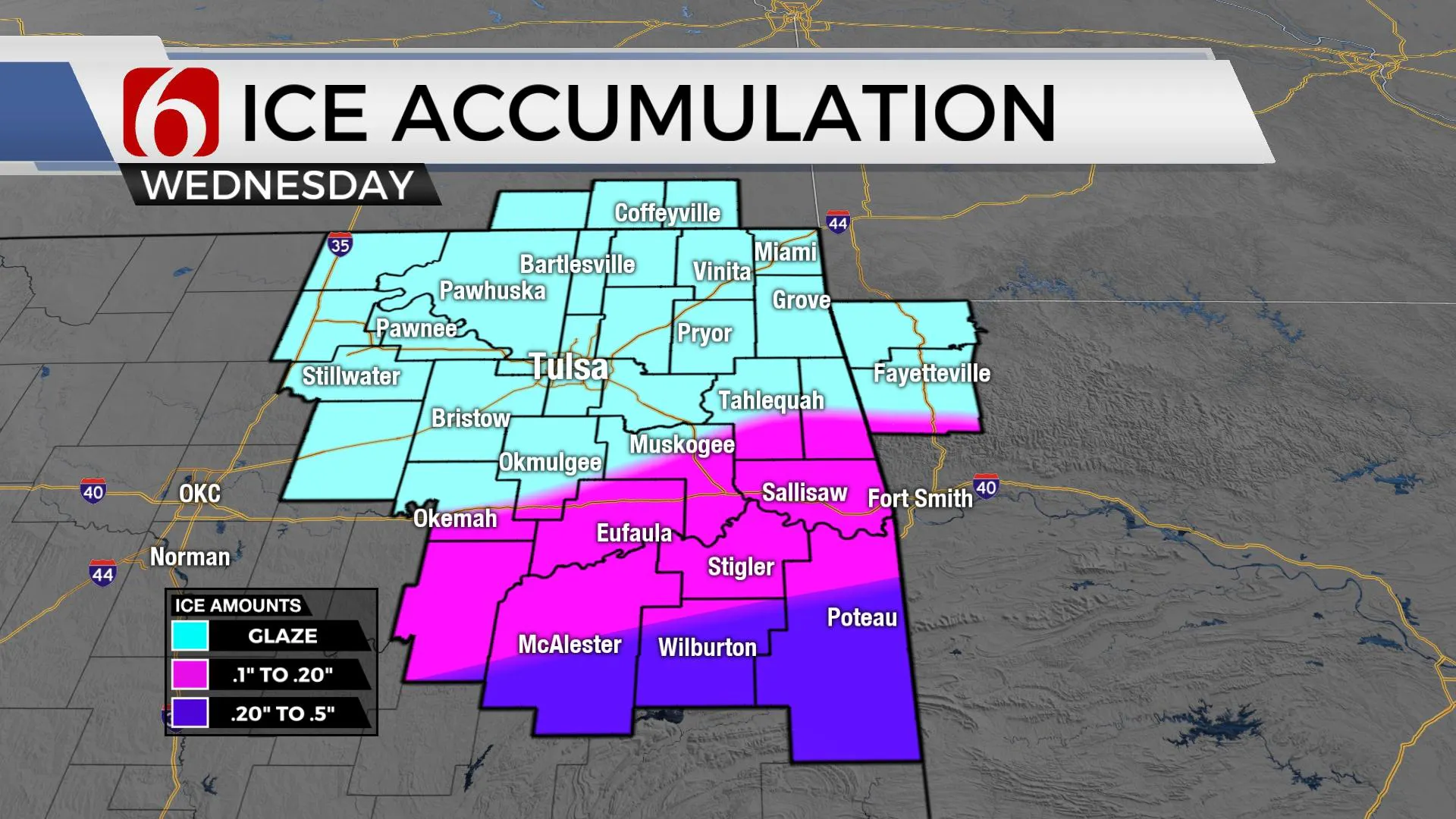
By daybreak, a strong cold front will be positioned from Ft. Smith to McAlester with freezing temps from Grand Lake to Tulsa to OKC. Freezing drizzle/rain will quickly cause a light glaze/coating on elevated surfaces. Most of the day will have temperatures falling to the mid-20s with N winds of 20-30 mph. Additional freezing drizzle will be possible during the day with the heaviest forming across the SE DMA from McAlester to Ft. Smith & especially south of that line. This will be the most likely area for significant icing.


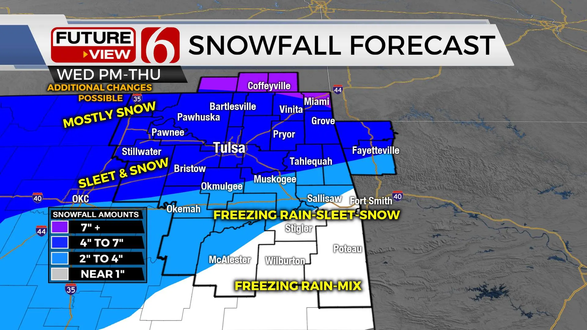
Another wave of energy brings additional moderate snow Thursday afternoon across the northern region with some mixing occurring across far southeastern OK. Impactful amounts of sleet and snow are likely across northern OK ranging from four to seven inches with locally higher amounts along the OK-Kansas state line. A mix of wintry precip from two to four inches will remain possible from I-40 northward to east-central OK. Freezing rain (ice) possibly nearing 0.20 to 0.50 inches will be possible across far southeastern OK. Icing is also possible across part of north Texas during this event.

The amount and duration of sleet will impact the snowfall accumulation. A longer duration of sleet will lower snow amounts. A shorter amount of sleet could increase snow amounts. Wintry forecast accumulation projections are still subject to change with this system. Regardless, impacts to travel are expected. North winds from 20 to 30 mph will be likely during most of the event. Combined with the icing potential, locations across southeastern OK may experience some power outages issues. Additionally, bitterly cold weather will remain through at least Saturday, possibly reaching above freezing for a short period this weekend. Wind chill values are expected in the subzero ranges during the early morning hours of Thursday and Friday.

Thanks for reading the Tuesday morning weather discussion and blog.
Have a super great day!
Alan Crone
KOTV
If you’re into podcasts, check out my daily weather update below. Search for NewsOn6 and ‘Weather Out The Door’ on most podcast providers, including Spotify, Stitcher, Tune-In and down below on Apple.

More Like This
February 1st, 2022
December 11th, 2024
December 11th, 2024
December 11th, 2024
Top Headlines
December 11th, 2024
December 11th, 2024
December 11th, 2024
December 11th, 2024


