Powerful Storm Nearing Soon
Parts of Oklahoma are on high alert on Tuesday as weather conditions are ripe for dangerous wildfires.Tuesday, February 15th 2022, 5:59 am
TULSA, Oklahoma -
Parts of Oklahoma are on high alert on Tuesday as weather conditions are ripe for dangerous wildfires.
Here are the details from News On 6 Meteorologist Alan Crone:
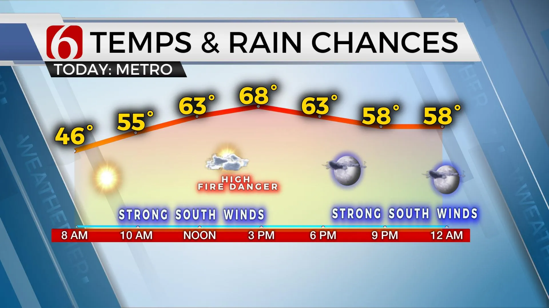
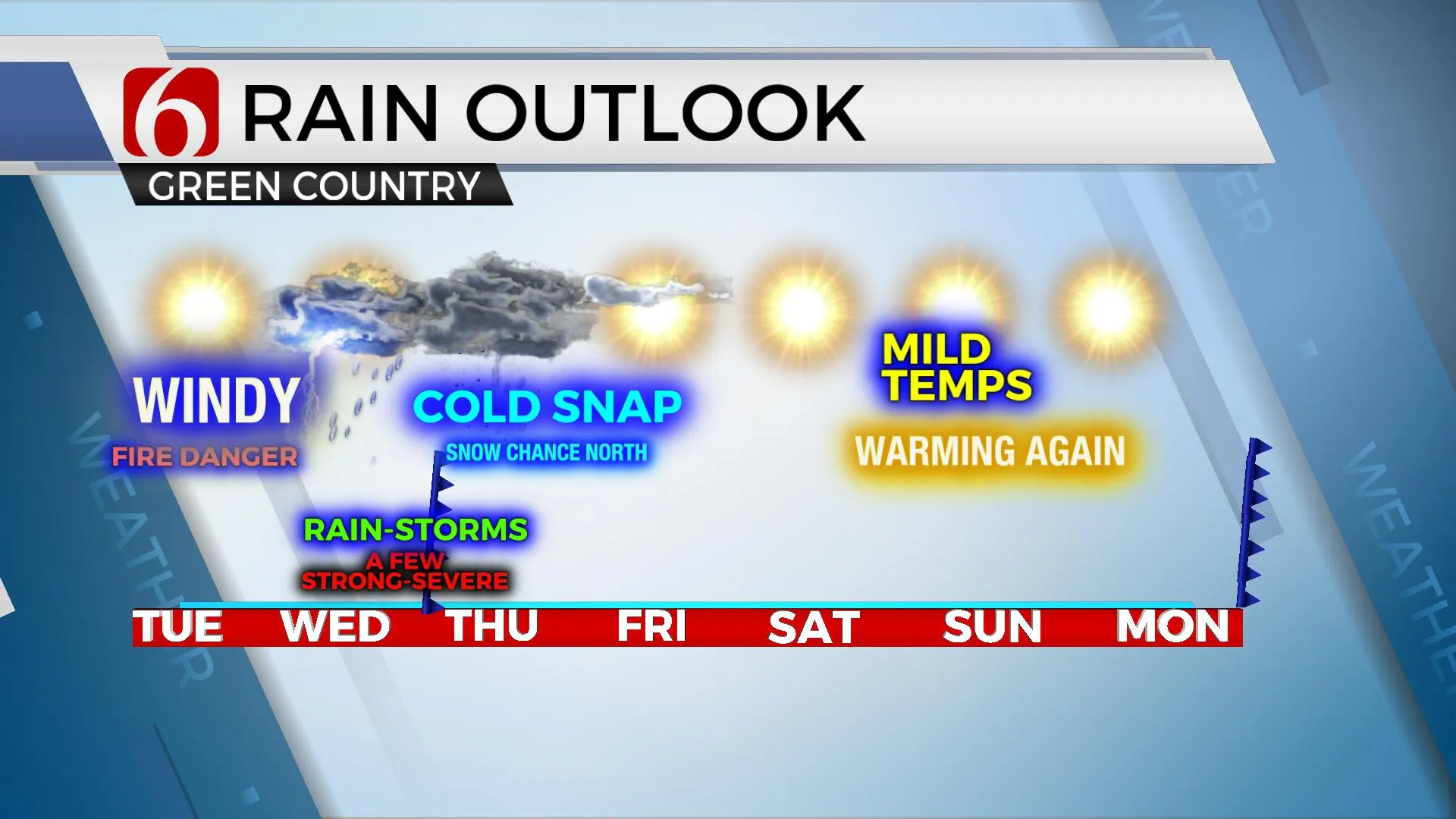
Three separate areas of concern will be noted for the next three days as a powerful upper-level storm system draws closer to the state. The first is the possibility of high fire danger issues on Tuesday, the second potential for strong to near severe storms, and the third is the chance for some wintry weather impacts for some locations across far northern OK and southern Kansas Thursday. Windy weather is likely on Tuesday as a surface low-pressure area develops along the Lee of the Rockies as the powerful upper-level low dives down the west coast. South winds will increase across OK on Tuesday with speeds of 20 to 40 mph across eastern sections and slightly higher top-end gusts across the western half of the state. Despite this strong southerly flow, low-level moisture will be slow to return initially with afternoon humidity near 35 to 40%. Fire spread rates will be very high today near Tulsa and nearing critically high values to our west. Please refrain from burning or any activity that could start a fire.

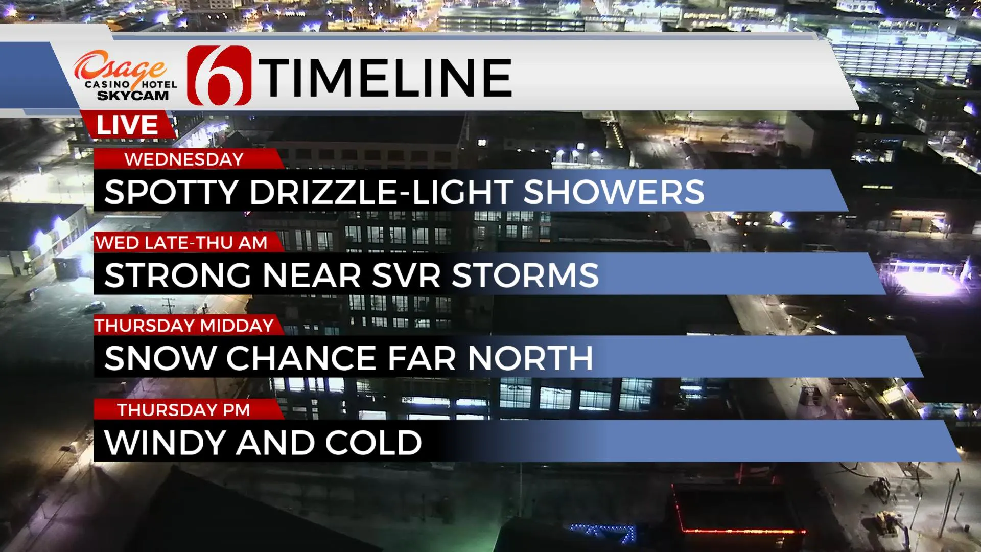
Wednesday the storm system is drawing near with clouds, gusty south winds, and highs still in the 60s. Scattered showers will break out during the afternoon. A dry line sharpens across far western OK, and a surface low-pressure area will develop near the Red River Valley. As the powerful upper-level wave nears, the surface low will move northeast and thunderstorms are likely late Wednesday night into Thursday morning, some potentially strong to severe and with pockets of moderate to locally heavy rainfall. While wind shear values are more than adequate for significant severe weather, surface instability may be marginal across northeastern OK while higher along the Red River from southeastern OK into northeast Texas. It's these southern sections that have higher likelihood of all modes of severe weather. The main threat for northeastern OK should be elevated hail, gusty winds, and locally heavy rainfall. The main window for strong to severe storms will be late Wednesday night through approximately 6 a.m. Thursday morning before a strong cold front surges southward ending the severe threat.

As the colder air races southeast, the surface low will be ejecting northeast into the mid-Missouri valley Thursday morning. A swath of precipitation is likely to follow on the backside of this low, mostly along and northeast of I-44 into southern Kansas. This will change from a mix to snow, with some accumulation along the OK-KS state line region. I'll keep a mention for some light snow near the metro Thursday morning with most accumulation confined northward along the state line where 1 to 2 inches will be possible for our immediate areas of concern. Much higher amounts are likely more northeast with this ejecting system. Strong north winds at 20 to 40 mph are likely Thursday midday to afternoon. Locations along the state line into southern Kansas could experience white-out conditions with any snow bands.

Temps quickly modify Friday and warmer afternoon highs in the 60s will be expected this weekend. Early next week this same active pattern may return with another threat of strong to severe storms followed by some mentions of wintry weather.
Thanks for reading the Tuesday morning weather discussion and blog.
Have a super great day!
Alan Crone
KOTV
If you’re into podcasts, check out my daily weather update below. Search for NewsOn6 and ‘Weather Out The Door’ on most podcast providers, including Spotify, Stitcher, Tune-In and down below on Apple.

More Like This
February 15th, 2022
June 21st, 2023
June 19th, 2023
June 13th, 2023
Top Headlines
December 14th, 2024
December 14th, 2024
December 14th, 2024
December 14th, 2024


