Morning Storms Move Out, Winter Weather Moves In
After an overnight round of rain and storms, winter weather is making its way into Green Country.Thursday, February 17th 2022, 7:06 am
TULSA, Oklahoma -
After an overnight round of rain and storms, winter weather is making its way into Green Country.
Here are the details from News On 6 Meteorologist Alan Crone:
A strong storm system is moving across the state bringing rain and storms followed by wintry weather impacts for part of northern Oklahoma. Storms will continue through the early morning hours along and south of I-40 and east of Highway 69. Some of these storms could be strong but the overall severe weather threat will quickly end as colder air arrives from the north.

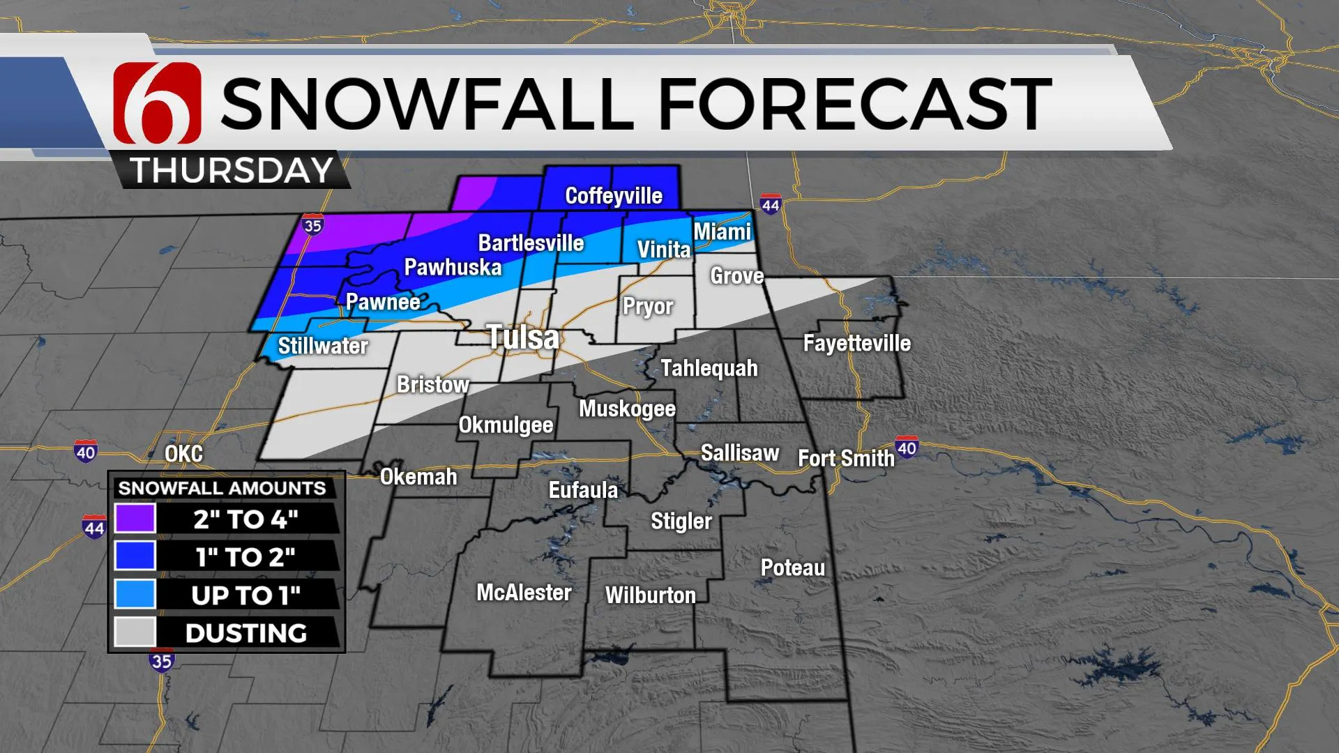
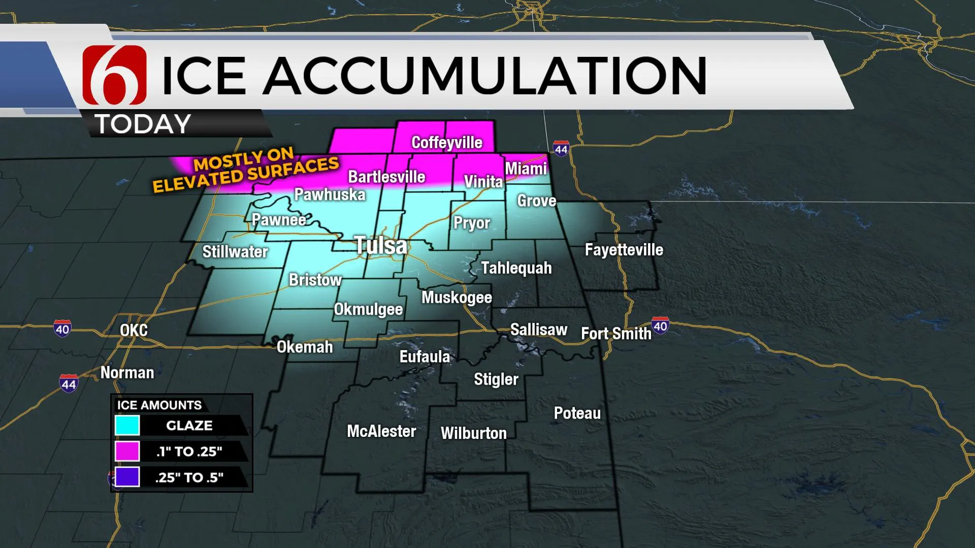
The surface cold front has already entered the metro and will quickly advance southeast through the morning undercutting updrafts and ending the threat of any significant severe weather threats. As the surface low lifts northeast into Missouri today and the upper-level trough swings across the state, a band of wintry weather will develop from northwestern OK into southern Kansas where winter storm warnings are underway. Some of these heavy bands of snow will brush the northeastern OK and southeastern Kansas vicinity where one to three inches of snow will be possible. Locations across far northwestern and northern Osage County could see from three to four inches of snow and a winter storm warning remains for this region. Other counties across the state line region are currently under a winter weather advisory. A winter weather advisory is now posted for locations along the I-44 corridor, including the Tulsa metro where some light freezing rain will turn to a mix of sleet or snow midday. This may result in some minor accumulations around the metro with much higher accumulation likely along the Ok-Kansas state line region.

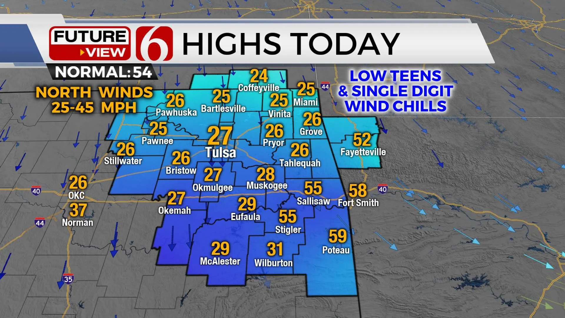
Strong north winds from 25 to 45 mph will be likely across the state line region and will create blizzard-like conditions by midday to early afternoon as these snow bands move across these areas. These bands will exit the region later this afternoon with decreasing clouds and much lighter winds by this evening. After a cold start Friday, the air mass will modify with weekend highs in the 60s along with mostly sunny conditions. Gusty south winds return Sunday into Monday as highs reach the lower 70s in spots before another strong cold front enters the state Tuesday with falling temps and another chance for additional arctic air and wintry weather.

Thanks for reading the Thursday morning weather discussion and blog.
Have a safe day!
Alan Crone
KOTV
If you’re into podcasts, check out my daily weather update below. Search for NewsOn6 and ‘Weather Out The Door’ on most podcast providers, including Spotify, Stitcher, Tune-In and down below on Apple.

More Like This
February 17th, 2022
June 21st, 2023
June 19th, 2023
June 13th, 2023
Top Headlines
December 11th, 2024
December 11th, 2024
December 11th, 2024
December 11th, 2024


