Pleasant Weekend Ahead
Warmer temperatures return after a day of winter weather.Friday, February 18th 2022, 6:53 am
TULSA, Oklahoma -
Warmer temperatures return after a day of winter weather.
Here are the details from News On 6 Meteorologist Alan Crone:
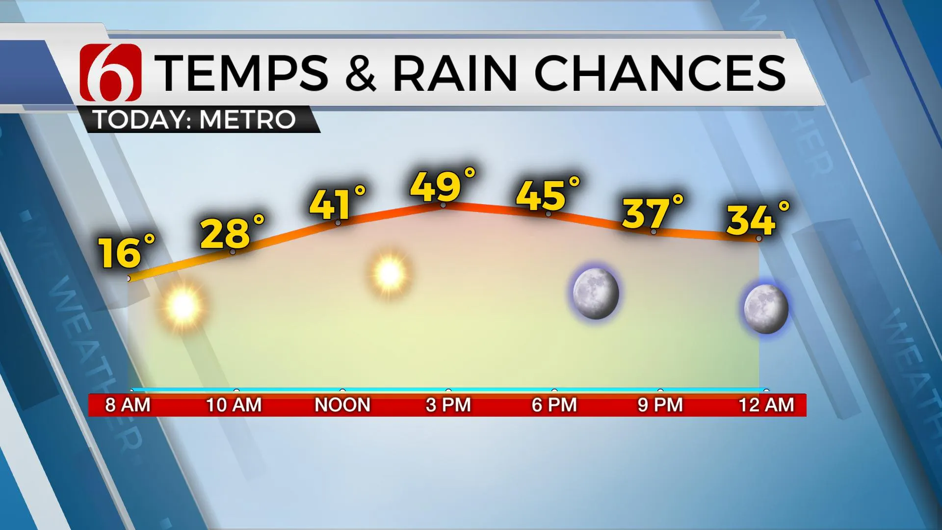
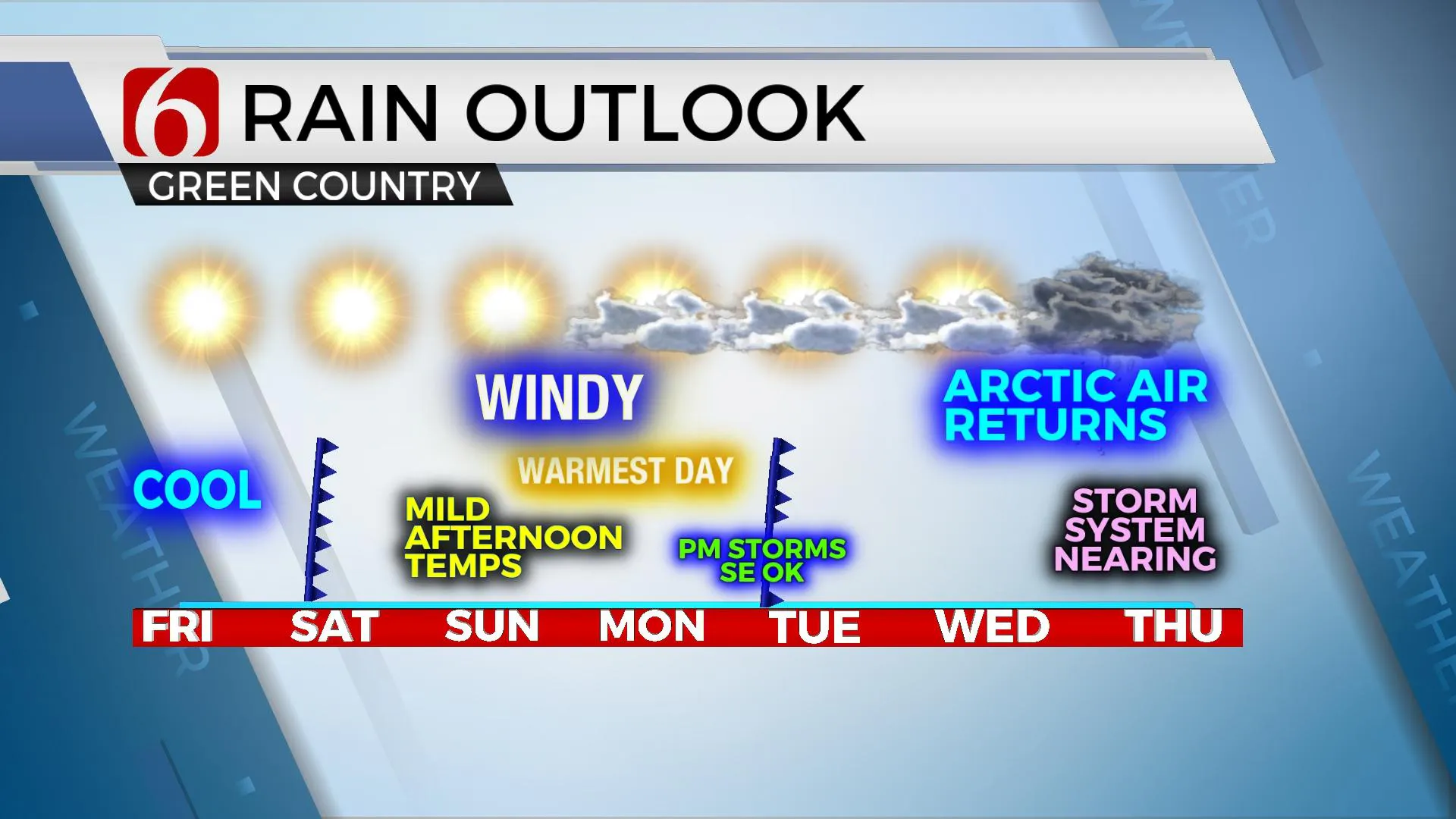
Clear and cold conditions are underway across northeastern OK with temps starting in the single digits and lower to mid-teens. Southwest winds around 10 to 15 mph will return with afternoon highs reaching the upper 40s to lower 50s with abundant sunshine. The pattern will bring pleasant weather this weekend with Saturday afternoon highs in the upper 50s to lower 60s and Sunday and Monday in the 70s before another strong arctic front rolls across the area Monday night into Tuesday morning. Moisture will initially be limited to far southeastern OK with this boundary where a few showers or storms may briefly occur early Tuesday morning.

Most data support the shallow and cold air remaining for the remainder of the week while the upper airflow from the southwest eventually brings several disturbances near the state. This pattern combination of shallow-cold air and a southwest upper flow is notorious for delivering winter storms across the state. Deterministic output suggests Thursday into Friday could bring all modes of wintry precipitation across part of the state. While we're well removed from any specific forecast parameters this far from late next week, confidence in this scenario is increasing. We'll keep you posted as we draw closer to the middle of next week.

Thanks for reading the Friday morning weather discussion and blog.
Have a super great day!
Alan Crone
KOTV
If you’re into podcasts, check out my daily weather update below. Search for NewsOn6 and ‘Weather Out The Door’ on most podcast providers, including Spotify, Stitcher, Tune-In and down below on Apple.

More Like This
February 18th, 2022
June 21st, 2023
June 19th, 2023
June 13th, 2023
Top Headlines
December 12th, 2024
December 12th, 2024
December 12th, 2024


