

Tracking A Weekend Cold Front
Warm weather continues on Thursday, but rain chances could soon return to Green Country.Thursday, March 3rd 2022, 6:32 am
TULSA, Oklahoma -
Warm weather continues on Thursday, but rain chances could soon return to Green Country.
Here are the details from News On 6 Meteorologist Alan Crone:
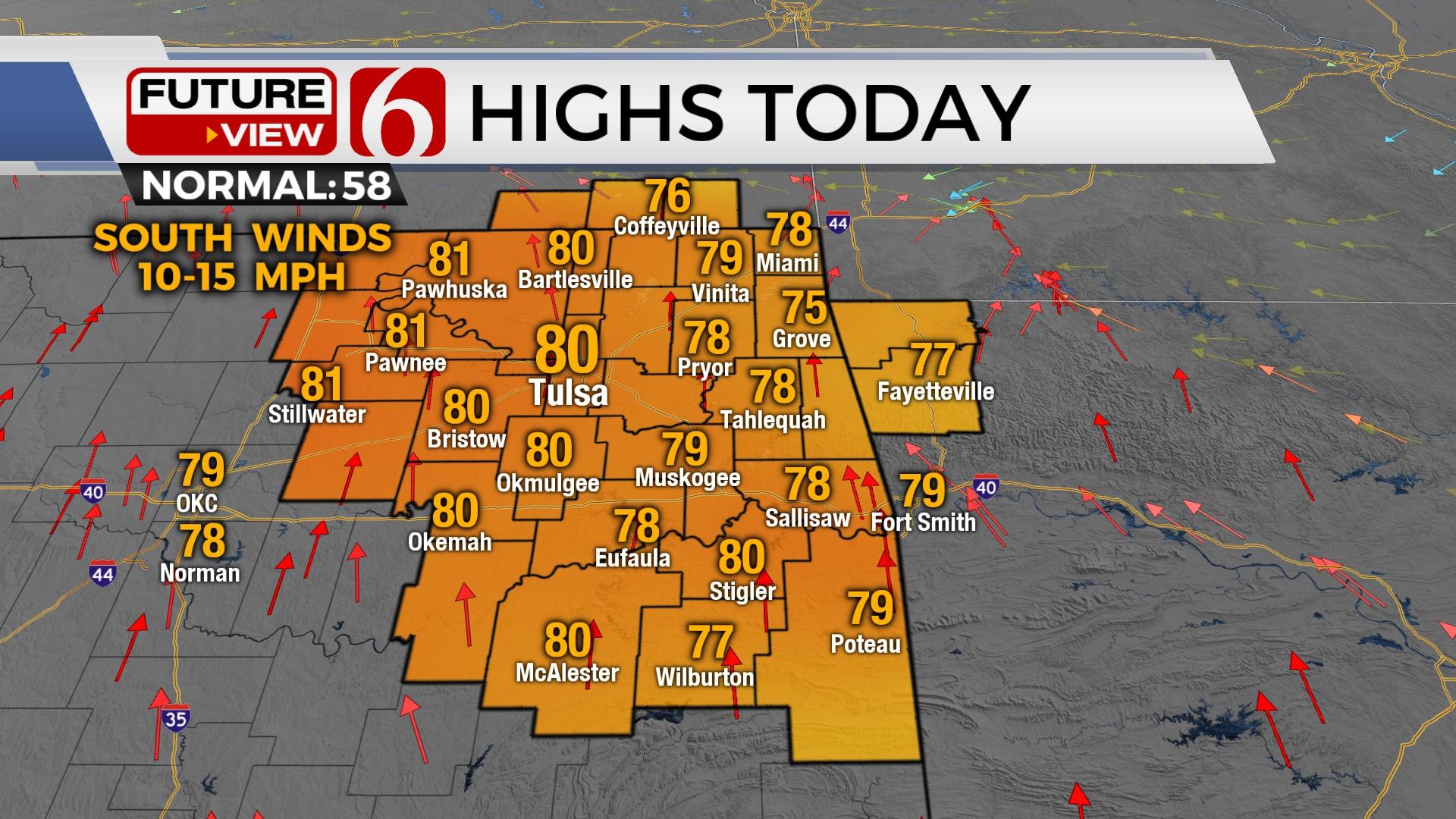
The pattern brings increasing rain and thunder chances back to the state this weekend, mostly Sunday, but there will be a slight chance for a few isolated storms Saturday east of the metro while critically high fire danger issues arrive to the west. Before this occurs, we’re looking at another fine weather day with afternoon highs in the upper 70s near 80 with sunshine and south winds from 10 to 20 mph. Some locations will be nearing daily record highs Thursday afternoon.

The first part of our changing pattern will be more noticeable Friday. The main trough across the western U.S. will send a strong disturbance around the base into the central plains Friday night into Saturday. The pressure gradient brings gusty south winds Friday from 15 to 30 mph with some clouds and highs in the mid-70s. Saturday morning a dry line will rapidly move across western OK and enter the I-35 corridor early afternoon before staling west of Tulsa. Locations east will have a chance for a few isolated storms, but the layer of warm air aloft may suppress this activity. Locations west of the dryline will experience very low humidity, strong southwest winds and critically high fire danger spread rates. This dry line retreats westward overnight as the main upper-level system draws closer to the state. A surface cold front enters northern OK Sunday morning and moves southeast Sunday afternoon and evening. Locations across southeastern to east-central OK will experience the potential for strong and severe storms where afternoon highs will reach the upper 60s near 70. The Tulsa metro is more than likely dropping into the lower 50s Sunday morning and remaining on the cool side of the front for the day with rain likely. This front clears southeastern OK Sunday night with colder air Monday and Tuesday. The potential for any leftover wintry weather threats for early Monday morning will continue to be monitored, but for now, will not be included in the forecast. Afternoon highs Monday will stay in the 40s and nearing the lower 50s Tuesday and lower 60s Wednesday. We see the potential for another cold snap to arrive by the end of next week. Stay tuned. We’re not finished with winter yet.

Thanks for reading the Thursday morning weather discussion and blog.
Have a super great day!
Alan Crone
KOTV


Get The Daily Update!
Be among the first to get breaking news, weather, and general news updates from News on 6 delivered right to your inbox!
More Like This
March 3rd, 2022

February 7th, 2024

October 21st, 2023

October 3rd, 2023
Top Headlines

December 13th, 2024

December 13th, 2024

December 13th, 2024

December 13th, 2024