Warmer Weather Returns Before The Next Round Of Storms
Sunny and warmer weather returns to Green Country before the next round of storms moves in on Thursday evening.Wednesday, March 16th 2022, 8:07 am
TULSA, Oklahoma -
Sunny and warmer weather returns to Green Country before the next round of storms moves in on Thursday evening.
Here are the details from News On 6 Meteorologist Alan Crone:
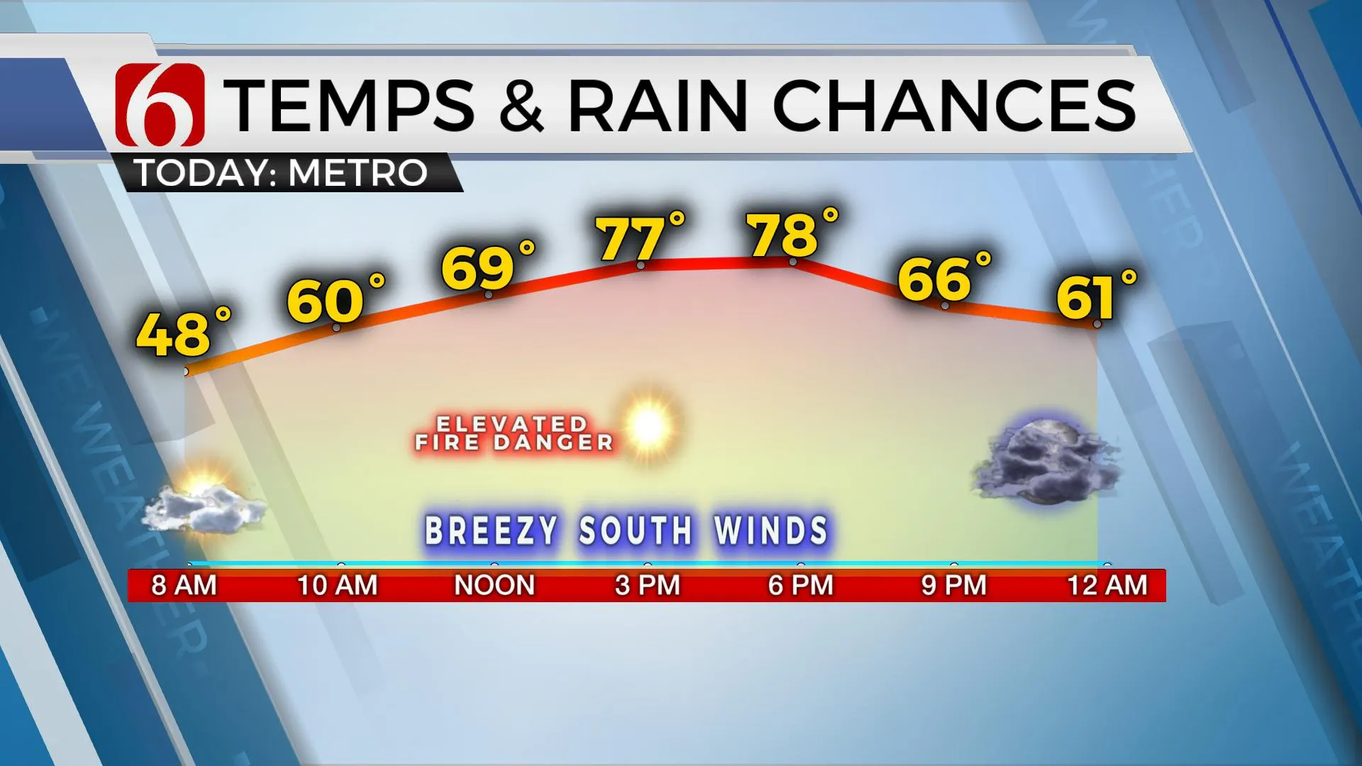
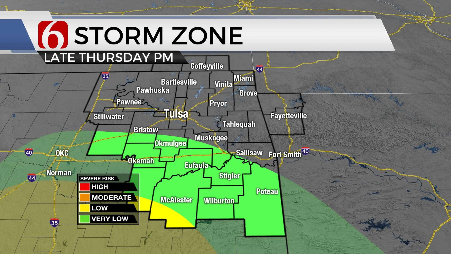
Sunshine returns on Wednesday along with south winds at 15 to 25 mph as afternoon highs move into the upper 70s. We’ll be tracking two storm systems over the next few days, the first arriving Thursday night and the second early next week. Both systems bring increasing rain and thunder chances to portions of northern and eastern Oklahoma. Current severe weather threats Thursday night appear to be mostly along the red river valley in the portions of far southern Oklahoma and north Texas. The second storm system next week supports some severe weather possibilities but differences in model data preclude us from delineating a specific severe weather threat location at this point. The initial examination of preliminary data support higher chances for strong and severe storms Monday across southern Oklahoma and south across Texas. But these areas could easily shift northward as we approach early next week.

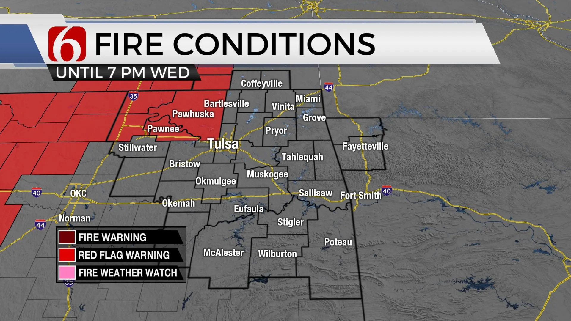
We anticipate fires spread rates increasing on Wednesday near and west of I 35. Dry conditions along with increasing south winds and low humidity through the afternoon will aid a rapid-fire rate with any wildfires that start. Red Flag warnings will be posed for part of Pawnee and Osage Counties. Gusty south winds are anticipated Thursday but increasing low-level moisture should offset the rate through the afternoon.

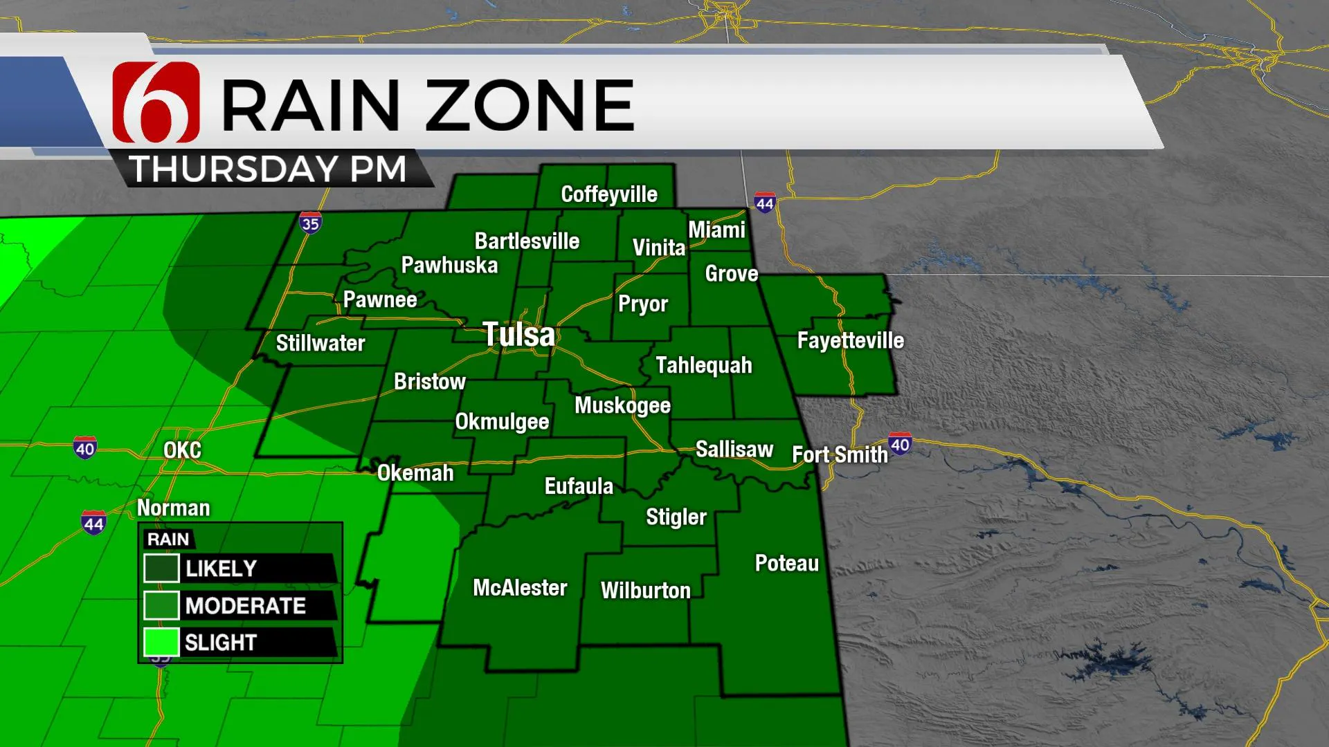
As the first upper-level system rejects from the western US across the state Thursday evening. a surface area of low pressure is expected to develop and track across southern Oklahoma Thursday night. Low-level moisture will pool ahead of this system creating a potential for showers and storms. As the surface low works east, the cold front surges south with additional showers and storms late Thursday night into predawn Friday. North winds are likely Friday morning with some leftover showers across far northern Oklahoma before the upper-level trough clears the state. Temperatures Friday afternoon will drop near or below seasonal averages with highs in the mid to upper 50s.

The weekend looks good. Saturday morning starts at the upper 30s with daytime highs nearing 70. Gusty south winds are likely to respond Sunday as the next strong upper-level trough moves across the western United States. South winds from 20 to 30 mph will be likely with afternoon highs reaching the mid to upper 70s. As the powerful upper-level storm system near the area early next week, showers and storms will be forming Monday and continuing through Monday night. The main system should exit the area late Monday night in the part of Tuesday, eventually bringing north winds slightly cooler air Tuesday into Wednesday with exiting showers and storms.

Thanks for reading the Wednesday morning weather discussion and blog,
Have a super great day!
Alan Crone
KOTV
If you’re into podcasts, check out my daily weather update below. Search for NewsOn6 and ‘Weather Out The Door’ on most podcast providers, including Spotify, Stitcher, Tune-In and down below on Apple.

More Like This
March 16th, 2022
June 21st, 2023
June 19th, 2023
June 13th, 2023
Top Headlines
December 14th, 2024
December 14th, 2024
December 14th, 2024
December 14th, 2024


