Dynamic Storm System Nearing
Red Flag warnings, wind advisories and severe storm threats are in the forecast on Tuesday.Tuesday, March 29th 2022, 4:49 am
TULSA, Oklahoma -
Red Flag warnings, wind advisories and severe storm threats are in the forecast on Tuesday.
Here are the details from News On 6 Meteorologist Alan Crone:
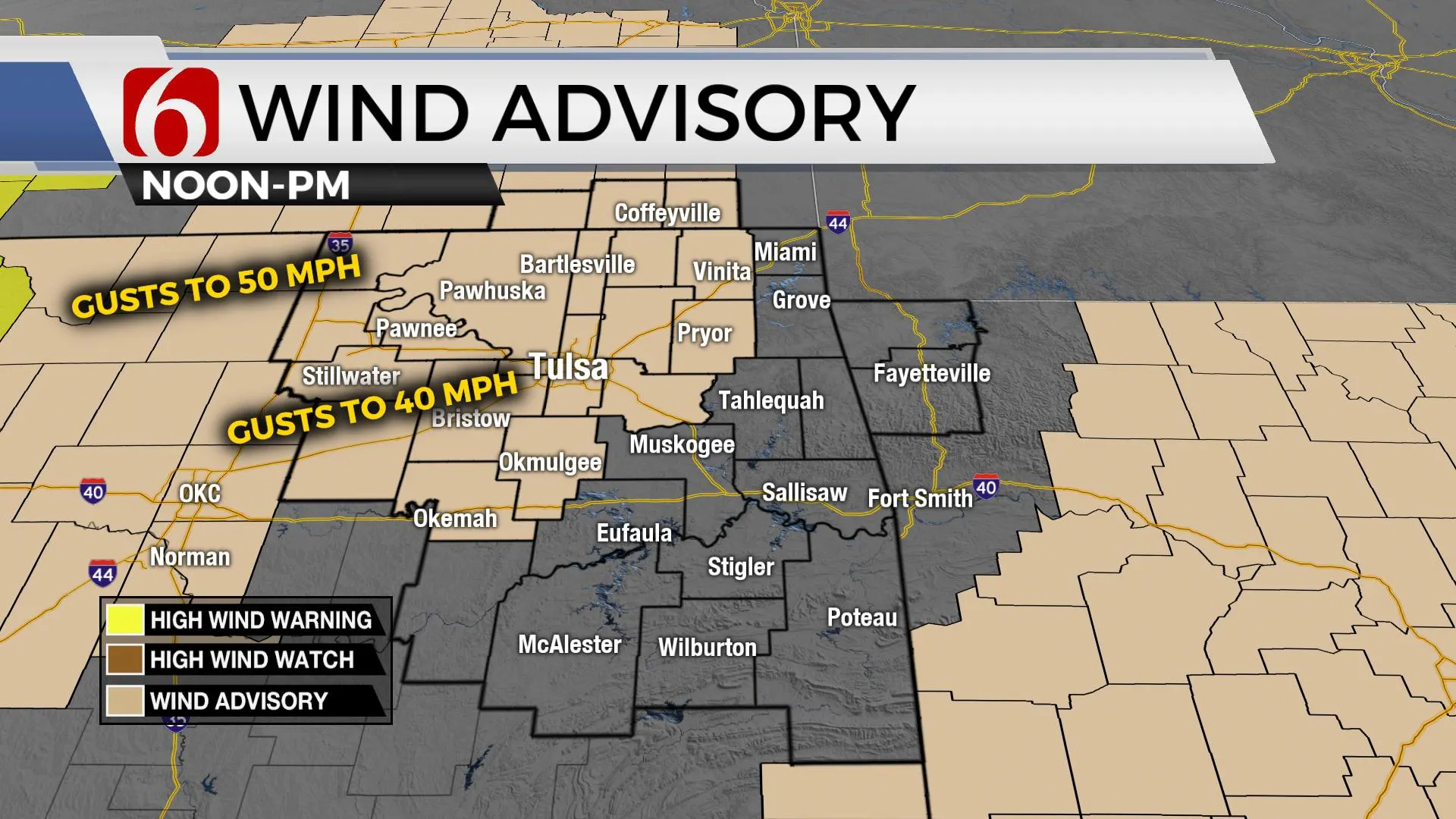
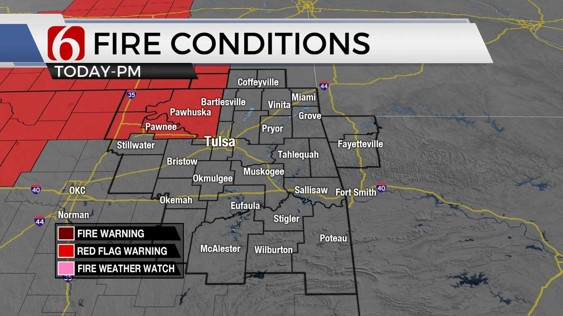
A dynamic storm system brings strong south wind, increasing fire danger, and late-night thunderstorms into the area. Some of these storms could be strong to severe. Daytime highs are expected in the upper 70s near 80. South winds are likely at 20 to 35 mph, with some higher gusts near and west of the area. A wind advisory will be underway during the day on Tuesday and early evening for most of Northeastern Oklahoma. A red flag warning will also be required for locations to our west, including Osage and Pawnee county. A much larger area of western Oklahoma will be included in red flag warnings where critically high fire danger issues are likely to continue. Later Tuesday afternoon and night, storm chances will be increasing as a strong storm system nears the area.

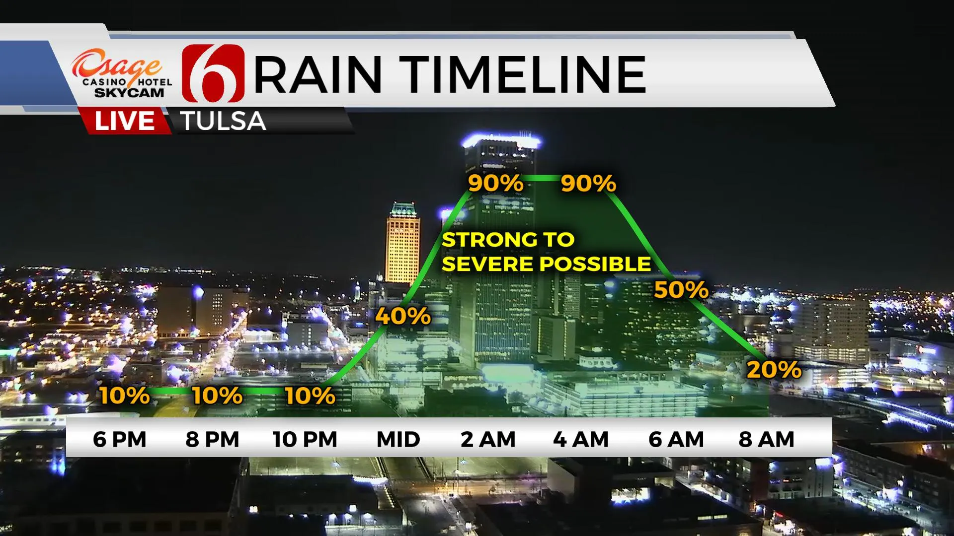
Through the afternoon and early evening, a layer of warm air aloft should suppress most if not all shower or storm activity. But later this evening storms are likely to develop across southwestern Oklahoma and spread east northeast. A dry line will quickly move from western sections to near I 35 by midnight. We do have a slight chance for a few storms early this evening, but our main window will be from midnight to 6 AM Wednesday. Some of the storms could be strong to severe, the primary threats wind and heavy rainfall. There will be a chance for leading-edge spin-ups, or embedded tornadoes in a few locations. This threat is currently low but not zero. If low-level moisture ends up greater than anticipated, this threat may also increase.

The dry line exits the area before sunrise tomorrow taking the severe threat to our east. But a cold front approaches the area by mid-day Wednesday with a slight chance for additional scattered showers near or east of the metro. More importantly, gusty northwest winds will bring chilly weather by the afternoon. Temperatures start tomorrow morning in the lower 60s but will be falling into the mid-40s by early afternoon as the cold front clears the area. Thursday appears pleasant. After a chilly start in the 30s, daytime highs should reach the lower 60s. Another fast-looking wave will bring a chance for a few showers or storms Friday night in the pre-dawn Saturday. The rest of the weekend unfortunately remains inconsistent in most data. I’ll make no major adjustments at this point, meaning Sunday remains dry and mild, but additional shower or storm chances may be added for part of Sunday or Monday. Will keep you posted.

Thanks for reading the Tuesday morning weather discussion and blog.
Have a super great day!
Alan Crone
KOTV
If you’re into podcasts, check out my daily weather update below. Search for NewsOn6 and ‘Weather Out The Door’ on most podcast providers, including Spotify, Stitcher, Tune-In and down below on Apple.

More Like This
March 29th, 2022
June 21st, 2023
June 19th, 2023
June 13th, 2023
Top Headlines
December 14th, 2024
December 14th, 2024
December 14th, 2024
December 14th, 2024


