Morning Storms Bringing Chilly Afternoon Weather
Showers and storms swept through Green Country on Tuesday night, bringing severe weather to some parts of the state.Wednesday, March 30th 2022, 5:15 am
TULSA, Oklahoma -
Showers and storms swept through Green Country on Tuesday night, bringing severe weather to some parts of the state.
Here are the details from News On 6 Meteorologist Alan Crone:
Strong to severe thunderstorm probabilities will quickly move out of Eastern Oklahoma into Arkansas over the next few hours. A cold front will enter northwestern sections of our area by mid-day and brings a chance for additional scattered showers or storms as this boundary sweeps across the area. These probabilities will be much lower than our overnight storms, and no significant severe weather threats are anticipated.
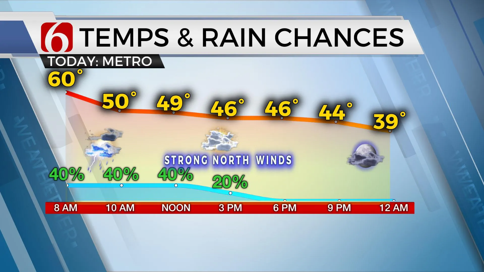
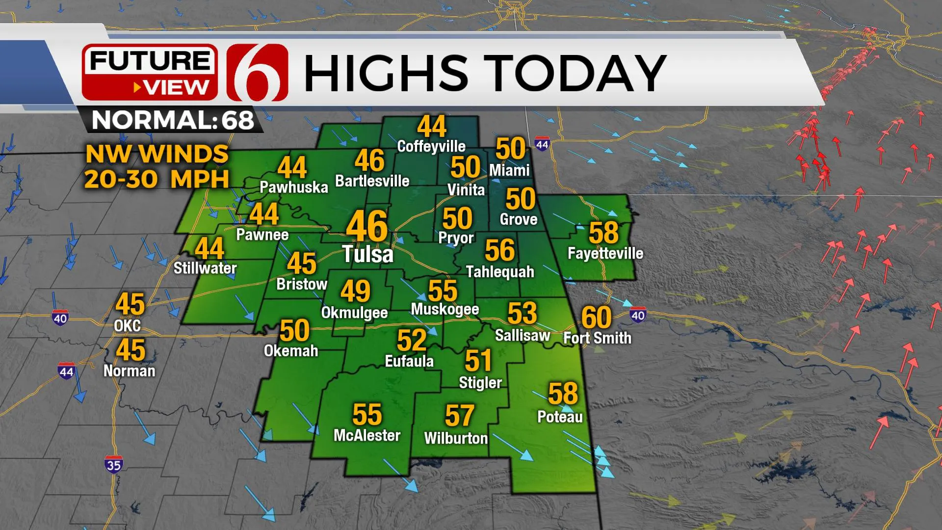
Temperatures will start Wednesday morning in the lower or mid-60s. As the cold front enters the region, strong northwest winds at 20 to 35 mph will bring chilly weather into the area. Temperatures will drop it to the lower 50s by noon, and into the mid-40s by the early afternoon across Northern Oklahoma. Clouds will clear from the northwest to southeast later tonight. This brings a cooler air mass into the area Thursday.

Temperatures start Thursday morning in the lower to mid-30s with afternoon highs in the upper 50s and lower 60s. We’ll have some sunshine and a few clouds occasionally. Northwest winds will remain at 10 to 22 mph. Another fast-moving upper-level wave enters our area Friday and brings a slight to moderate chance of scattered showers across Northern Oklahoma by evening. This is a progressive wave and should exit the area early Saturday morning. Severe weather threats are not expected with the system. Most of our weekend looks good with afternoon highs Saturday in the mid-60s and returning into the lower 70s Sunday.

Our next stronger storm system will be nearing the area Sunday evening into early next week with increasing rain and thunder chances for portions of the state. Some important parameters are yet to be determined, but the pattern suggests the potential for a few strong to severe storms during these periods. This system is far from being locked into a confident solution.

Thanks for reading the Wednesday morning weather discussion and blog.
Have a super great day!
Alan Crone

More Like This
March 30th, 2022
June 21st, 2023
June 19th, 2023
June 13th, 2023
Top Headlines
December 12th, 2024
December 12th, 2024
December 12th, 2024


