Storm Chances Return Soon
A sunny and breezy day is ahead, but storm chances could soon return to Green Country.Monday, April 18th 2022, 6:34 am
TULSA, Oklahoma -
A sunny and breezy day is ahead, but storm chances could soon return to Green Country.
Here are the details from News On 6 Meteorologist Alan Crone:
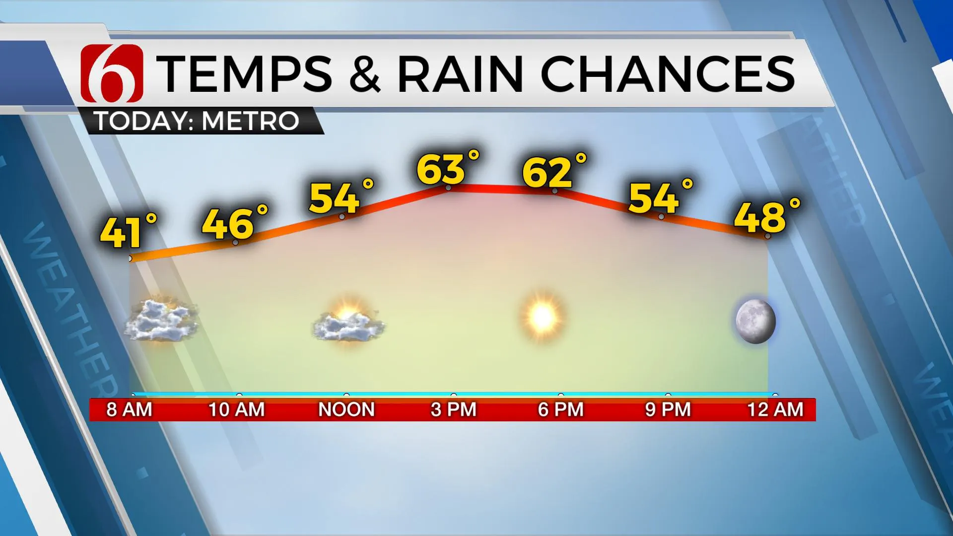
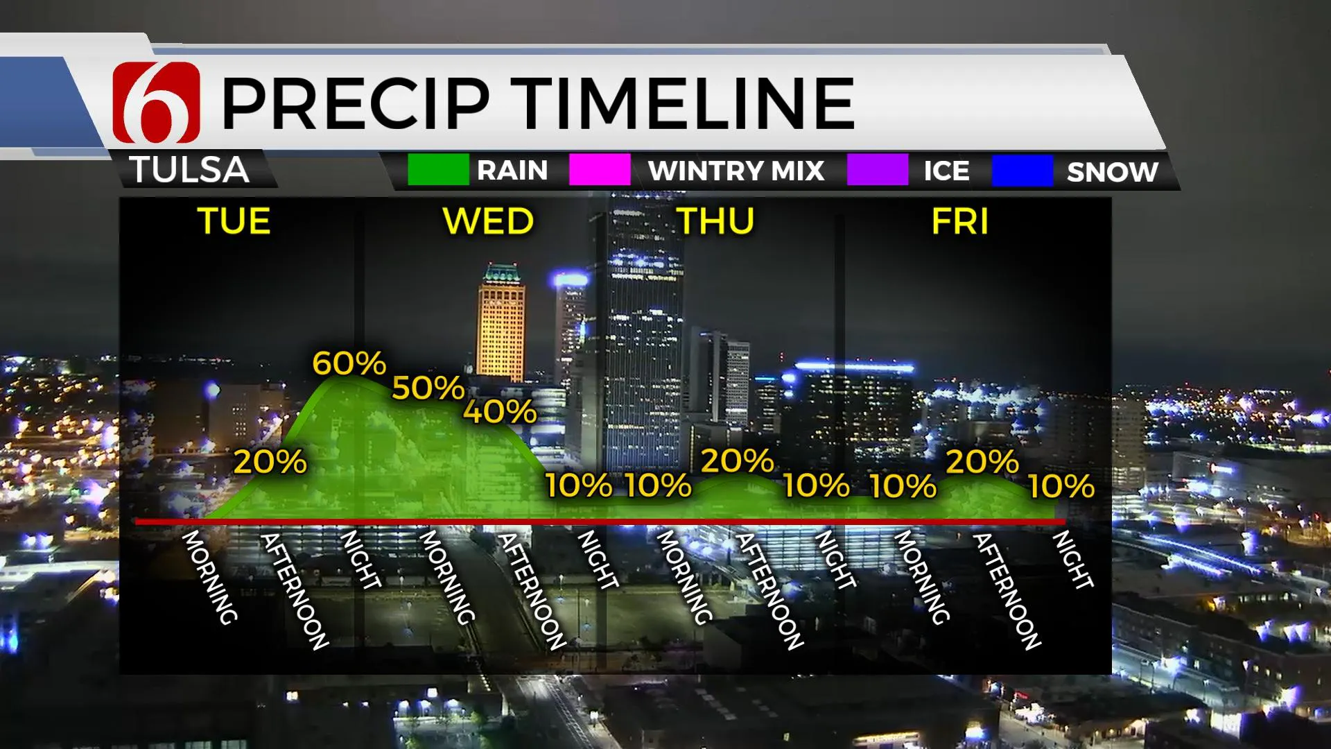
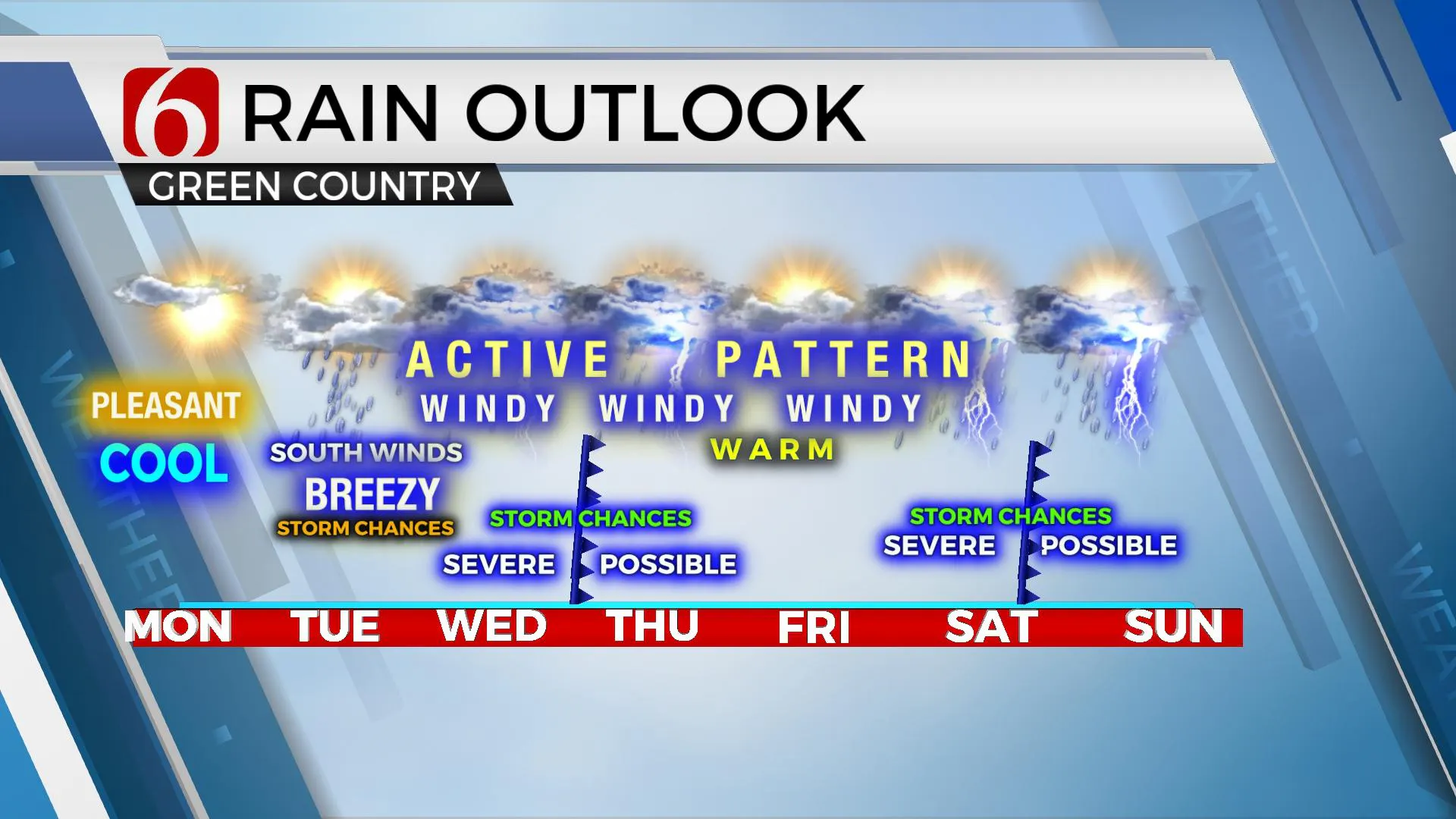
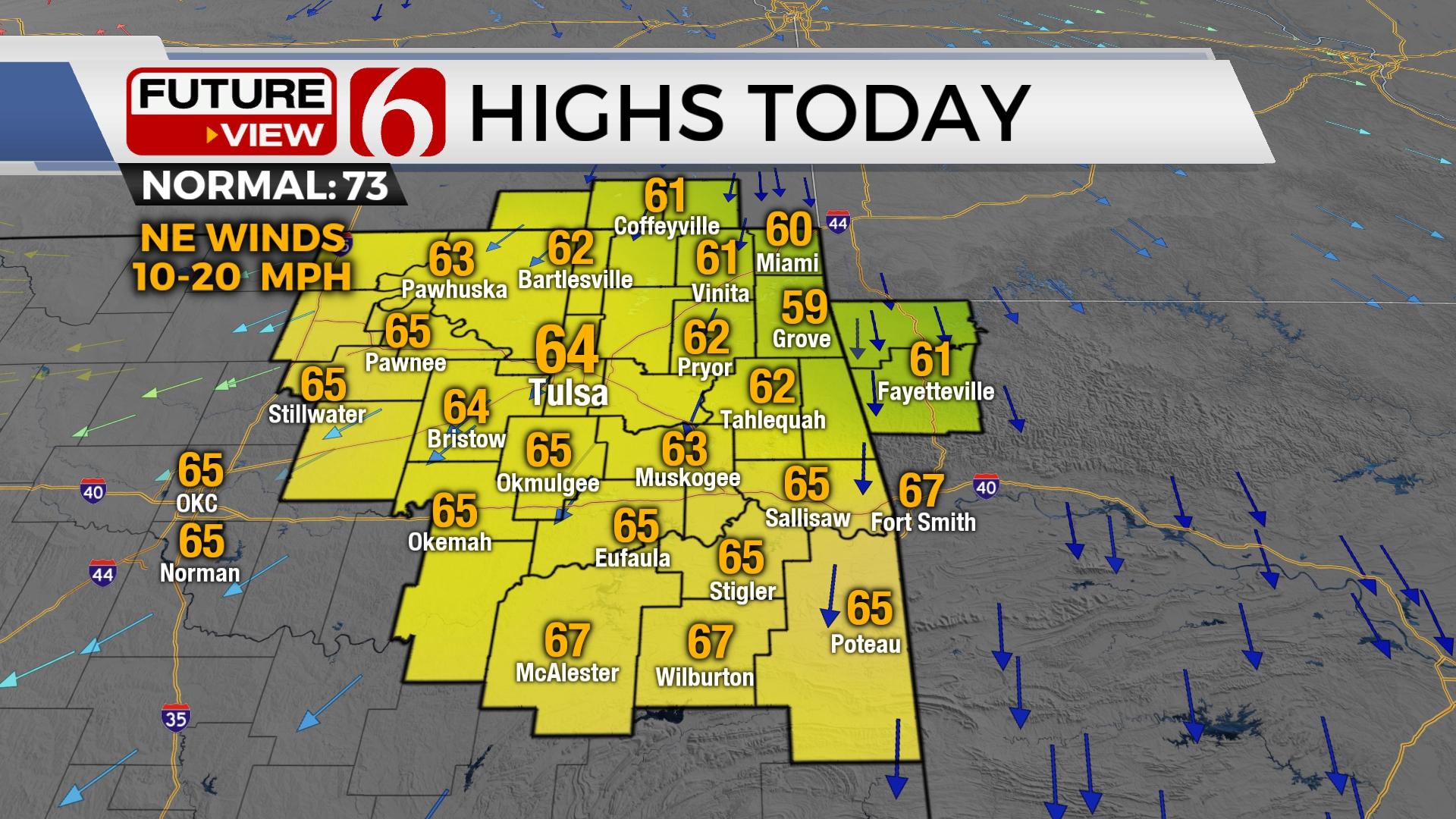
A surface ridge of high pressure will remain the dominant feature on Monday. After morning clouds thin out, we’ll see more sunshine and pleasant weather. Afternoon highs will reach the mid-60s with north winds around 10 to 20 mph after starting Monday morning with lows in the upper 30s and lower 40s. The stronger belt of westerlies currently remains north but will be dropping southward soon as the upper flow transitions from westerly to southwesterly by the end of the week. This will bring several systems near the state, including the first Tuesday evening into Wednesday and the second this weekend. While deeper low-level moisture is expected to return by midweek, the forcing for the first wave may only support marginal risk of a few strong and severe storms for Wednesday. The weekend wave is much stronger and will support a greater risk of severe weather returning across the state.

Temps for the period will remain seasonably cool with highs both today and tomorrow in the 60s. The first wave brings rain and thunder chances across the state Tuesday night into Wednesday followed by some short-term mid-level ridging for the end of the week. Severe storm chances tomorrow should remain west of the area but may increase some Wednesday. A weak boundary may sneak down not far northern OK Wednesday evening, stalling and then retreating quickly north Thursday. A chance for a few storms will be near this boundary Thursday morning to midday. As the mid-level ridge briefly appears, this will increase temps above the seasonal average, moving into at least the lower 80s by the end of the week for afternoon highs. Morning lows in the 60s will be likely from Wednesday through Saturday.

The upper air flow will bring a stronger system near the pains this weekend with some support for a cold front nearing Saturday afternoon and evening, and other data suggesting overnight into Sunday morning. Regardless, both sets would offer the potential for strong and severe storm mentions based on pattern recognition and climatology. Stronger flow and parameter overlays may be slightly north of the state for the highest chances for strong to severe storms. Additional changes and updates are likely for the weekend.

Thanks for reading the Monday morning weather discussion and blog.
Have a super great day!
Alan Crone
KOTV
If you’re into podcasts, check out my daily weather update. Search for NewsOn6 and ‘Weather Out The Door’ on most podcast providers, including Spotify, Stitcher and Tune-In, or Click Here to listen on Apple Podcasts.
More Like This
April 18th, 2022
June 21st, 2023
June 19th, 2023
June 13th, 2023
Top Headlines
April 25th, 2024
April 25th, 2024
April 25th, 2024


