

Tracking Friday Severe Weather Threats
Early morning rain will impact parts of Green Country on Thursday before gusty winds move in toward the afternoon.Thursday, April 28th 2022, 5:20 am
TULSA, Oklahoma -
Early morning rain will impact parts of Green Country on Thursday before gusty winds move in toward the afternoon.
Here are the details from News On 6 Meteorologist Alan Crone:

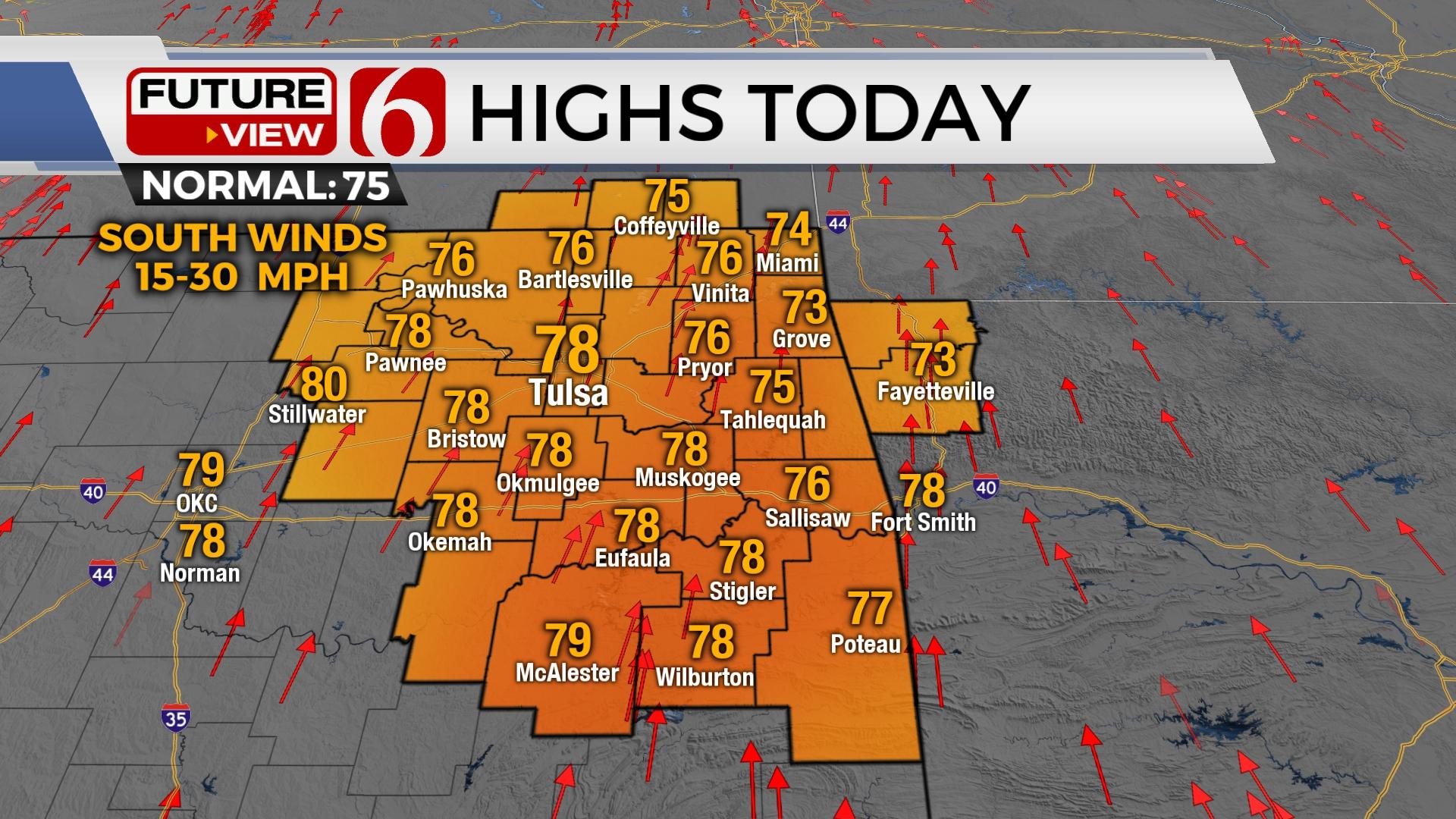
A weak short-wave is moving across the northern third of Oklahoma Thursday morning with scattered showers and storms in some locations. Severe weather is not expected, but gusty winds near and north of this decaying area of storms may produce wind speeds from 30 to 45 mph in spots. Additionally, gusty south winds will also be likely through the day and evening as a stronger system organizes across the Rockies and moves into the central plains tomorrow. South winds from 15 to 30 mph will be likely today and winds from 20 to 40 mph Friday. Wind advisories will be required Friday. A few additional scattered storms may develop later tonight or early Friday morning with a low chance of a strong to severe storm across southeastern Kansas. The main window for severe weather threats will remain later Friday afternoon and evening as the stronger system ejects into the plains.

A dry line will develop Friday associated with a surface low-pressure area moving into central Kansas. A cold front will trail the low and enter southeastern Kansas and northeastern OK late Friday night into pre-dawn Saturday. A window from 5 p.m. Friday through midnight supports the mention of scattered storm development along and ahead of the dry line. A strong capping inversion may limit or prohibit storm formation during this time, but any storms that do form would be high-end severe weather makers producing all modes of severe weather. Later as the cold front overtakes the dryline, storms are more likely to develop post-frontal (behind the front) and move southeast into northern OK. These storms will have the potential to produce damaging winds and hail before weakening as they drop southeast pre-dawn Saturday morning. This cold front should clear most of the area bringing pleasant conditions for the weekend. But the boundary is expected to retreat northward Sunday night into Monday morning as a warm front with additional showers and storms spreads back across the area. Severe weather threats will return Monday, and then again Wednesday with yet another system nearing the state.

Thanks for reading the Thursday morning weather discussion and blog.
Have a super great day!
Alan Crone
KOTV
If you’re into podcasts, check out my daily weather update. Search for NewsOn6 and ‘Weather Out The Door’ on most podcast providers, including Spotify, Stitcher and Tune-In, or Click Here to listen on Apple Podcasts.

Get The Daily Update!
Be among the first to get breaking news, weather, and general news updates from News on 6 delivered right to your inbox!
More Like This
April 28th, 2022

June 21st, 2023

June 19th, 2023

June 13th, 2023
Top Headlines

December 12th, 2024

December 12th, 2024

December 12th, 2024
