Early-Morning Storms, Summerlike Afternoon Temperatures
Early morning storms swept through parts of the state on Thursday, but another summerlike afternoon with humid and breezy conditions is expected.Thursday, May 19th 2022, 6:03 am
TULSA, Oklahoma -
Early morning storms swept through parts of the state on Thursday, but another summerlike afternoon with humid and breezy conditions is expected.
Here are the details from News On 6 Meteorologist Alan Crone:
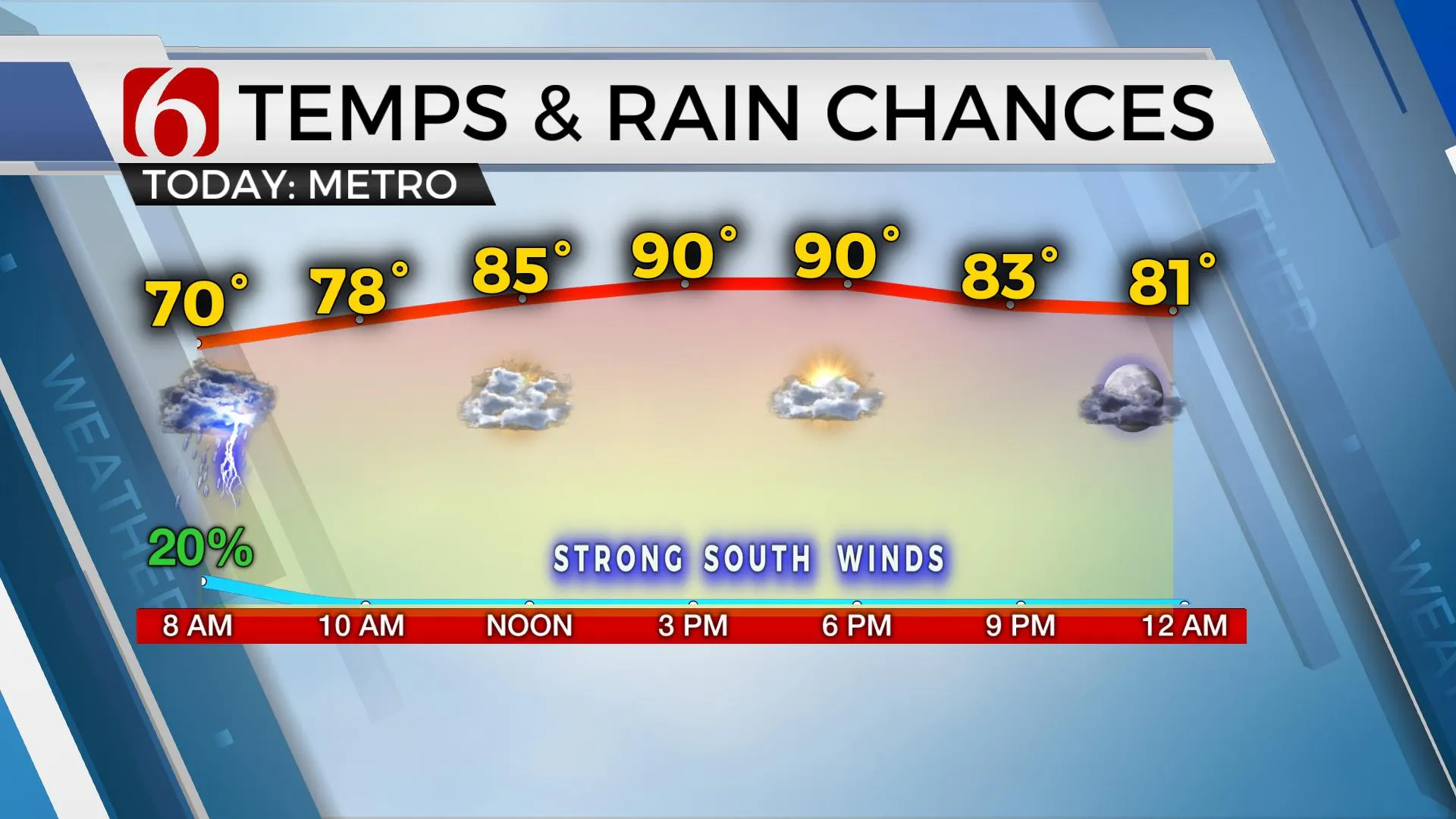
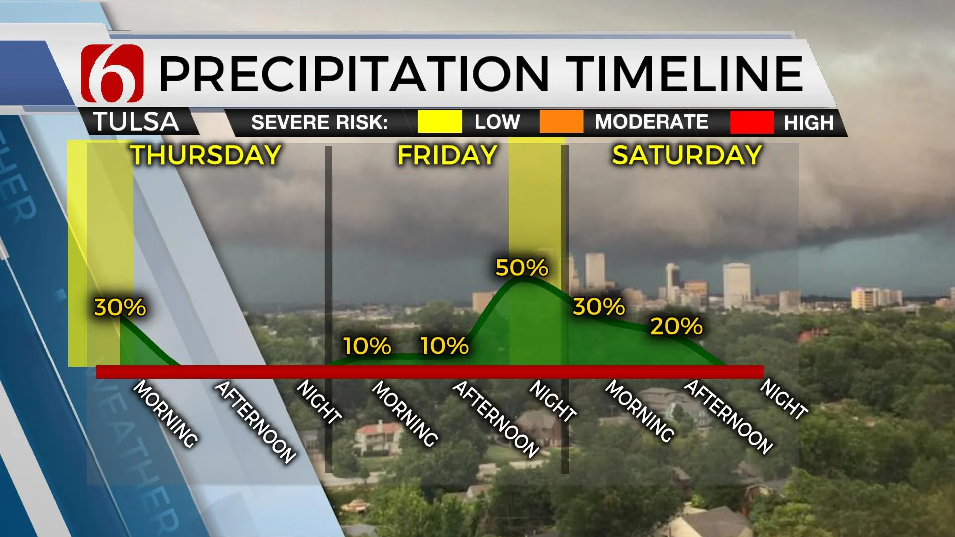
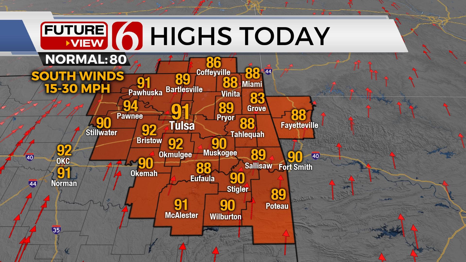
We're tracking a decaying complex of storms early Thursday morning moving across northeastern Oklahoma, near the metro. The environment is favorable for a few damaging downbursts of wind along with frequent cloud to ground lightning in some areas. The activity should quickly exit between 6 a.m. and 8 a.m. but may linger in a few spots through 10 a.m. across extreme eastern areas. Behind the departing system strong south winds will arrive with gusts from 20 to 30 mph. Afternoon highs will reach the lower 90s with heat index values nearing the mid-90s. Another small window for a few storms will remain early Friday morning across the OK-KS state line region before a slow yet strong cold front nears the state Friday evening. Stronger south winds are likely Friday near 20 to 35 mph through the afternoon with highs reaching the mid to upper 80s with heat index values in the lower to mid-90s. The slow-moving cold front enters the area late Friday afternoon and evening. This front will bring strong to severe storms across the southeastern third of the state, with a few mentions of strong to severe storms near the metro later Friday afternoon and evening. Most data support a slightly better chance for severe storms located across south central OK into the southern third of the state Friday evening. A few strong to severe storms will remain possible near the metro early Friday evening.

The upper air flow will mostly be parallel to the boundary Friday into early Saturday. This means the front is more than likely going to be a slow-moving system which will now make Saturday's forecast problematic. As the front slowly passes the northern OK area Saturday morning, scattered showers will remain possible, at least for the first half of the morning. The potential temp range Saturday afternoon near Tulsa could be anywhere from the upper 50s to the lower 80s depending upon the different timing scenarios with the frontal movement. We continue to favor a slightly more progressive frontal passage. This means Saturday morning may start in the 70s and then drop into the mid-60s by midday to afternoon with some lingering showers through the first half of the day. Locations across southeastern OK will still reach the lower 80s early afternoon before the front finally enters these areas with additional storm chances, including the mention for a few strong to severe storms across these areas. The main upper-level trough finally moves far enough east by Saturday evening to shove the front more south. A surface ridge of high pressure is likely to be near Sunday morning bringing lows in the 40s north and 50s south. Afternoon highs in the lower 70s will be likely Sunday afternoon with mostly sunny sky and north winds near 10 to 20 mph. If for some reason more cloud cover remains Sunday, afternoon highs could easily stay in the lower to mid-60s through the afternoon.

Early next week, additional storm chances will quickly return Monday with overrunning precipitation and highs in the lower 70s. More storms are likely Tuesday with highs nearing the lower 80s. A few severe storms will remain possible Tuesday.
Thanks for reading the Thursday morning weather discussion and blog.
Have a super great day!
Alan Crone
KOTV
More Like This
May 19th, 2022
June 21st, 2023
June 19th, 2023
June 13th, 2023
Top Headlines
December 13th, 2024
December 13th, 2024
December 13th, 2024
December 13th, 2024


