Heat Wave Continues
Summer weather has arrived in Green Country as another week of hot temperatures is ahead.Monday, June 20th 2022, 8:20 am
TULSA, Oklahoma -
Summer weather has arrived in Green Country as another week of hot temperatures is ahead.
Here are the details from News On 6 Meteorologist Alan Crone:

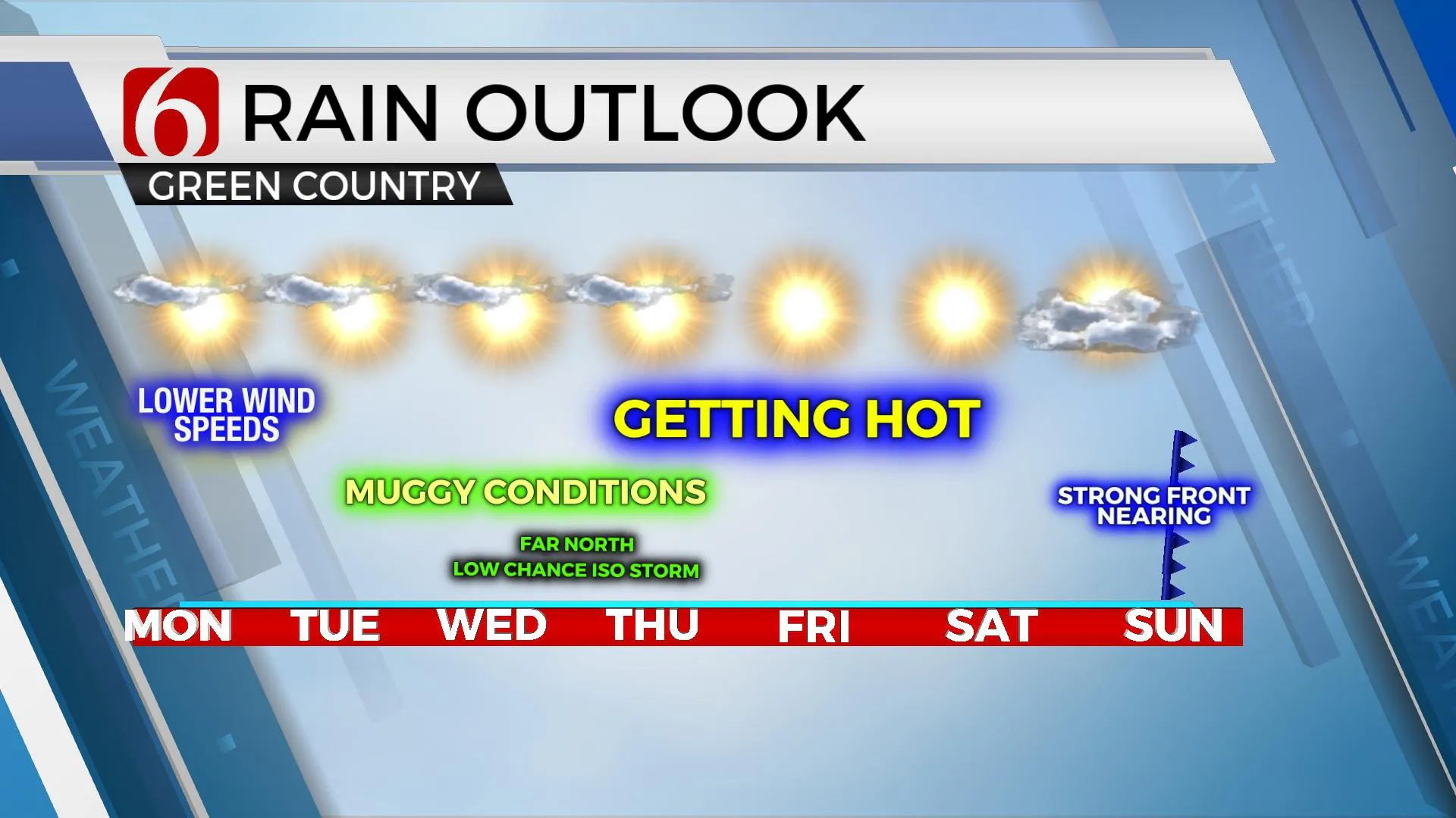
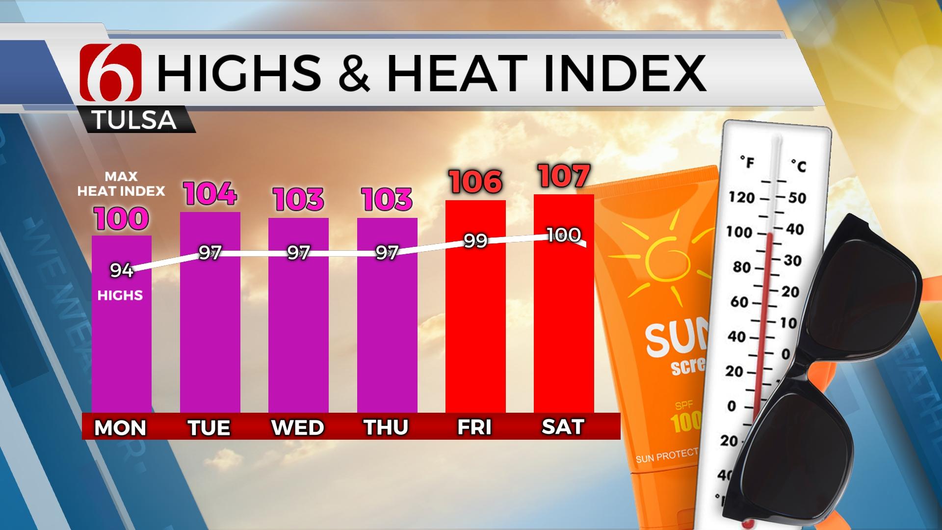
The mid-level ridge will remain the dominant weather feature for the next few days. The center of this ridge positioned across the southern plains will keep the organized convective systems removed from the area. Wednesday and Thursday the ridge weakens and may allow a few showers or storms to brush the northern extent of the ridge, mostly across southern Kansas, extreme northeastern OK, far northeastern Arkansas, and southwestern Missouri. We’ll keep a low pop (10%) for both during these periods. Later in the week, most data support the ridge gaining strength Friday and Saturday with highs nearing 100 before weakening Sunday into early next week. At the surface, a strong front for June will be possible Sunday with northeast winds and temps dropping into the upper 80s and lower 90s for afternoon highs.
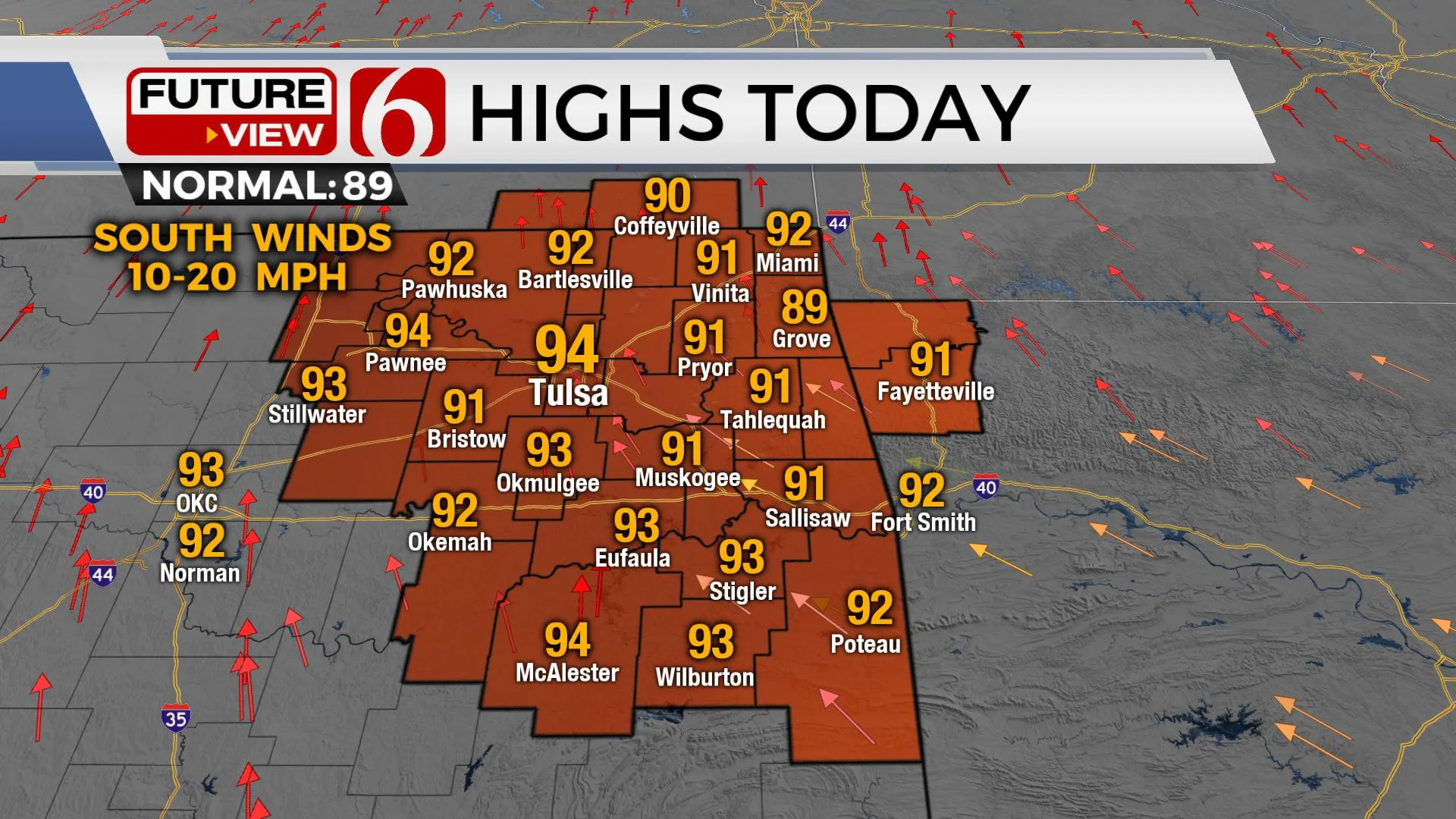
Temps today will reach the lower to mid-90s with south winds around 10 to 20 mph. Heat index values nearing 100 will be likely. As the ridge gains strength, the temps and heat index values will climb Tuesday through the end of the week.

Thanks for reading the Monday morning weather discussion and blog.
Have a super great day!
Alan Crone
KOTV
If you’re into podcasts, check out my daily weather update. Search for NewsOn6 and ‘Weather Out The Door’ on most podcast providers, including Spotify, Stitcher and Tune-In, or Click Here to listen on Apple Podcasts.
More Like This
June 20th, 2022
June 21st, 2023
June 19th, 2023
June 13th, 2023
Top Headlines
December 12th, 2024
December 12th, 2024
December 12th, 2024


