More Hot Weather Before A Sunday Front Brings Relief
A weak boundary located across northern Oklahoma will slowly lift north or become diffused early Thursday morning.Thursday, June 23rd 2022, 5:53 am
TULSA, Oklahoma -
A weak boundary located across northern Oklahoma will slowly lift north or become diffused early Thursday morning.
A few scattered showers will remain near these areas for the next hour or so before exiting the area.
Later Thursday, additional storms are likely to develop across central Kansas, near the boundary, as a disturbance arrives from the Rockies.
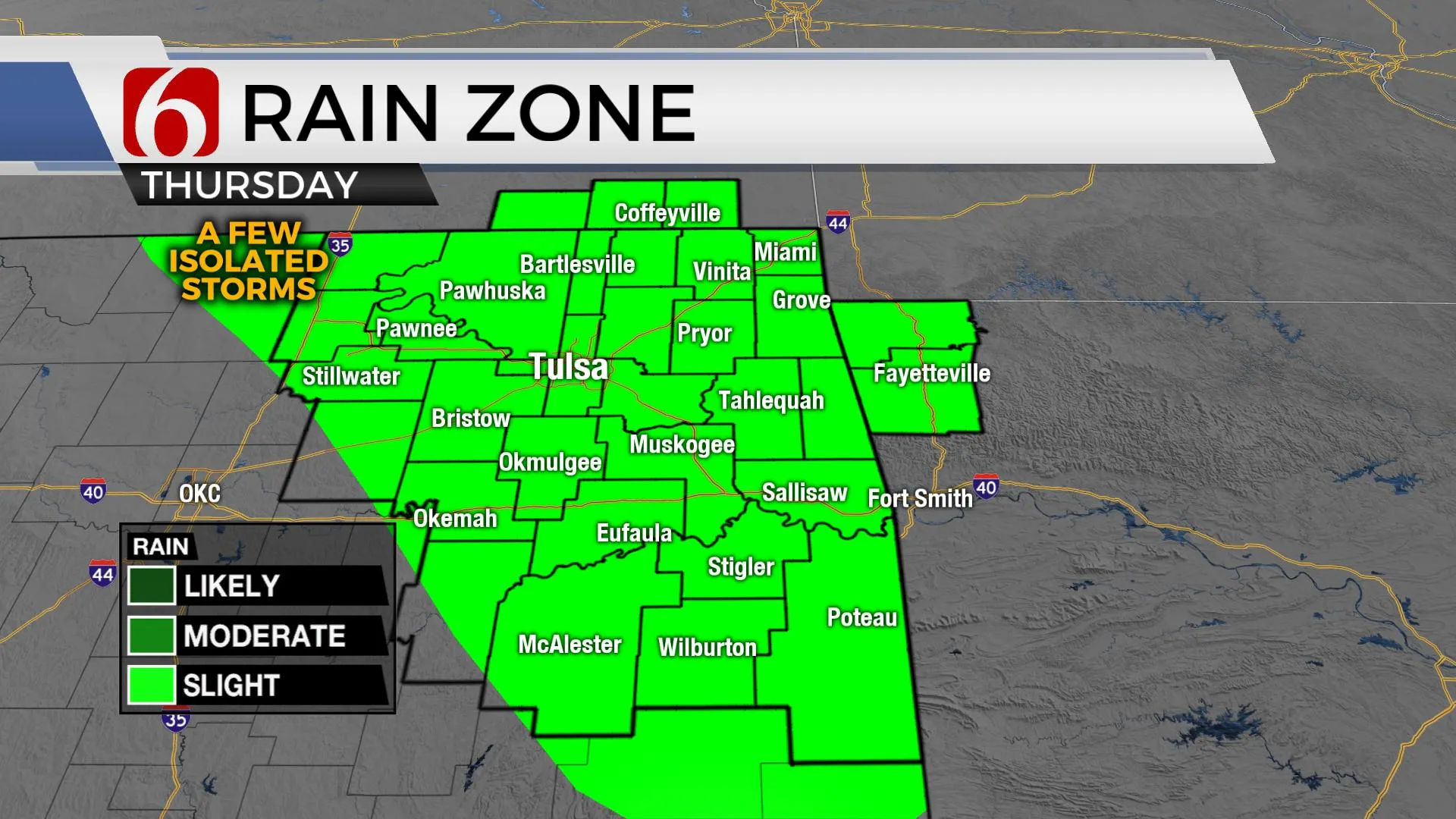
Most of this activity will remain north of our immediate area, but there will be at least a small window for a few isolated, pop-up storms today across eastern Oklahoma.
Thursday will be the 13th consecutive day of 90 degrees or higher maximum temperatures for the Tulsa metro.
We’re forecasting to reach 15 days before a mini-pattern change allows a cold front, bringing some relief Sunday into early next week.
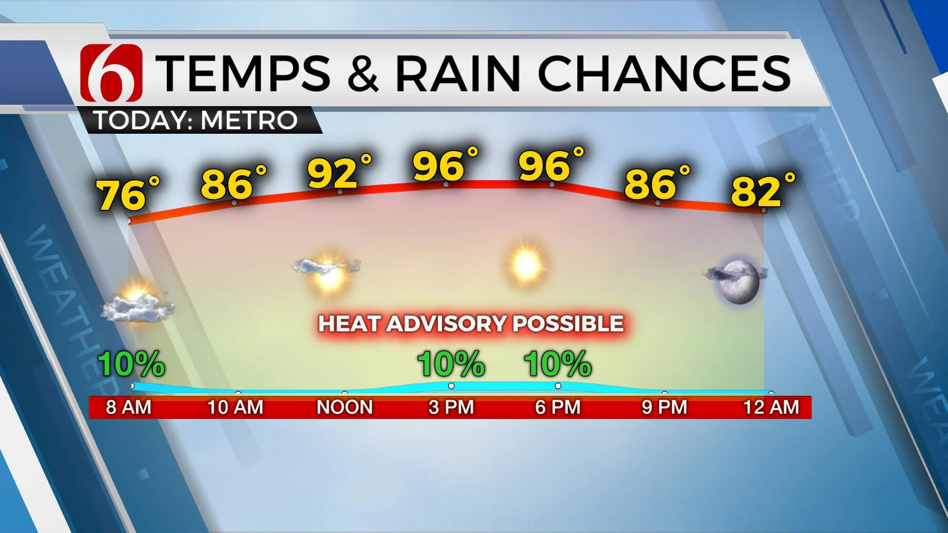
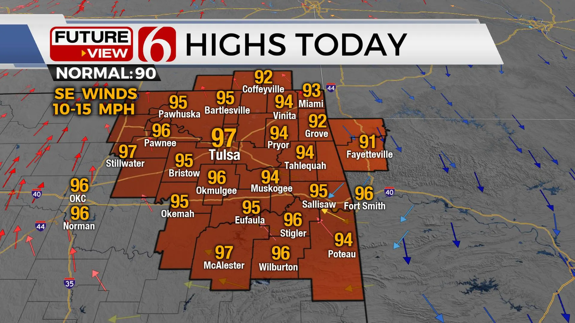
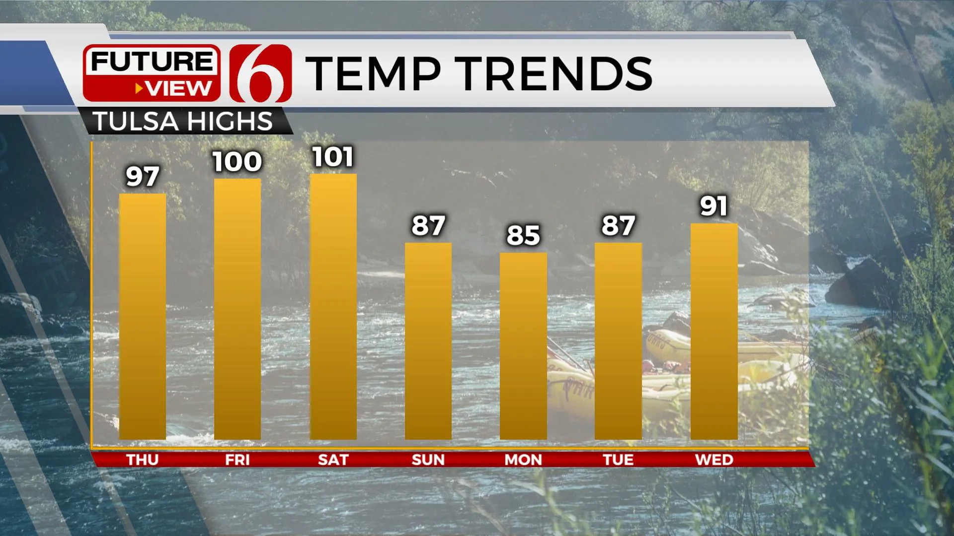
Afternoon highs will reach the mid-90s again Thursday, with heat index values nearing 103-108.
Another heat advisory will be possible and additional advisories are likely Friday and Saturday as the mid-level ridge of high pressure settles near northeastern Oklahoma.
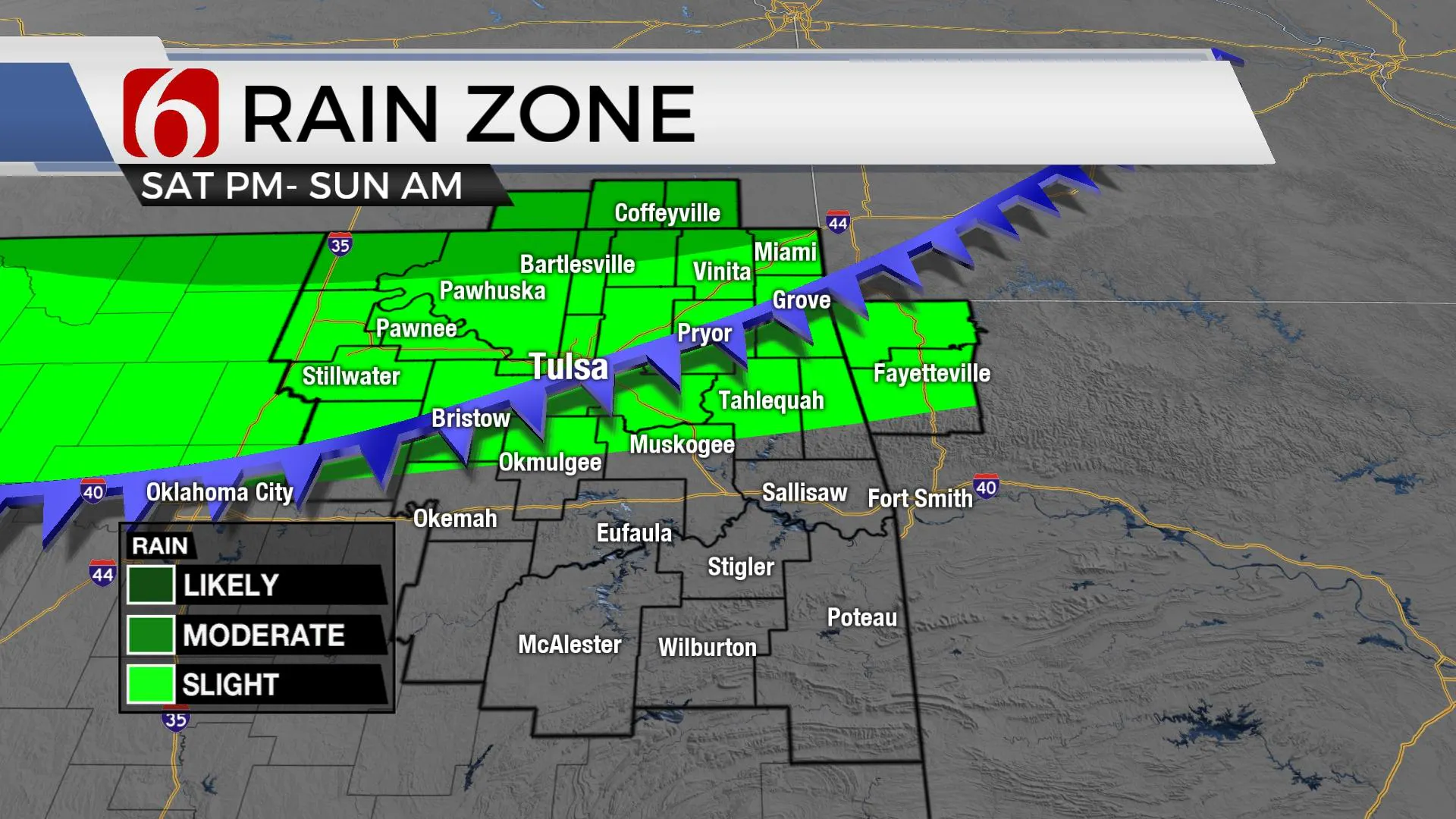
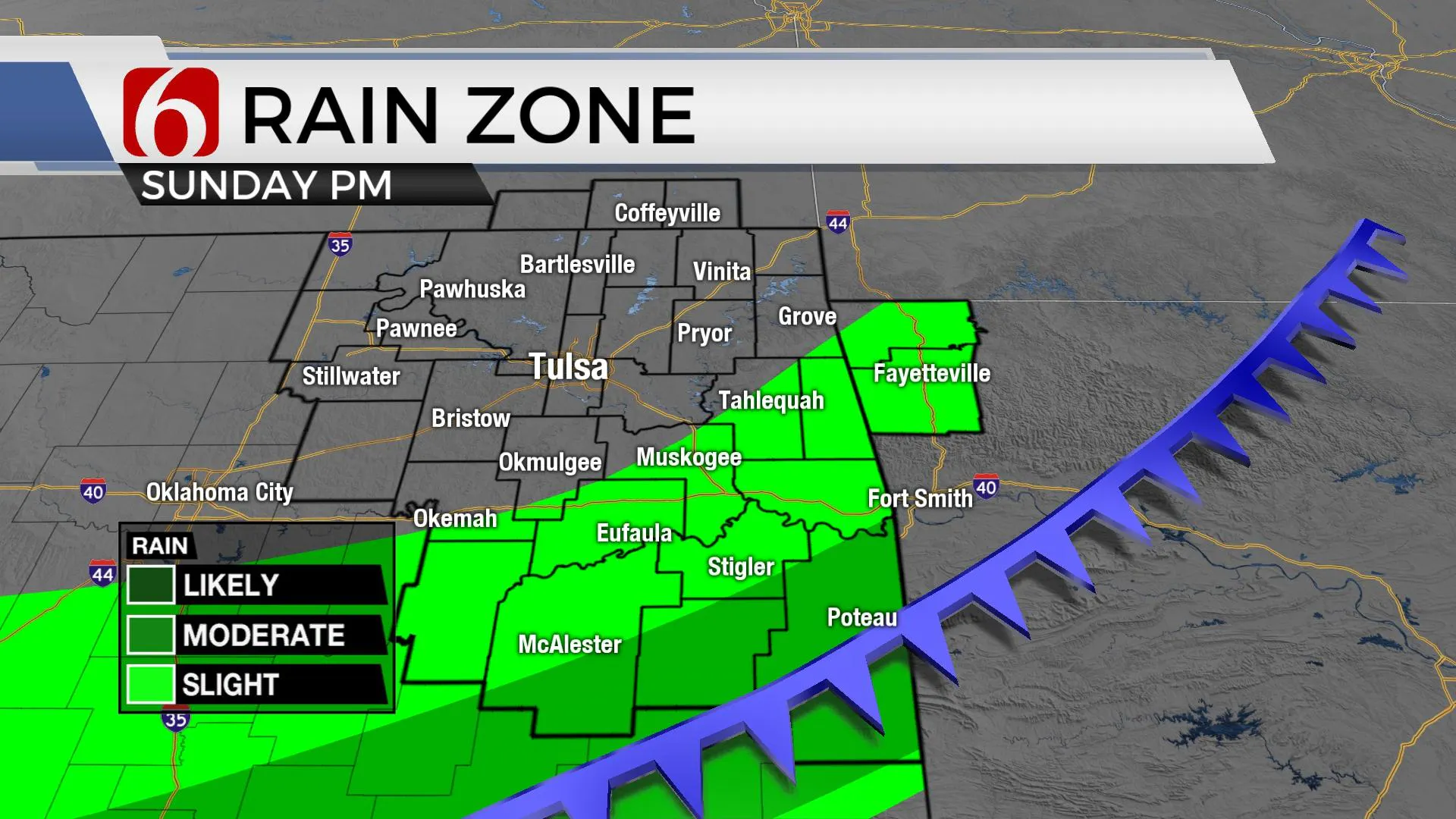
Daytime highs will max near 100 or slightly higher Friday and Saturday, before a strong front rolls across the area late Saturday night and Sunday morning.
This will bring a chance for a few scattered showers or storms, but more importantly brings a drier air mass Sunday night into early next week.
This will bring relief to our current heat wave Monday through Wednesday.
The morning podcast link can be found by clicking here.
More Like This
June 23rd, 2022
November 12th, 2024
November 11th, 2024
November 7th, 2024
Top Headlines
December 13th, 2024
December 13th, 2024
December 13th, 2024
December 13th, 2024


