Tracking 2 Fronts Soon
Another pleasant morning is expected on Tuesday.Tuesday, October 4th 2022, 6:14 am
TULSA, Okla. -
Another pleasant morning is expected on Tuesday.
Here are the details from News On 6 Meteorologist Alan Crone:

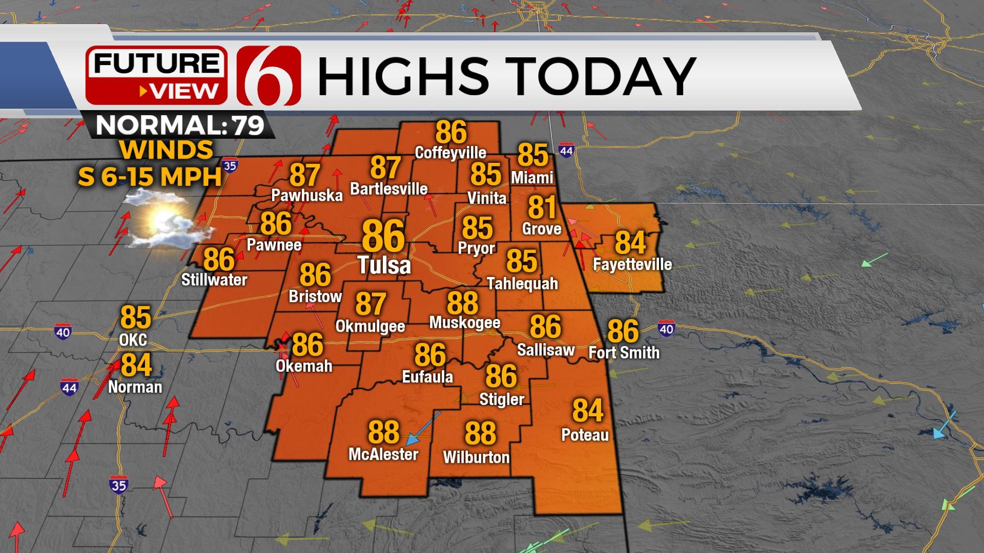
It may not seem like it, but the pattern is changing. Our blocking pattern that has been in place for the last several days is beginning to break down. A trough across the Intermountain region will move eastward over the next 36 hours and bring a surface boundary across part of Northern Oklahoma Wednesday. This front should cross most of Northern Oklahoma before stalling, but with very little only minor changes in daytime highs. As the front crosses the area, and the upper trough remains to our northeast, there will be a window for a few clouds across Northern Oklahoma and southern Kansas. The potential for a sprinkle or a brief shower will be possible across southeastern Kansas Wednesday morning through midday. It’s highly unlikely that any of this extremely light precipitation will move across Northern Oklahoma, but I suppose it’s a very low possibility. The front will become diffuse and lose its influence quickly Wednesday afternoon and evening. Daytime highs Wednesday are expected back into the mid-80s, but with north winds at 10 to 15 mph.

Thursday the upper airflow will be from the northwest as a significant area of low pressure aloft is positioned across the upper Midwest of the United States. This shoves a decent fall front into the southern plains late Thursday night into early Friday morning. As this front quickly advances across the area, gusty north winds at 15 to 30 mph will be likely with temperatures becoming more fall like through the day. Friday afternoon highs will more than likely stay in the lower 70s across northeastern Oklahoma and still reach some lower 80s across southeastern sections. The airmass behind the Friday front is extremely dry. Dewpoint temperatures in the upper 20s and lower 30s are likely to overspread the area. This will bring the ability for much cooler weather Friday night into Saturday. Friday night football games will be in the 60s, with temperatures dropping into the 40s Saturday morning. Saturday afternoon highs may easily stay in the 60s across Northern Oklahoma and the lower 70s across the southern Section of the state.

After a respite, Sunday, a week upper-level low across the desert Southwest will be ejecting east across Oklahoma early next week. Despite the initial presence of low-level dry air, the possibility of increasing low level moisture will aid in some shower chances with this system. This will bring at least a chance for some measurable precipitation for a small part of Northern Oklahoma late Sunday into early Monday. The pattern will continue to be more progressive for the next 2 to 3 weeks and will provide more opportunities for measurable precipitation along with periodic intrusions of fall weather. Our long-awaited return to a fall weather pattern seems to be unfolding in early stages.
Thanks for reading the Tuesday morning weather discussion and blog.
Have a super great day!
Alan Crone
KOTV
If you’re into podcasts, check out my daily weather update. Search for NewsOn6 and ‘Weather Out The Door’ on most podcast providers, including Spotify, Stitcher and Tune-In, or Click Here to listen on Apple Podcasts.

Get The Daily Update!
Be among the first to get breaking news, weather, and general news updates from News on 6 delivered right to your inbox!
More Like This
October 4th, 2022

June 21st, 2023

June 19th, 2023

June 13th, 2023
Top Headlines

April 18th, 2024


