Breezy, Warm Friday Before Weekend Storm Chances
Expect a chilly start to the day before temperatures warm back up towards the afternoon hours.Friday, October 14th 2022, 7:33 am
Expect a chilly start to the day before temperatures warm back up towards the afternoon hours.
Here are the details from News On 6 Meteorologist Alan Crone:

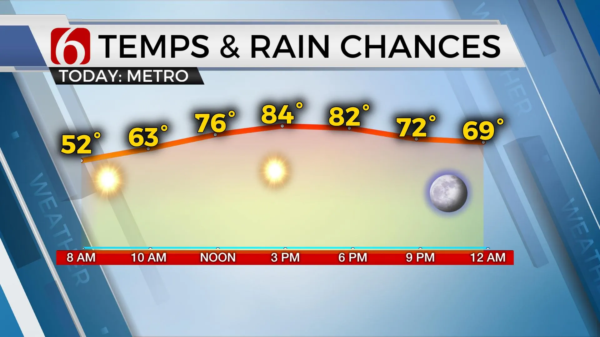
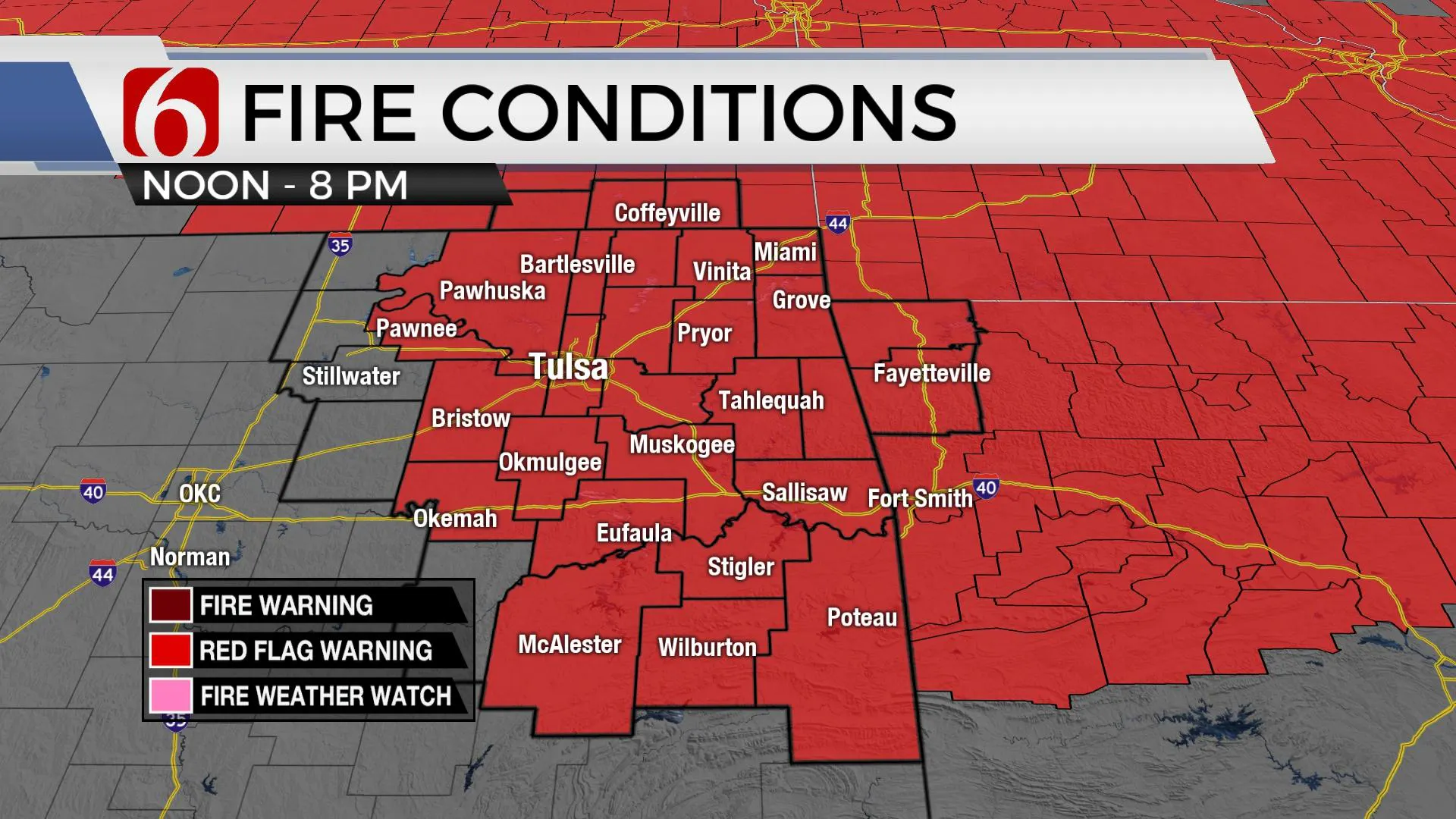
TULSA, Okla. - After a chilly morning, temperatures are expected to rise above normal on Friday afternoon with highs in the lower to mid-80s. Gusty southwest winds arrive midday into the afternoon with increasing fire spread concern across most of the state. Red Flag Warnings will be underway again Friday afternoon for most of northeastern Oklahoma. A cold front arrives Saturday bringing storm chances into the state for some locations. Some of the coolest weather of the early fall season arrives early next week for a brief period.

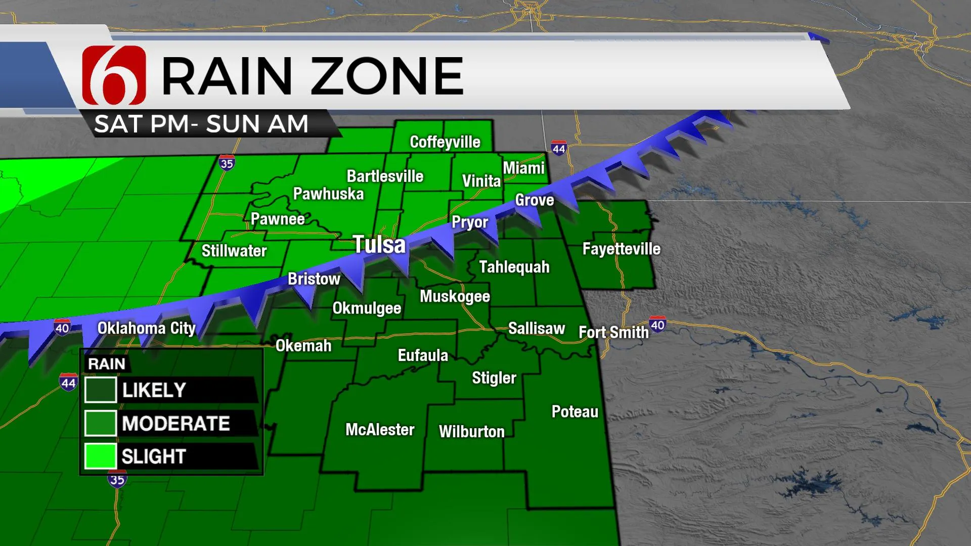
A powerful upper trough is positioned across Hudson Bay Canada into the Great Lakes region. In the southern stream, a compact upper-level low is near the Baja area. A surface cold front will move across the central plains Friday and enter northern Oklahoma Saturday while slowly progressing southward by evening. Upper-level lift rotating around the base of the southwestern U.S. low will approach the state by Saturday afternoon and evening as the cold front is moving south. This results in scattered storm chances, including the mention for a few strong to severe storms. Deeper low-level moisture is expected across southeastern Oklahoma and north Texas. As the front moves southward, additional lift arrives from the low to our west and the upper flow to our north. This should trigger scattered showers and storms behind the boundary late Saturday into pre-dawn Sunday. While some of this activity will be post-frontal in the northern sections, a few cells producing hail would be possible. Sunday morning most of this activity will be across the southern third of the state moving into north TX midday. Drier air will arrive effectively taking precipitation chances out of the area.

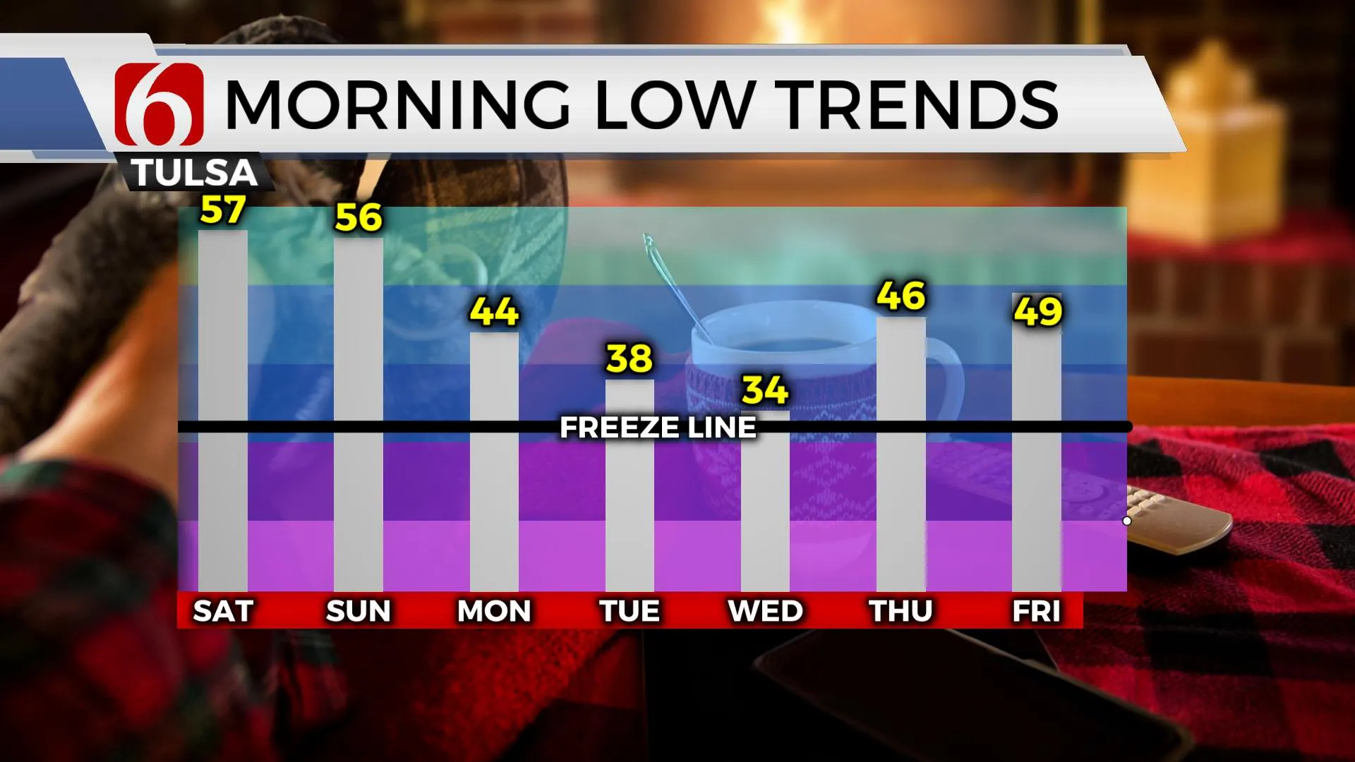
As the deep trough slowly drops southward next week, a strong surface ridge of high pressure from Canada migrates into the central plains Tuesday and into northeastern Oklahoma Wednesday morning. This brings the coolest (coldest) air of the early fall season to the state (and upper Midwest) for a few days. Most data support highs Monday in the lower to mid-60s with a more notable cool-down Tuesday with morning lows in the upper 30s and afternoon highs in the 50s north and lower 60s south. As the surface ridge settles directly over northeastern Oklahoma Tuesday night and Wednesday morning, clear sky, dry air, and light winds will allow temps dropping to near local dewpoints. This will bring morning lows in the lower to mid-30s with afternoon highs rebounding in the mid to upper 60s. South to southwest winds return Thursday as the ridge exits the area with afternoon highs in the upper 70s. The next storm system should arrive next weekend with another chance for showers and storms.

Thanks for reading the Friday morning weather discussion and blog.
Have a super great day!
Alan Crone
KOTV
More Like This
October 14th, 2022
June 21st, 2023
June 19th, 2023
June 13th, 2023
Top Headlines
December 11th, 2024
December 11th, 2024
December 11th, 2024
December 11th, 2024


