First Freeze Of The Fall Season Arriving Soon
A coming cold front means cooler temps in the Tulsa area.Monday, October 17th 2022, 6:08 am
TULSA, Okla. -
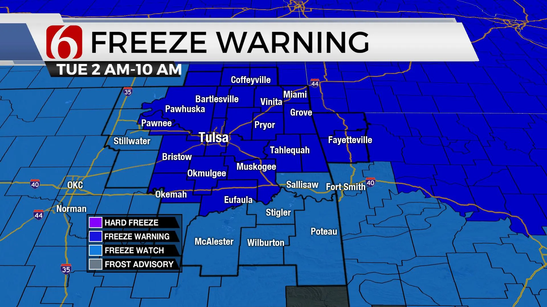
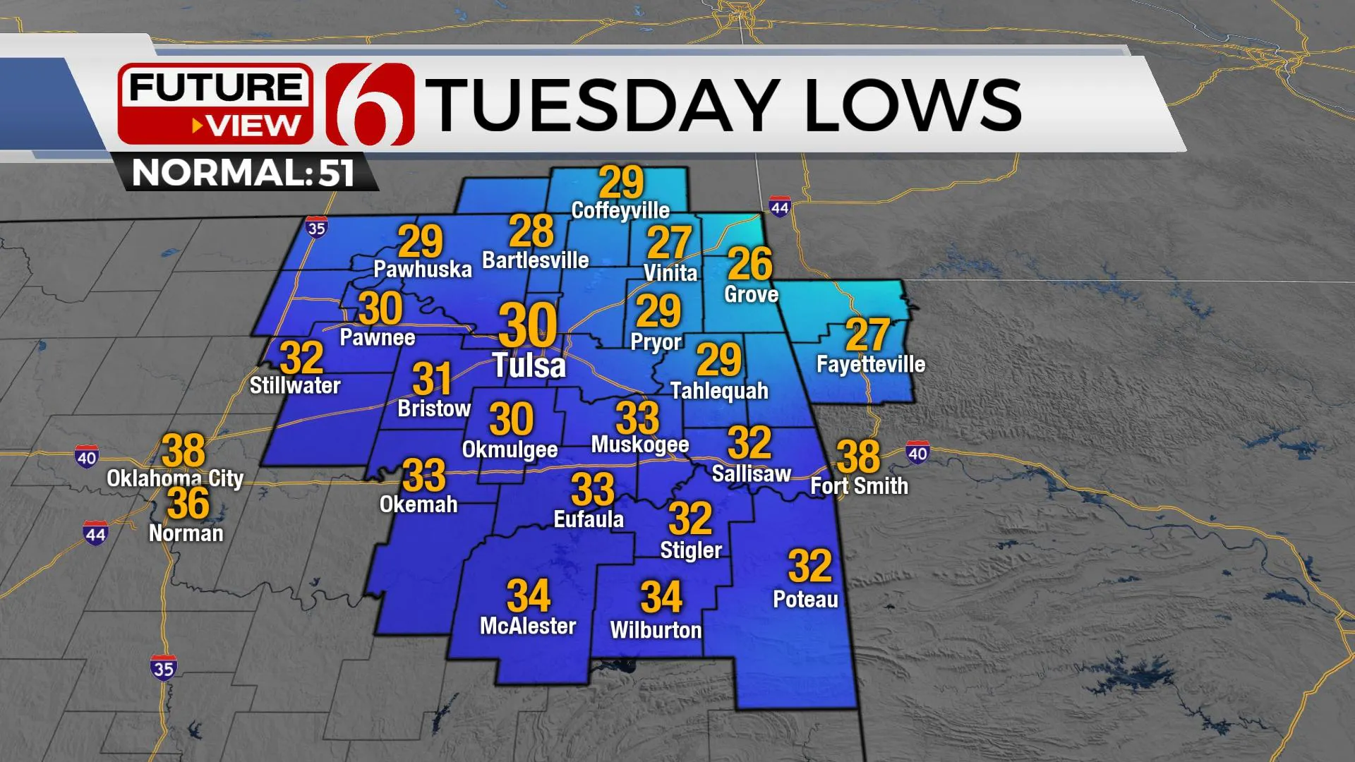
A Canadian ridge of high pressure builds southward reaching northern Oklahoma Tuesday afternoon and centering very near the area overnight into Wednesday morning. This brings the coolest air of the early fall season, including freezing temperatures for portions of northeastern Oklahoma pre-dawn Tuesday and over a larger portion of the state late Tuesday night and Wednesday morning. Freeze warnings and watches are posted for the area tonight into Tuesday morning. Widespread freeze warnings are likely late Tuesday night into Wednesday morning. This pattern will bring a hard freeze to portions of the area. The ridge migrates away from the area Wednesday with a pattern change this weekend that should persist for most of next week bringing much warmer weather into the state. Shower and storm chances should return sometime late Sunday night into Monday with additional chances for the middle of next week.
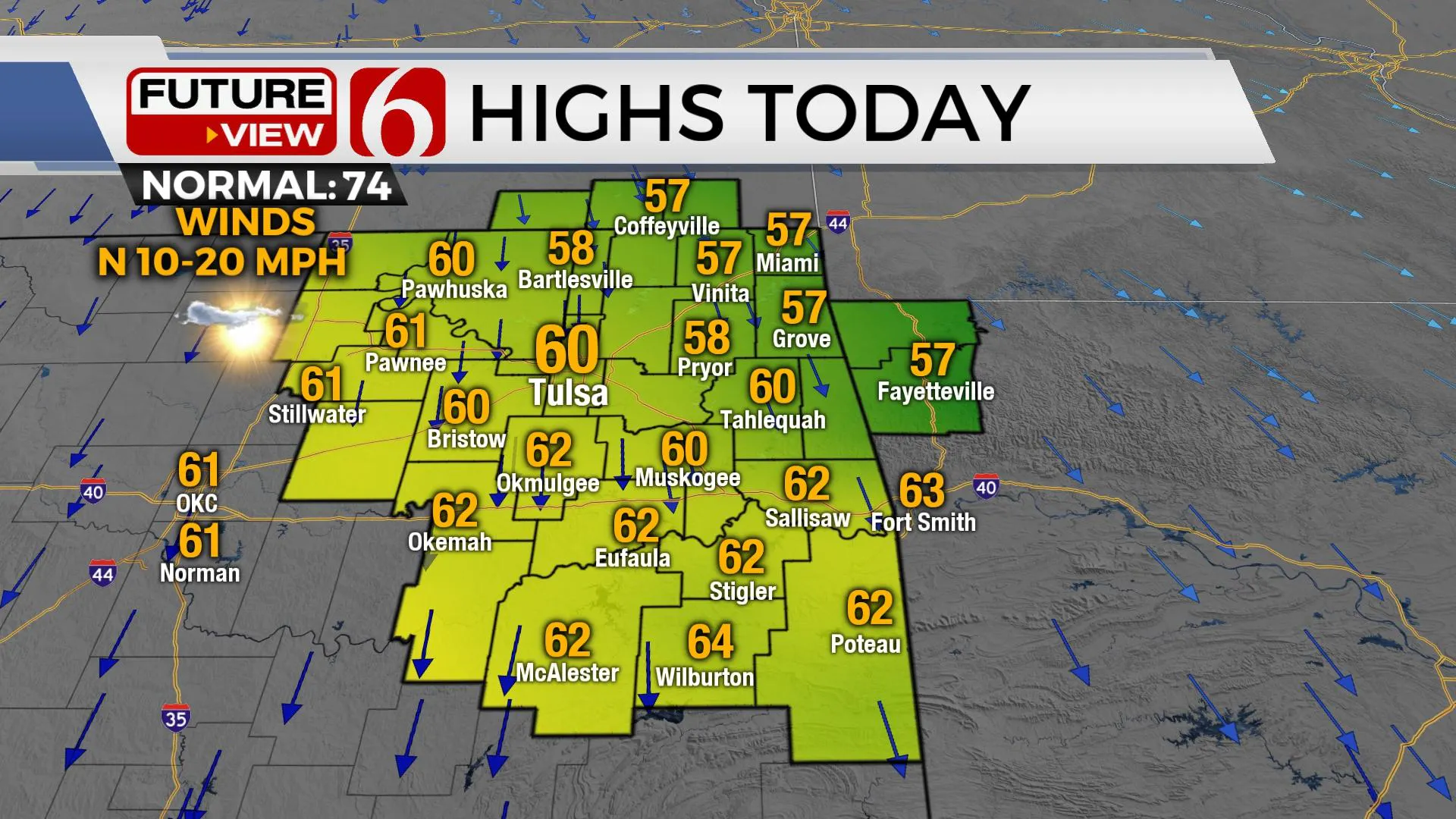
This upper air flow is characterized by a broad and deep low centered over Hudson Bay Canada and extending across the Great Lakes Region, where some significant snowfall is likely today and tonight across the upper peninsula of Michigan. This low will stay in the current position for the next few days before finally moving east later this week. The northwest upper air flow behind the system brings the chilly weather across the plains states, including Oklahoma, for the next few days. The upper flow is expected to change later this week as a southwest flow develops into the weekend. This brings our next rain and storm chance into the area late Sunday into Monday with another system likely by the middle of next week.
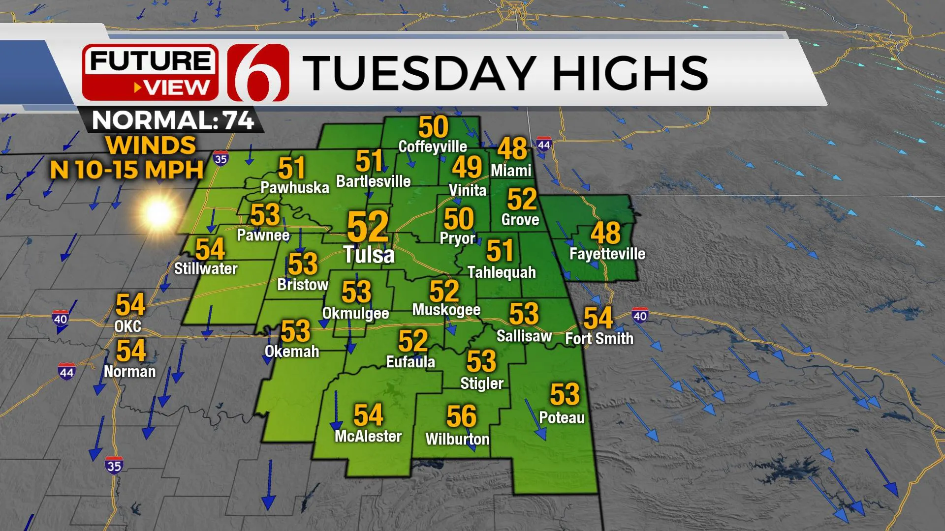
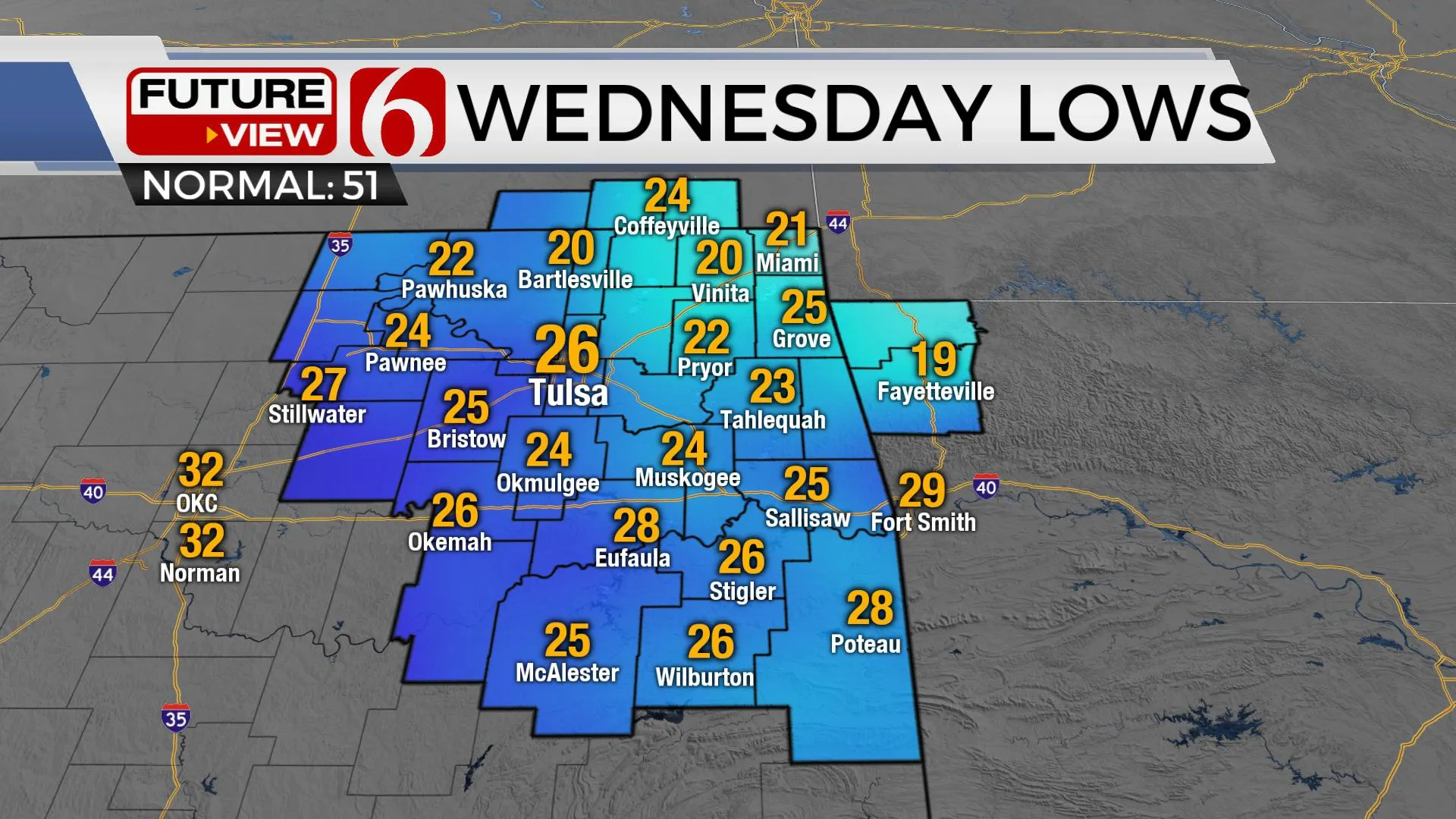
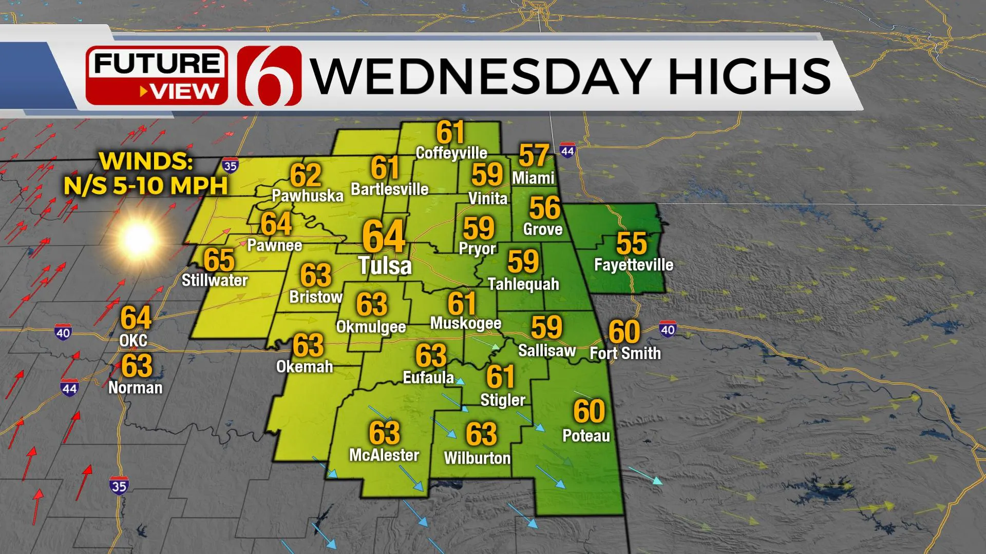
Daytime highs later this week climb into the 70s Thursday and the lower to mid-80s Friday through the weekend. Strong southwest winds are likely this weekend with increasing low-level moisture directly ahead of the system Sunday. Before this occurs, fire weather spread rates will be a concern. Extremely dry low-level air moves into the region Tuesday with dew points dropping into the single digits Tuesday night and Wednesday morning with elevated fire danger issues continuing into the early part of the weekend.
Thanks for reading the Monday morning weather discussion and blog.
More Like This
October 17th, 2022
January 20th, 2024
December 30th, 2023
December 17th, 2023
Top Headlines
December 11th, 2024
December 11th, 2024
December 11th, 2024
December 11th, 2024


