A Pattern Change Underway As Cooler Weather Comes
A chilly morning brings a pleasant day with sunshine and relatively light winds this afternoon.Thursday, October 20th 2022, 5:56 am
TULSA, Okla. -
A chilly morning brings a pleasant afternoon with sunshine and relatively light winds this afternoon. Highs will reach the mid to upper 70s. A big pattern change quickly brings windy and warmer weather across the state this weekend with afternoon highs in the 80s. Our next system brings mentions for a few storms early next week.

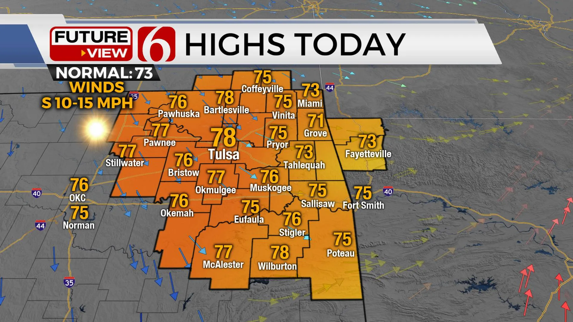
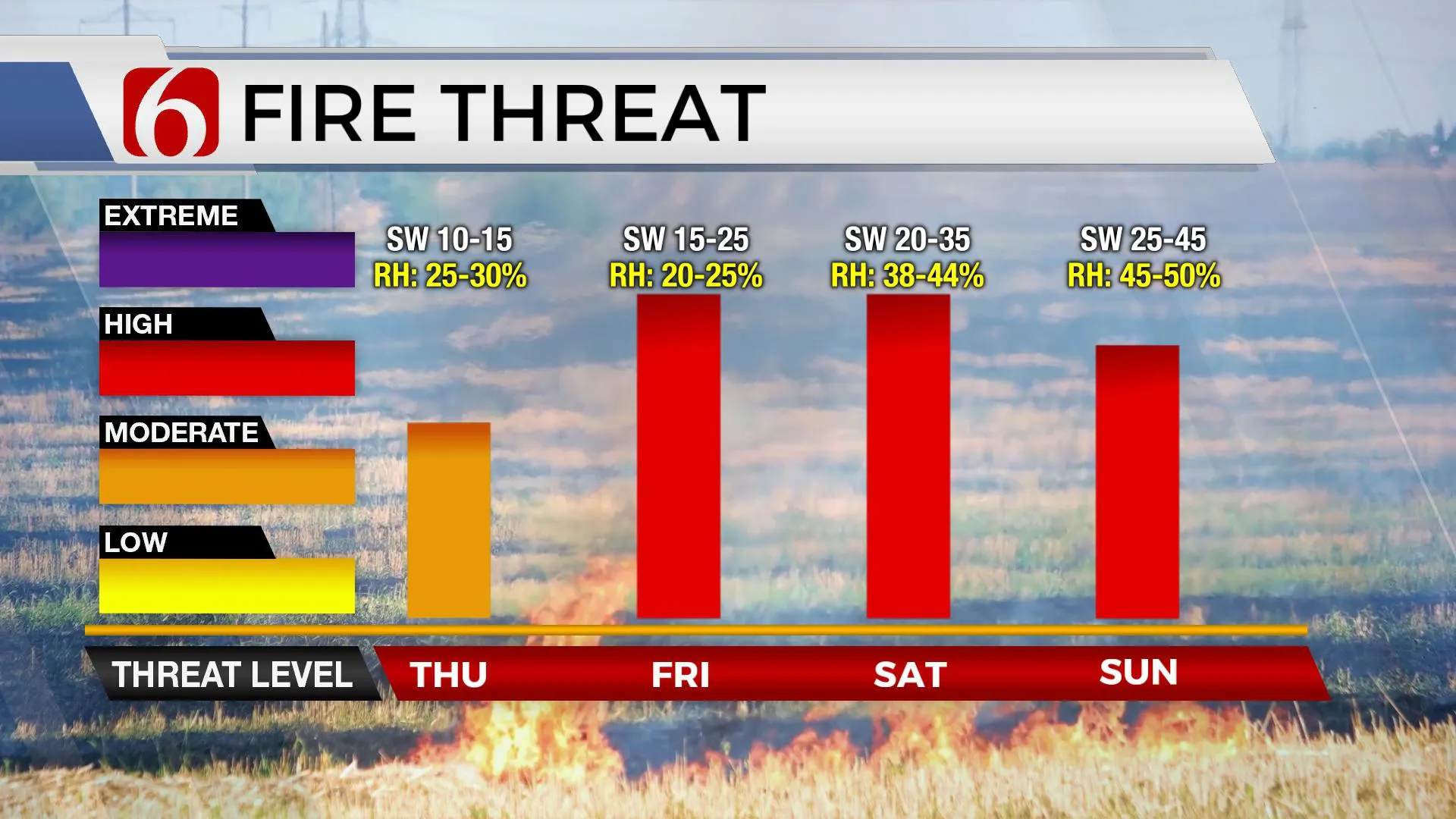
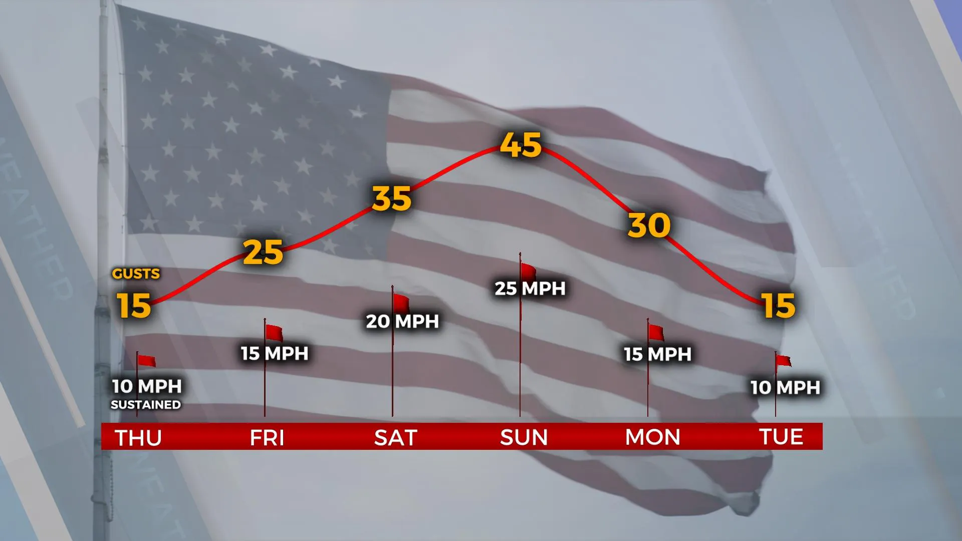
The upper trough across the northeastern U.S. is finally moving east as the ridge in the west is breaking down. This signals a pattern change that will bring more active weather from the west to the central plains soon, including early next week with a mention for showers and storms beginning late Sunday into Monday. There remain inconsistencies in some data regarding the exact scenario, but we’ll continue with a moderate chance for a few storms as a cold front and upper-level system nears the state. In the near-term, beautiful weather is expected today with highs in the mid to upper 70s along with southwest winds from 10 to 15 mph. The pressure gradient significantly tightens this weekend as pressure falls across the Lee of the Rockies will induce very strong winds from 20 to 35 mph Saturday and nearing 40 to 45 mph gusts Sunday. Before low level moisture surges across the central and eastern sections of the state Sunday, fire spread conditions may reach near critically high levels Friday and Saturday. A dry line feature is expected to sharpen up this weekend and places the far western half of the state in extremely dry and windy conditions. We’ll experience the windy weather across the eastern half of the state but increasing moisture may offset some fire spread rates Sunday, but not much. Burn bans remain.
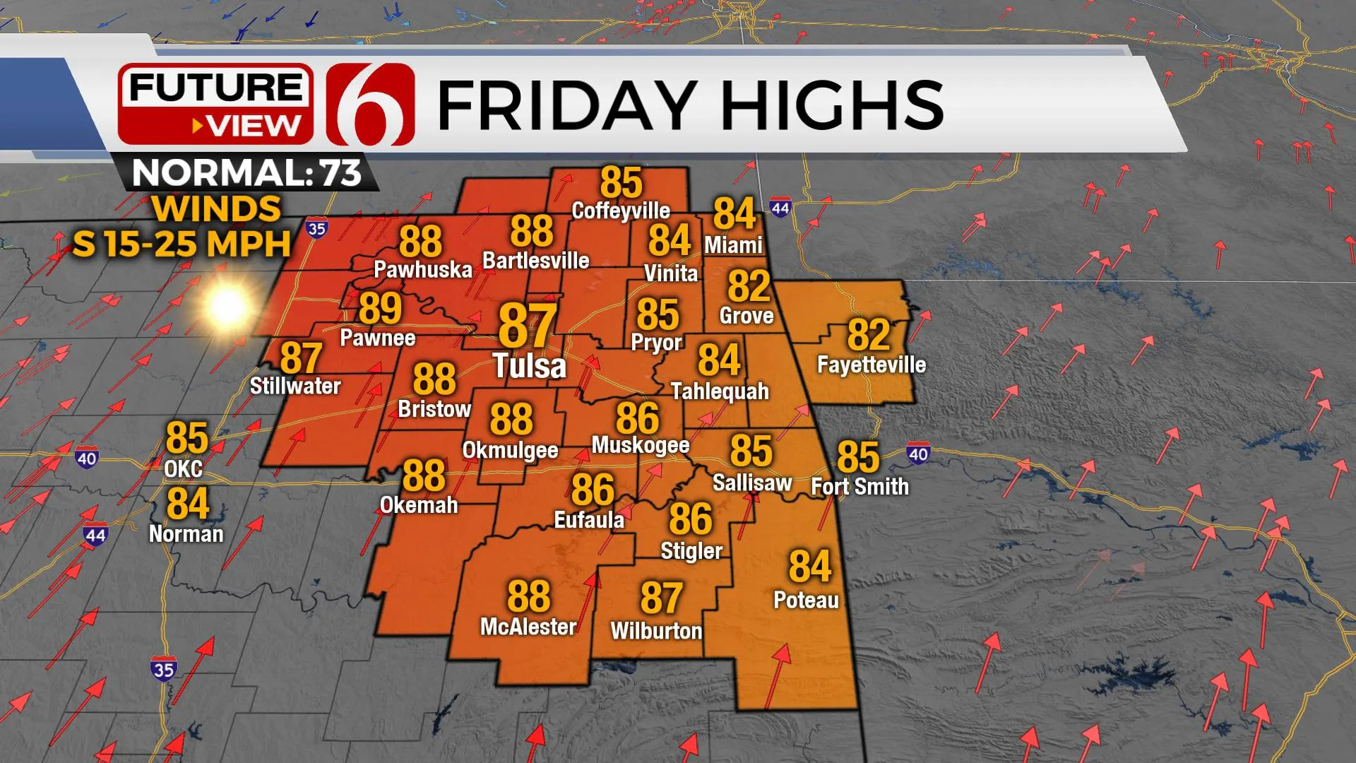
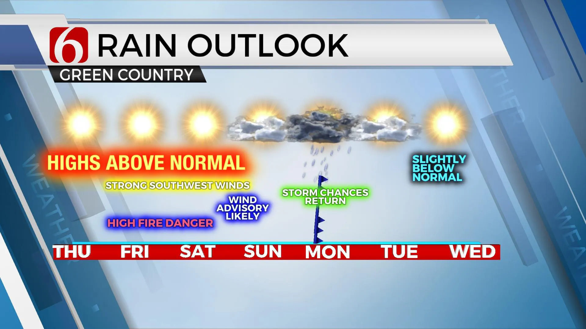
Sunday night into Monday the northern stream features a strong upper-level disturbance ejecting from the Rockies into the central plains. The tail-end of this lift will trigger a few showers and storms late Sunday night or early Monday morning across far northern OK and southern KS. Meanwhile in the southern stream, a wave of energy approaches from the west and generates scattered storms across Texas. As the surface cold front moves across the area Monday, storms will be possible across part of Eastern OK, but some data suggest the higher coverage may remain slightly east of Tulsa. We’ll continue with a moderate chance of storms Monday. Additional changes are possible.
Thanks for reading the Thursday morning weather discussion and blog.
More Like This
October 20th, 2022
December 12th, 2024
December 12th, 2024
December 12th, 2024
Top Headlines
December 12th, 2024
December 12th, 2024
December 12th, 2024
December 12th, 2024


