

Cold Weather Pattern Begins
Chilly temperatures return to Green Country after showers and storms swept across the state on Tuesday.Wednesday, December 14th 2022, 6:04 am
If you’re into podcasts or in a rush, check out my daily weather update. Search for NewsOn6 and ‘Weather Out The Door’ on most podcast providers, including Spotify, Stitcher and Tune-In, or Click Here to listen on Apple Podcasts.
TULSA, Okla. - Chilly temperatures return to Green Country after showers and storms swept across the state on Tuesday.
Here are the details from News On 6 Meteorologist Alan Crone:

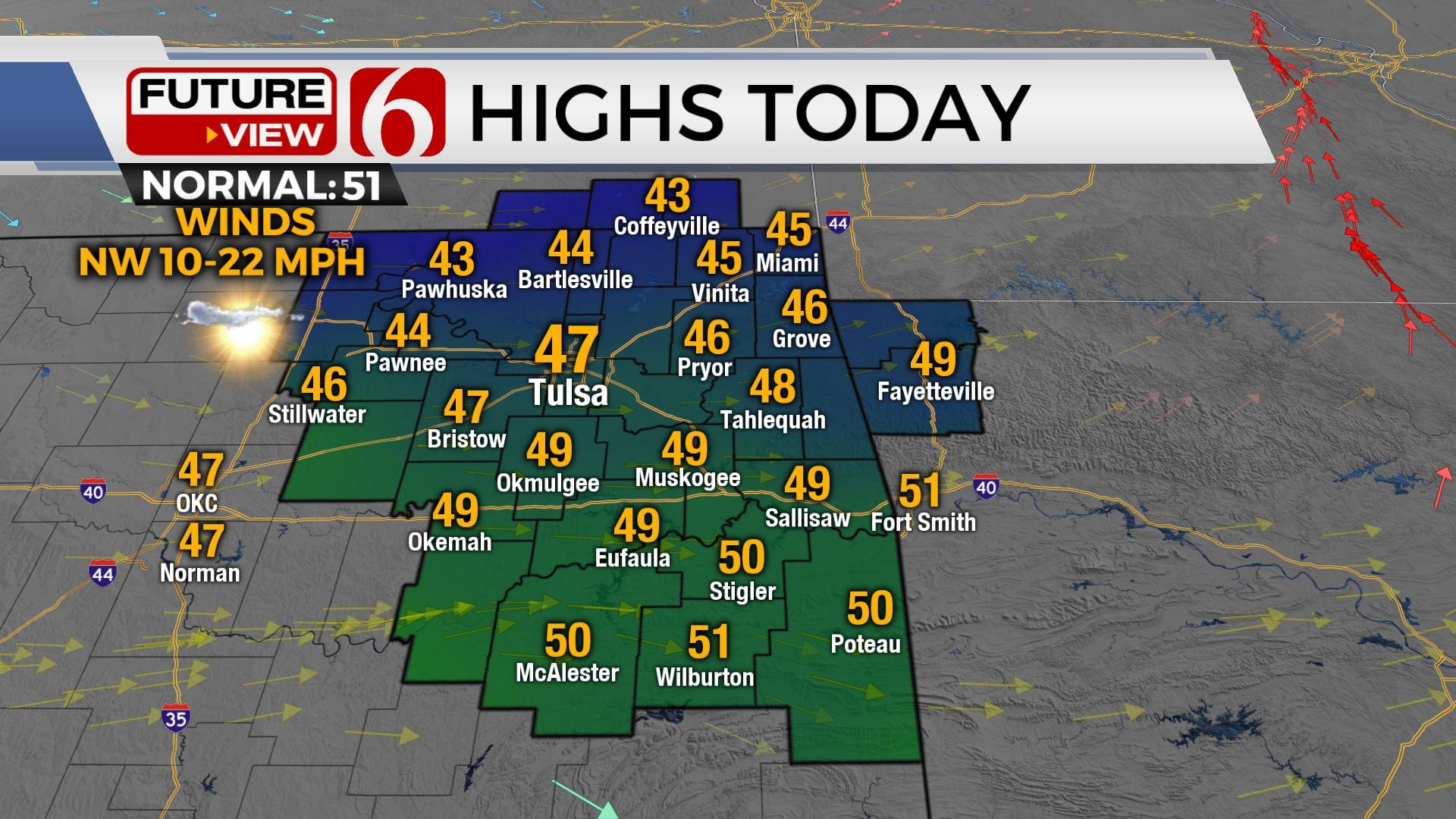
A few clouds near or south this morning will exit soon with mostly sunny and cooler weather today. Highs will reach the upper 40s in Tulsa with a slightly breezy west-to-northwest wind. A return to colder weather appears likely for most of the foreseeable future.

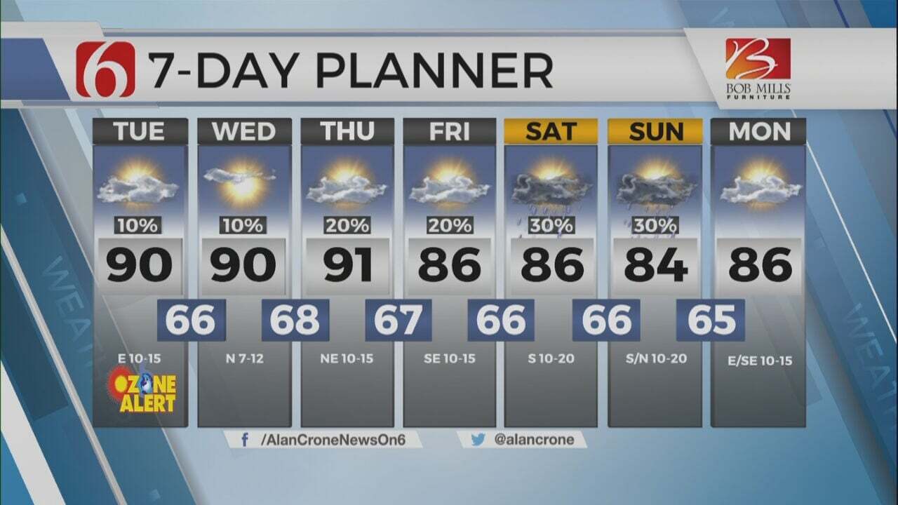
A powerful upper-level low continues to pinwheel across the central plains producing blizzard conditions north and severe weather threats southeast. A secondary lobe of energy rotates across the base of this feature bringing colder weather southward into the state today and will be enforced with cold and dry weather through the end of the week. The exception is this morning across far southeastern Oklahoma, where a few small areas of light precipitation may occur with lows in the upper 30s and lower 40s. Northern Oklahoma will be colder this morning with temps in the upper 20s and lower 30s. West to northwest winds remain today at 10 to 25 mph with afternoon highs in the mid to upper 40s north and lower 50s far south. Colder weather will continue to arrive for the next few days with morning lows mostly in the 20s and highs in the lower 40s. Friday may be the coldest in the short term with highs in the upper 30s and lower 40s. Another short-wave skirts the state this weekend with a return of southerly wind Sunday. A few showers or storms may occur across the far southeastern third of the state early Monday, but we'll keep the weekend dry and relegate a low chance for showers Monday.

The signal for much colder air of arctic origin will eventually arrive next week. The exact timing remains elusive at this point but has been suggested for several days in both operational and ensemble data. As the colder air drops southward, the pattern will more than likely remain progressive bringing the possibility of some precipitation chances across the state. As data becomes more consistent, and confidence increases, we'll be offering more specifics about these scenarios.
Thanks for reading the Wednesday morning weather discussion and blog.
Have a super great day!
Alan Crone
KOTV

Get The Daily Update!
Be among the first to get breaking news, weather, and general news updates from News on 6 delivered right to your inbox!
More Like This
December 14th, 2022

July 3rd, 2023

June 8th, 2023
June 6th, 2023
Top Headlines

December 12th, 2024

December 12th, 2024

December 12th, 2024
