Bitterly Cold Weather Arriving Soon
Frigid temperatures are on the way as winter weather quickly approaches Green Country.Wednesday, December 21st 2022, 7:02 am
If you’re into podcasts or in a rush, check out my daily weather update. Search for NewsOn6 and ‘Weather Out The Door’ on most podcast providers, including Spotify, Stitcher and Tune-In, or Click Here to listen on Apple Podcasts.
TULSA, Okla. - Frigid temperatures are on the way as winter weather quickly approaches Green Country.
Here are the details from News On 6 Meteorologist Alan Crone:
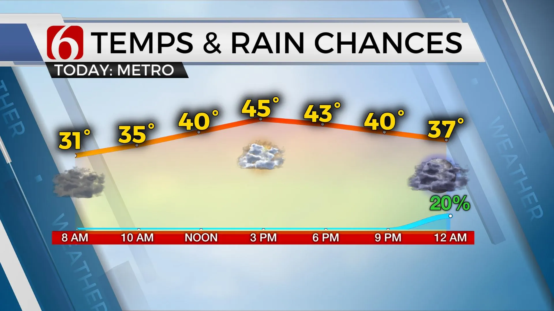
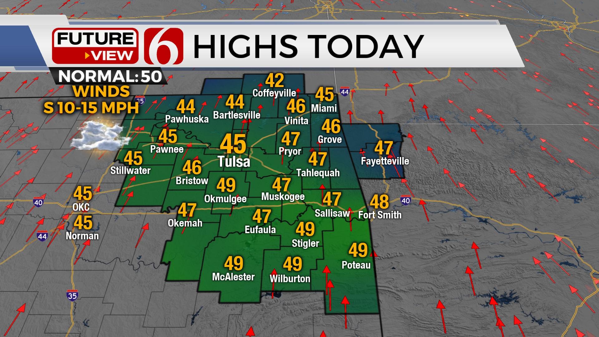
Morning clouds may support some mist in a few spots with temperatures near freezing. Afternoon highs will reach the mid-40s north and upper-40s south with some sunshine and south winds at 10 to 15 mph on Wednesday. Temperatures plummet pre-dawn Thursday bringing bitterly cold weather, dangerous wind chills, and some wintry weather precipitation across northeastern Oklahoma.
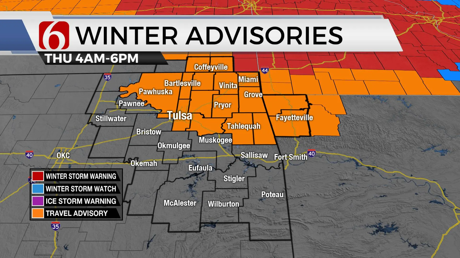
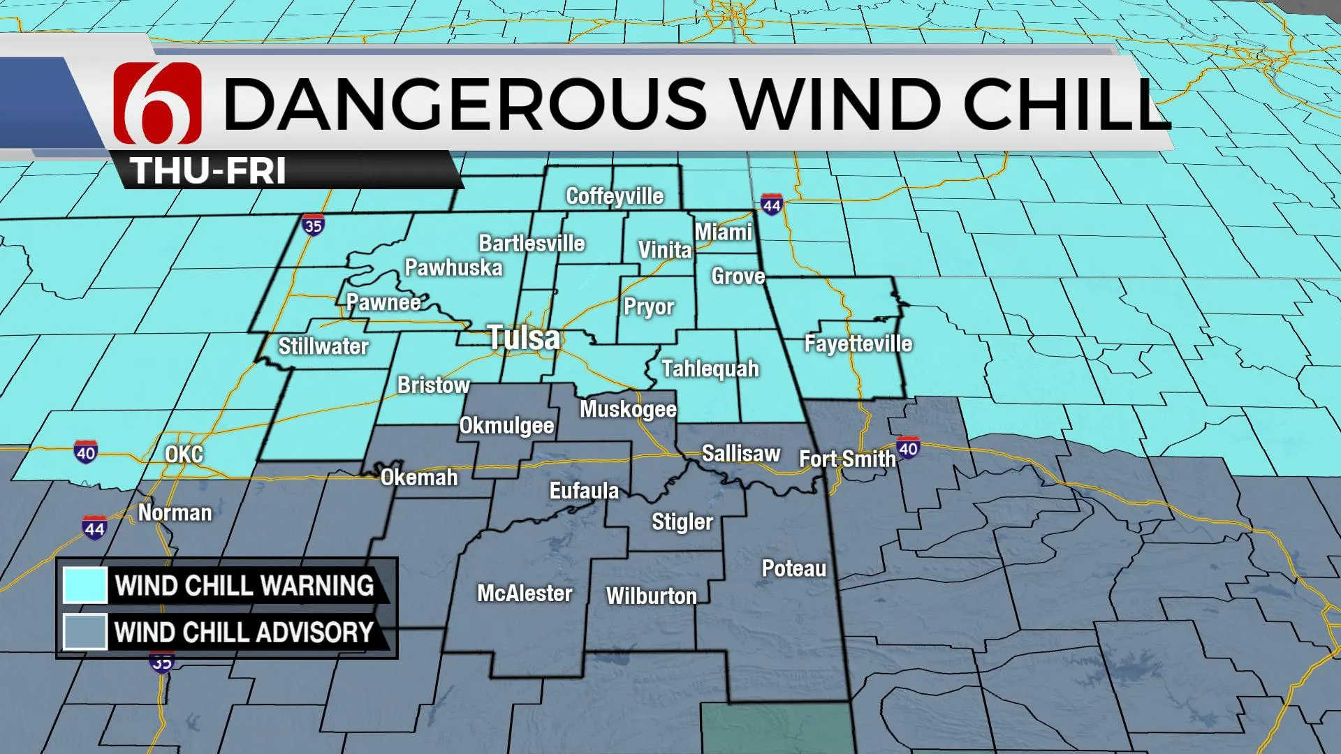
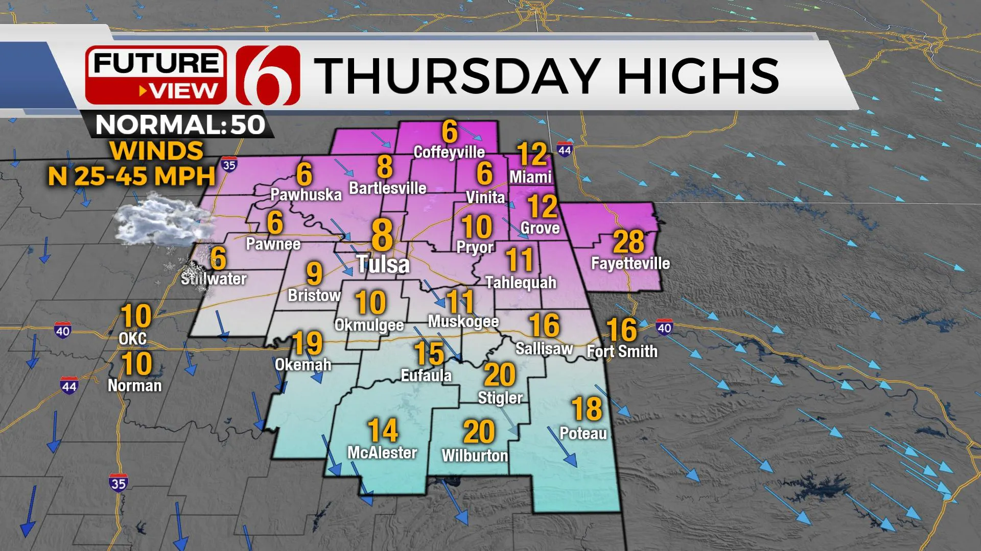
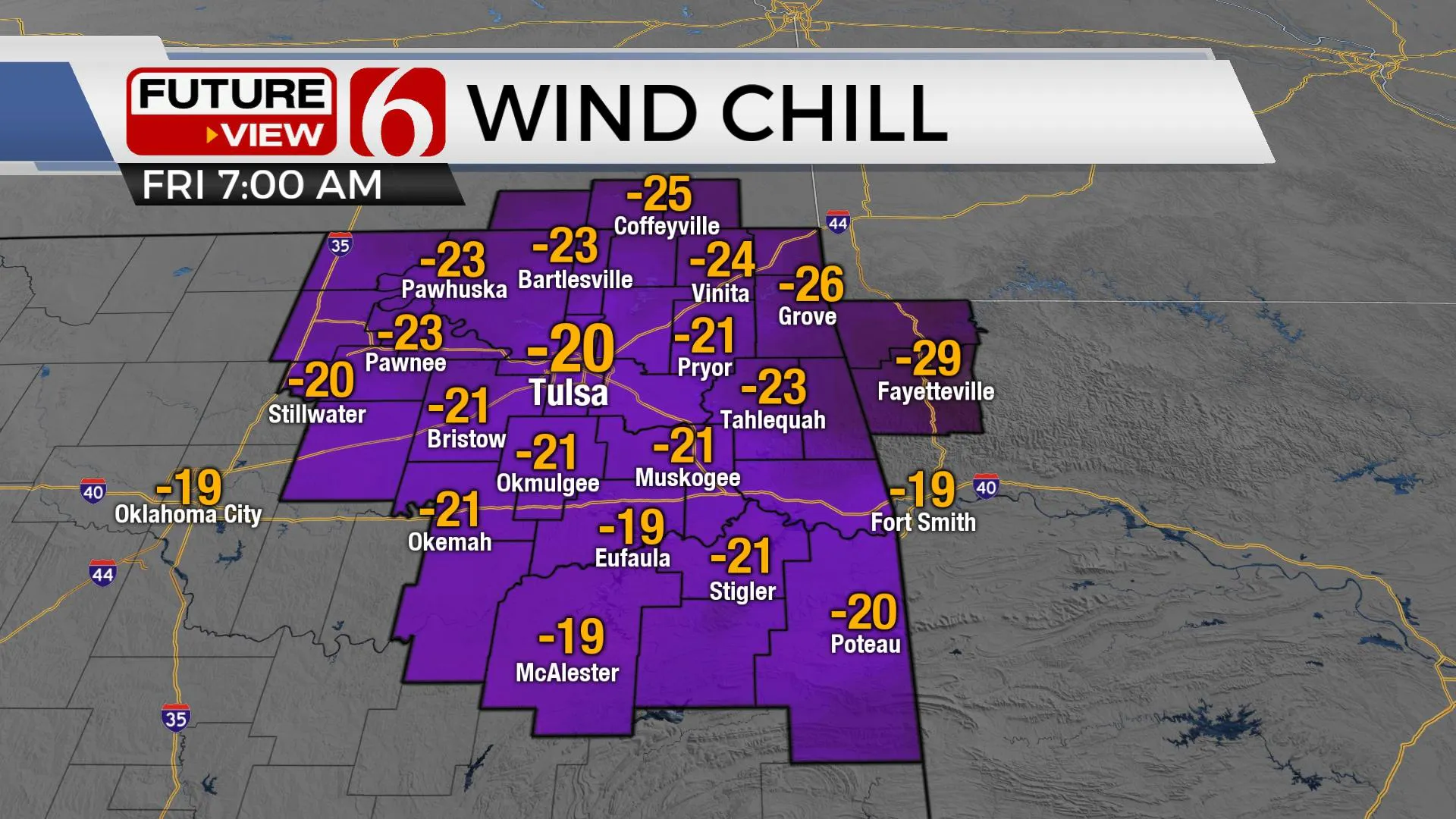
As the elongated lead wave (upper trough) exits southern Canada into the northern plains, surface cyclogenesis will occur with the eventual outcome placing a powerful 969 mb low across the Great Lakes Friday into Saturday. As this system quickly develops, a powerful cold front surges southward today and reaches far northwestern Oklahoma around midnight and passes northeastern sections pre-dawn Thursday. This strong cold front clears southeastern Oklahoma by mid-morning as a 1050 mb surface high develops from southeastern Canada into the Intermountain region of the Rockies. A significant surge of cross-polar origin air arrives as strong northwest winds howl from 25 to 45 mph. Temperatures drop from the lower 20s into the single digits early Thursday with wind chills plummeting into the -10 to -25 range. A wind chill warning will be in effect for a large area of northeastern Oklahoma with wind chill advisories across southern Oklahoma. A winter weather advisory will also be in effect for part of northeastern Oklahoma Thursday.
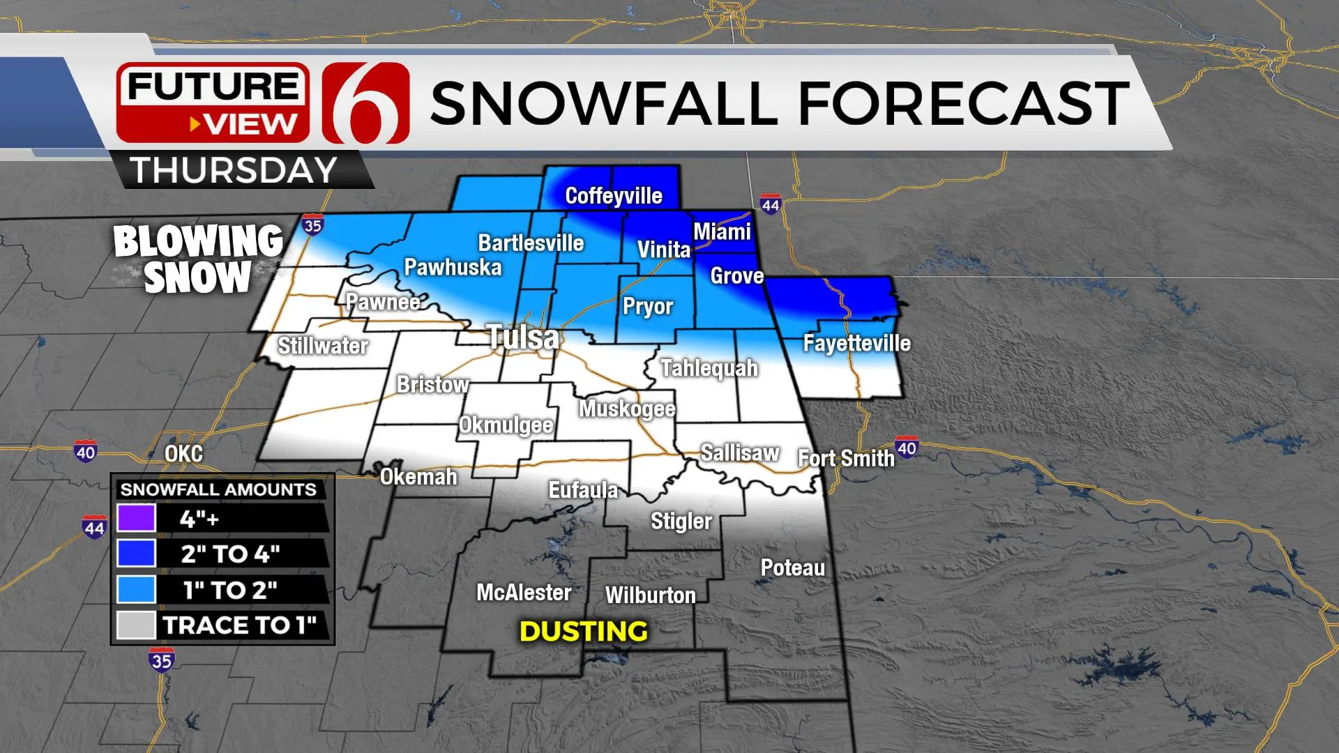
As the front nears the region later tonight, periods of light rain or drizzle are likely to develop in the vicinity of southern Kansas and northeastern Oklahoma. As the front rapidly surges southeast, the potential for a flash freeze will occur allowing precipitation to freeze on contact with elevated surfaces and some roadways. While amounts will be light, any freezing drizzle or light rain in this pattern can quickly lead to hazardous travel. The period of potential freezing precipitation will not last long but will follow the progression of the front as it moves southeast. Any remaining moisture will change to light snow early Thursday before ending early Thursday afternoon. Amounts from 1 to 3 inches will be possible mostly across far northeastern OK and southeastern Kansas. Snowfall for the Tulsa metro will be light, only amounting to near or less than one inch but strong northwest winds from 25 to 45 mph may result in blizzard-like conditions for a few hours. While our main issues will be bitterly cold weather and dangerous wind chill values, hazardous driving conditions will be possible with this event and a winter weather advisory will be in effect for this reason.
A weak upper-level wave crosses the region Saturday, but any notable impacts of snow will be well southwest of the area.
Another stronger system may drop down the central plains Sunday night into early next week bringing another front and some light precipitation chances, but the air mass will remain mostly the same with a moderating influence into the middle of next week. I’ve lowered temps a few degrees below most model guidance for Monday and Tuesday but will keep the period void of precipitation at this point. Most data support a warming trend by the middle to end of next week with afternoon highs nearing the 60s.
Thanks for reading the Wednesday morning weather discussion and blog.
Have a super great day!
Alan Crone
KOTV
More Like This
December 21st, 2022
June 21st, 2023
June 19th, 2023
June 13th, 2023
Top Headlines
December 13th, 2024
December 13th, 2024
December 13th, 2024
December 13th, 2024

