Tracking A Friday Morning Clipper
Some mist and spotty showers are possible across parts of Green Country as temperatures fall on Friday morning.Friday, February 10th 2023, 8:19 am
TULSA, Okla. -
If you’re into podcasts or in a rush, check out my daily weather update. Search for NewsOn6 and ‘Weather Out The Door’ on most podcast providers, including Spotify, Stitcher and Tune-In, or Click Here to listen on Apple Podcasts.
TULSA, Okla. - Some mist and spotty showers are possible across parts of Green Country as temperatures fall on Friday morning.
Here are the details from News On 6 Meteorologist Alan Crone:
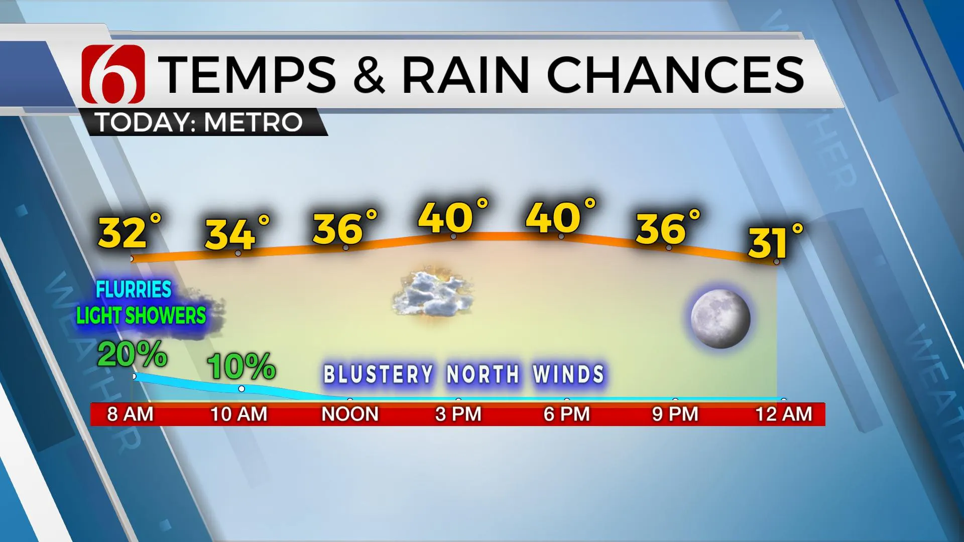
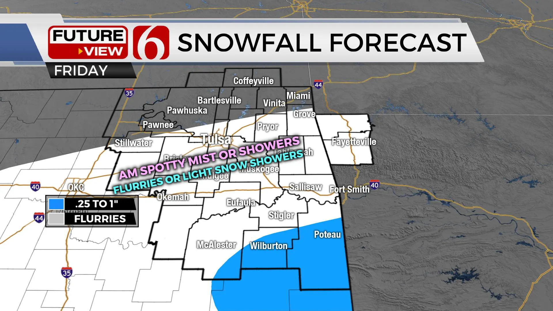
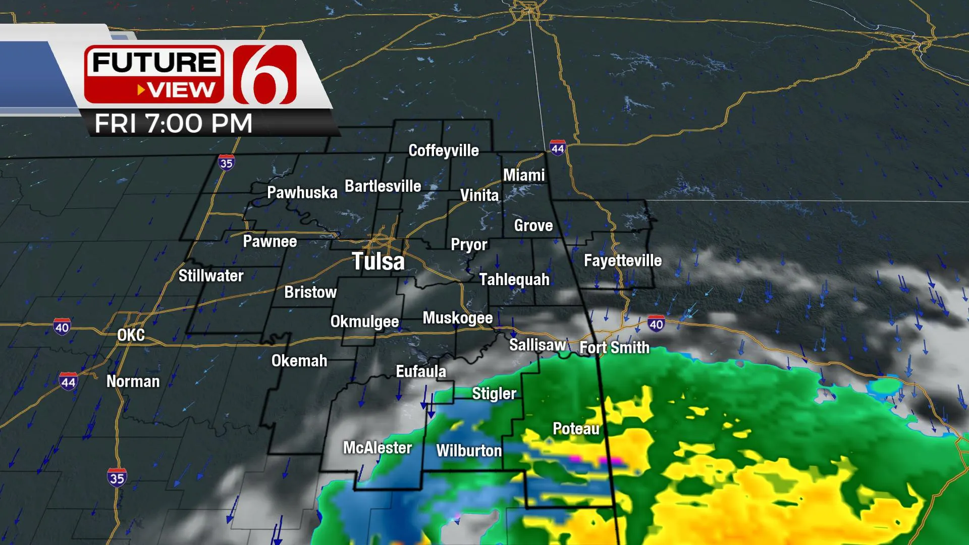
A mixture of light rain and mist changing to some flurries or light snow showers will remain early Friday morning as a strong upper-level trough clips our immediate area. The system is tracking more southward compared to Thursday’s data. This will greatly limit or even remove the potential for any measurable snowfall across northeastern Oklahoma. A band of light mist or snow flurries will remain early Friday morning but will not last long for the metro. Higher chances for more rain mixing with snow will arrive across far southeastern Oklahoma and southwestern Arkansas through midday and early afternoon. Some of these areas across far southeastern Oklahoma may see slushy snow accumulations on grassy regions, but no significant accumulation will be expected. Blustery and chilly weather remains Friday. As of Friday morning, no winter weather advisories are in effect.
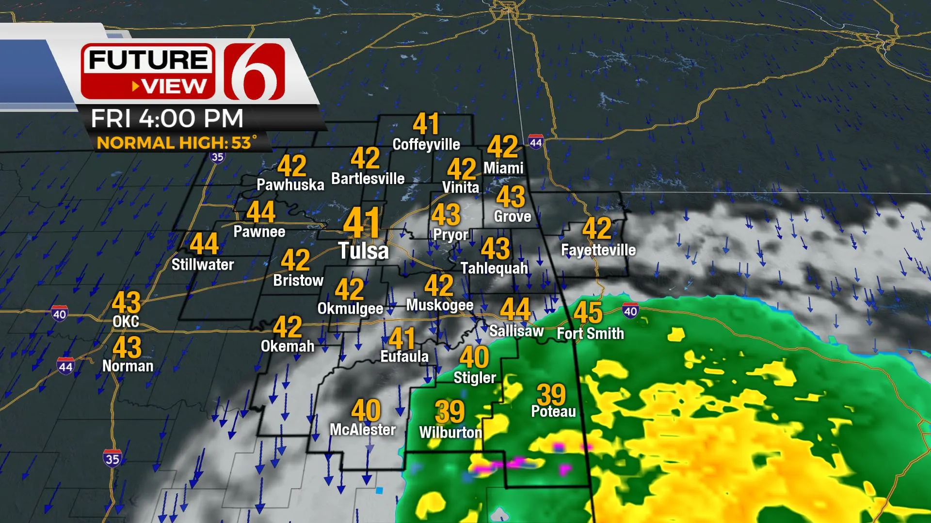
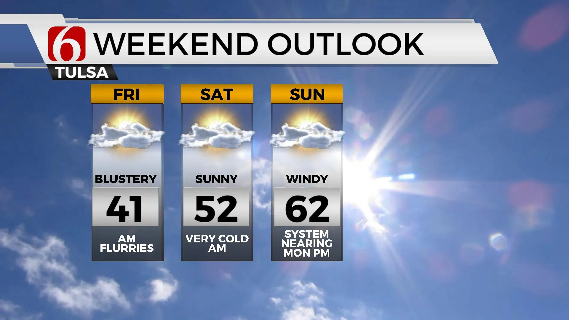
The track of the upper-level trough should dive southeast over the next few hours. This may keep some rain-to-snow production up and running across far southeastern Oklahoma and western Arkansas for the afternoon and early evening. Most of this has already passed the Tulsa metro on Friday morning with a clearing sky by afternoon and northwest winds from 15 to 25 mph. Afternoon highs will stay in the mid to upper 30s across far southeastern Oklahoma where clouds and some precip may linger longer today. But spots northwest of Tulsa will see more sunshine and highs nearing the lower 40s. Clouds clear and winds diminish later Saturday night allowing plummeting temps into early Saturday morning. This means Saturday morning starts in the lower to mid-20s in Tulsa. Saturday afternoon features relatively light winds with sunshine and highs in the upper 40s and lower 50s. The next storm system begins influencing our weather Sunday with gusty south winds from 20 to 30 mph and increasing clouds. This brings slightly warmer weather, nearing the lower 60s for highs.
Early next week features the return of precipitation, mostly in the form of rain with some thunder late Monday into Tuesday. Some important features of this system may still change, but the overall severe weather threat appears to remain south of the state. If the system slows down any more than currently advertised, some strong to severe storm threats could sneak into southeastern Oklahoma Tuesday. At this point, severe threats will remain across Texas and Louisiana for early Tuesday and even part of Wednesday.
The extended ensemble data also suggest another stout system nearing by Wednesday evening into Thursday of next week. This will should bring additional precipitation chances but the probability for wintry weather impacts may also be increasing near or north of the immediate area. We’ll have more on this system early next week.
Thanks for reading the Friday morning weather discussion and blog.
Have a super great day!
Alan Crone
KOTV
More Like This
February 10th, 2023
July 3rd, 2023
June 8th, 2023
June 6th, 2023
Top Headlines
December 13th, 2024
December 13th, 2024
December 13th, 2024
December 13th, 2024


