Spring Weather Returns Soon
Spring has arrived, but chilly temperatures stick around on Monday.Monday, March 20th 2023, 5:35 am
If you’re into podcasts or in a rush, check out my daily weather update. Search for NewsOn6 and ‘Weather Out The Door’ on most podcast providers, including Spotify, Stitcher and Tune-In, or Click Here to listen on Apple Podcasts.
TULSA, Okla. - Spring has arrived, but chilly temperatures stick around on Monday.
Here are the details from News On 6 Meteorologist Alan Crone:
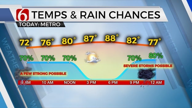
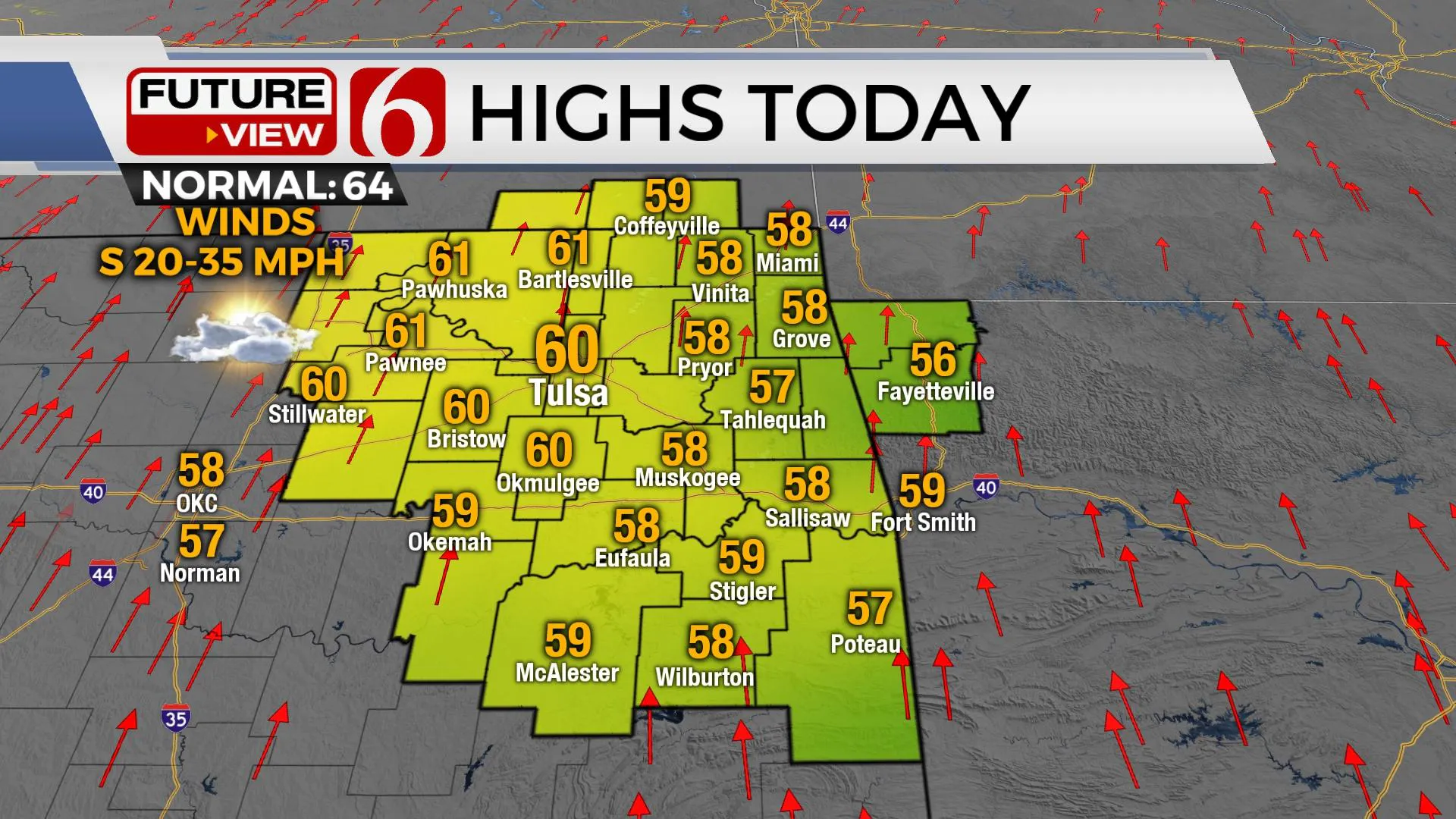
The colder weather that's been centered across the state will be quickly moving away from the area as the pattern brings several days of southerly flow, including moisture, and warmer temperatures. We'll be nearing the upper 70s to lower 80s Wednesday before our next cold front moves into the area Thursday night into early Friday morning bringing another round of strong to severe storm potential along with some pockets of locally heavy rain. We expect strong and gusty south winds by this afternoon with mostly to partly cloudy sky and highs in the upper 50s and lower 60s. Fire spread rates will be problematic despite the return of southerly flow. Temps will start in the upper 20s and lower 30s for the early morning hours.
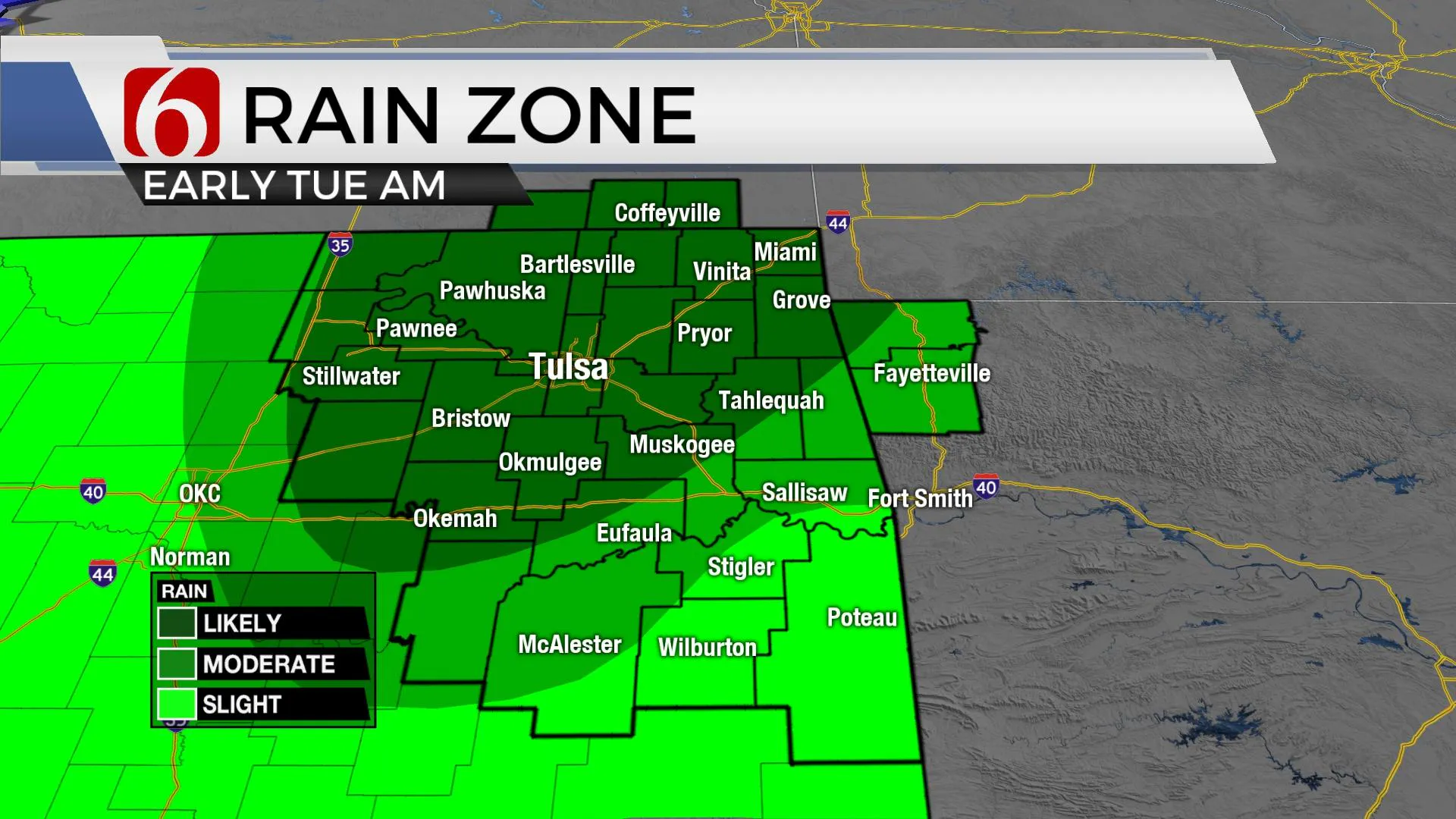
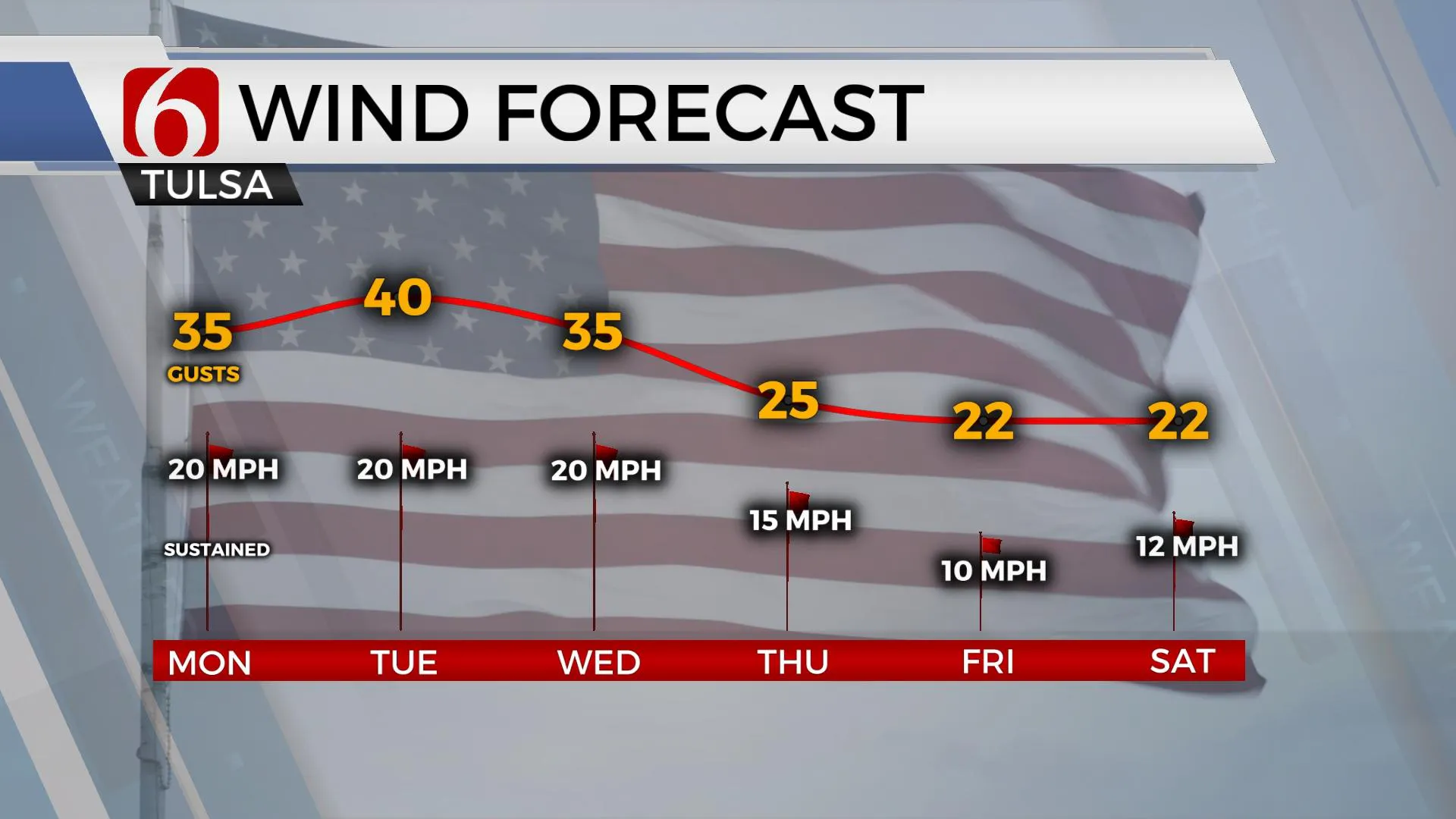
A lead wave will lift across the area later tonight into Tuesday, effectively bringing a surface warm front from the south to north through the day. This brings deeper low-level moisture from the south to the north. As the lift from this system arrives, scattered showers along with some thunder will be possible early Tuesday morning but will quickly move away from the area by mid-morning. The surface pressure gradient is likely to tighten-up Tuesday with south winds gusting from 25 to 40 mph. We'll be on the edge of another wind advisory Tuesday with highs in the lower 60s.
Wednesday will be a windy and warm day with highs in the upper 70s and lower 80s.
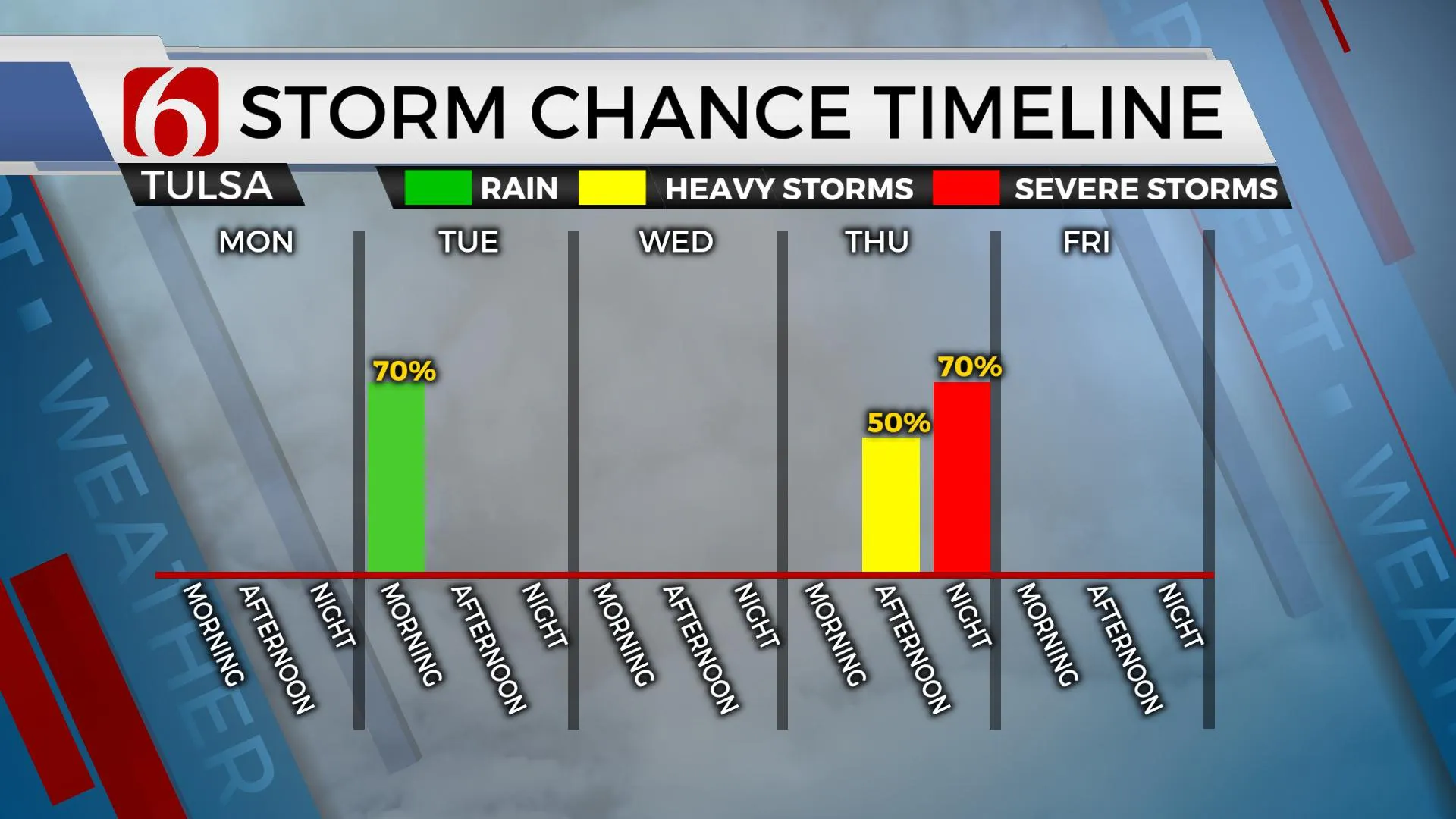
The next stronger upper-level system will be nearing Thursday and exiting early Friday. Strong south winds with highs in the 70s will increase convective and potential energy as it nears the state. Unlike the last several systems we've experienced, a few days of southerly low-level flow will already be in place before this system arrives. This means the parameters for severe weather should be a little higher and slightly more northward compared to the previous systems for the Thursday evening and early Friday morning periods. We'll have more about these threats tomorrow but would encourage you to remain aware of your weather surroundings later this week.
Thanks for reading the Monday morning weather discussion and blog.
Have a super great day!
Alan Crone
KOTV
More Like This
March 20th, 2023
July 12th, 2023
July 7th, 2023
June 26th, 2023
Top Headlines
December 13th, 2024
December 13th, 2024
December 13th, 2024
December 13th, 2024


