Chilly Weather Returns To Northern Oklahoma
The cold front has cleared most of the region but remains across far southeastern Oklahoma this morning where warmer weather remains for the next few hours.Friday, March 24th 2023, 5:48 am
TULSA, Okla. -
The cold front has cleared most of the region but remains across far southeastern Oklahoma this morning where warmer weather remains for the next few hours. Scattered storms, some still strong to near severe will be possible in this region across extreme southeastern Oklahoma for a few morning hours. More northward, including the Tulsa metro temps are in the 40s and will only reach the lower to mid-50s this afternoon with gusty north winds at 12 to 22 mph. Some scattered showers will remain possible for the morning to midday hours near the metro before ending around noon.
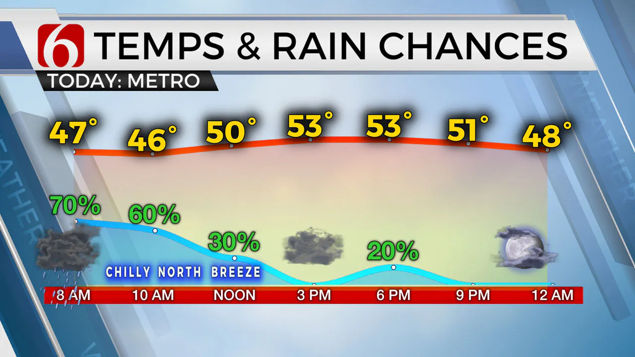
The main upper-level trough moves across the area this evening and may trigger a small shower or isolated storm across northern Oklahoma. A weak system nears Saturday night into Sunday morning with higher probabilities for measurable precipitation north of our immediate area. A few showers may brush the Oklahoma-Kansas state line region. Another weak wave may brush the region Monday night into Tuesday with low probability of a shower or two, mostly north of the region. The next stronger storm should near the state by later next week with severe weather chances returning Thursday.
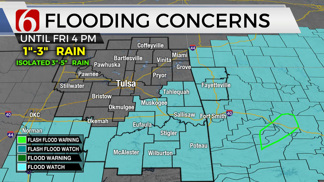
The flood watch remains intact for those areas along and north of the surface boundary, including most of southeastern and eastern Oklahoma through at least midday. The Tulsa metro is not included in the flood watch. Pockets of locally heavy rainfall developed yesterday afternoon and evening along the cool side of the boundary. Some locations received anywhere from 1 to 3 inches, with a few spots across far eastern Oklahoma nearing 4 to 5 inches. Please remain aware of low water crossing areas for the morning commute. Some streams, creeks, and rivers will also see rising water today, tonight, and into Friday before levels will drop by this weekend.
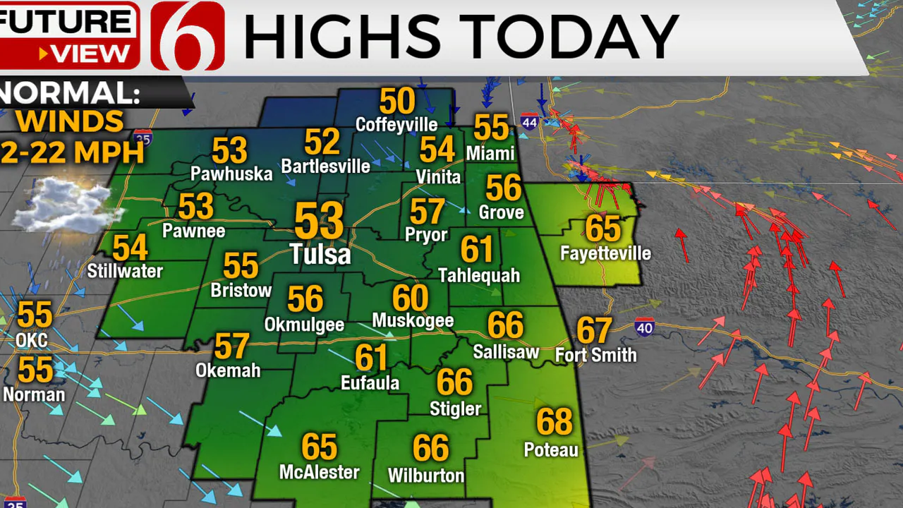
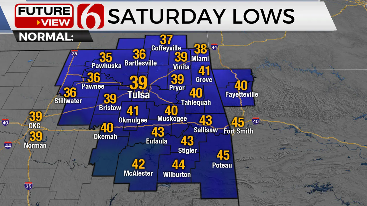
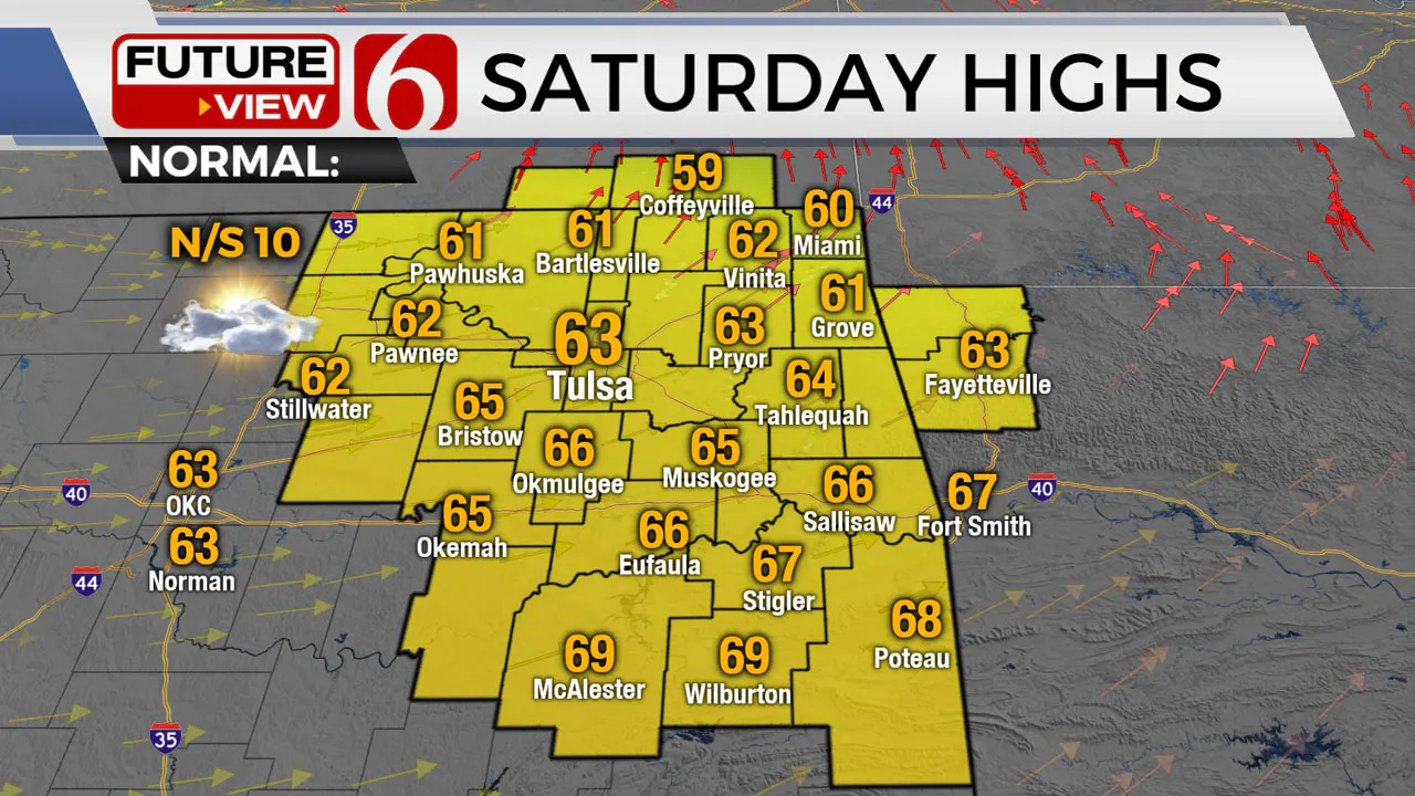
Temp trends will remain cool today with highs in the 50s north and 60s southeast. Saturday morning starts in the upper 30s and lower 40s with highs reaching the lower 60s. Sunday highs should reach the mid-60s north and lower 70s south before the next cold front brings another surge of cool weather Monday and Tuesday. Morning lows will drop into the 30s with highs in the mid to upper 50s. Data continue to suggest a strong system nearing by Thursday of next week with increasing probabilities for thunderstorms, including the possibly of strong to severe storms.
Thanks for reading the Friday morning weather discussion and blog.
Have a super great day!
More Like This
March 24th, 2023
December 12th, 2024
December 12th, 2024
December 12th, 2024
Top Headlines
December 12th, 2024
December 12th, 2024
December 12th, 2024


