Slow Warming Trend Arriving Soon
Expect chilly temperatures as you head out the door before warmer weather arrives toward the afternoon hours.Friday, April 7th 2023, 5:57 am
If you’re into podcasts or in a rush, check out my daily weather update. Search for NewsOn6 and ‘Weather Out The Door’ on most podcast providers, including Spotify, Stitcher and Tune-In, or Click Here to listen on Apple Podcasts.
TULSA, Okla. - Expect chilly temperatures as you head out the door before warmer weather arrives toward the afternoon hours.
Here are the details from News On 6 Meteorologist Alan Crone:

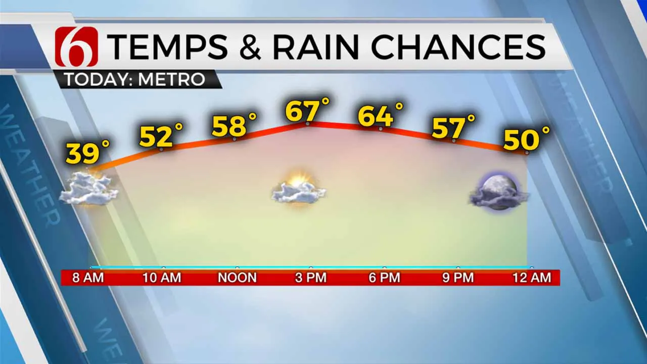
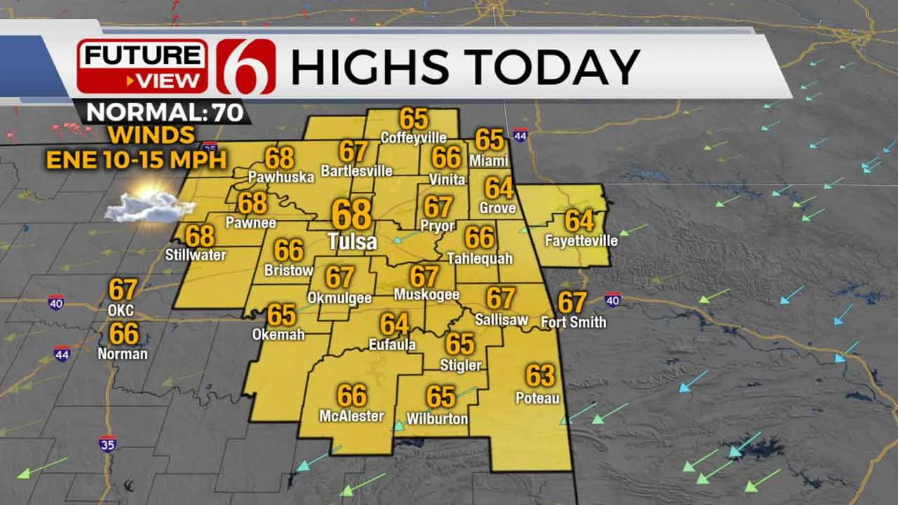
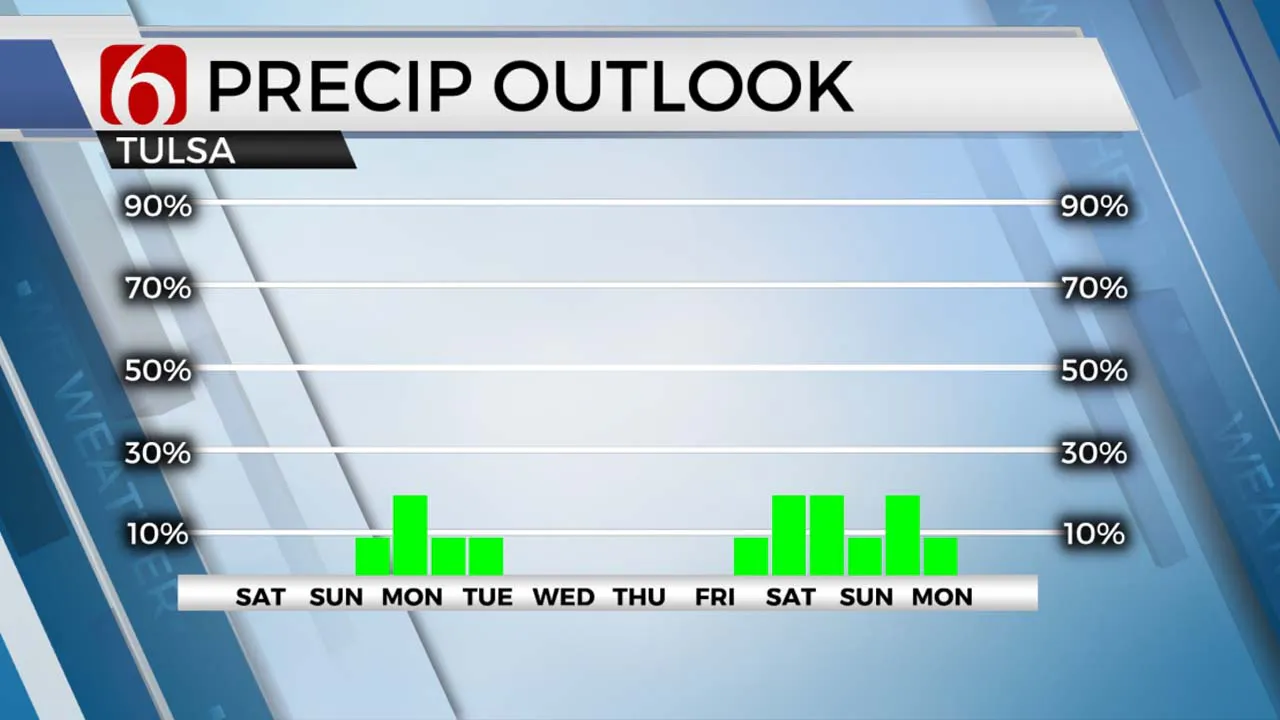
A freeze warning remains for the early morning hours along and northwest of I-44 where temps have dropped into the lower 30s. The Tulsa metro temps are mostly in the mid-30s and will quickly climb into the 50s midday with afternoon highs in the upper 60s. A persistent east to northeast wind will remain at 10 to 15 mph. Dry low-level air will keep fire danger issues slightly elevated but not nearly as high as previous days due to the lighter wind speeds. A storm system remains well south of our immediate area today but will be close enough to spread a few showers into the Red River Valley later tonight or pre-dawn Saturday. We’ll see a few clouds due to this feature both today and more so Saturday, but afternoon highs should still reach the upper 60s south and lower 70s north. Easter Sunday begins with lows in the mid to upper 40s with afternoon highs in the lower 70s. South winds will return at 10 to 15 mph midday with a few higher gusts into the afternoon. A weak upper-level wave should drop south from the central plains states Sunday into early Monday. This will be strong enough to generate a few showers or rumbles of thunder during this period, but the overall coverage is expected to remain relatively low. We’ve confined the shower chances Sunday across northwestern OK, but by late evening into Monday, probabilities arrive across the northeastern third of the state. Our probability for Monday remains at 20% to near 30%. We are watching several items of interest that could have impacts on sensible weather for next week.

The data continues suggesting the development of a quasi-closed low over or near Oklahoma early next week before drifting southeast across Texas. This trend in the data started yesterday morning and continues with the latest incoming runs today. I’ll be making some adjustments to our temperatures for early next week resulting in cooler temps compared to the previous forecast of upper 70s and lower 80s. The presence of the midlevel feature can help to produce some scattered showers or storms but the presence of mostly dry air currently in place will delay the return of more significant moisture until later next week as a stronger upper trough nears eastern sections of the state. This 2nd trough appears to be our next stronger weather maker arriving sometime next weekend.

Thanks for reading the Friday morning weather discussion and blog.
Have a super great day!
Alan Crone
KOTV
More Like This
April 7th, 2023
July 12th, 2023
July 7th, 2023
June 26th, 2023
Top Headlines
December 13th, 2024
December 13th, 2024
December 13th, 2024
December 13th, 2024


