Tracking 2 Systems This Week
The chance for showers and storms hangs around on Monday.Monday, April 10th 2023, 5:36 am
If you’re into podcasts or in a rush, check out my daily weather update. Search for NewsOn6 and ‘Weather Out The Door’ on most podcast providers, including Spotify, Stitcher and Tune-In, or Click Here to listen on Apple Podcasts.
TULSA, Okla. - The chance for showers and storms hangs around on Monday.

Here are the details from News On 6 Meteorologist Alan Crone:
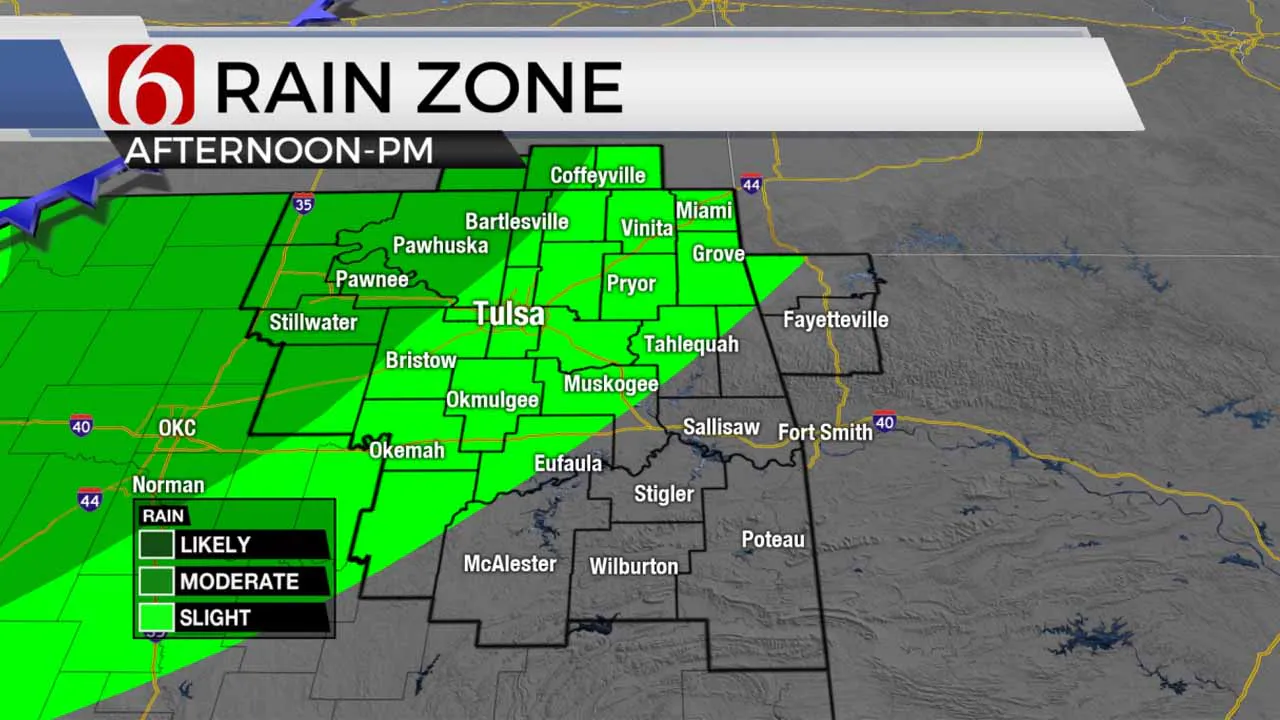
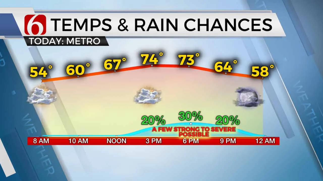
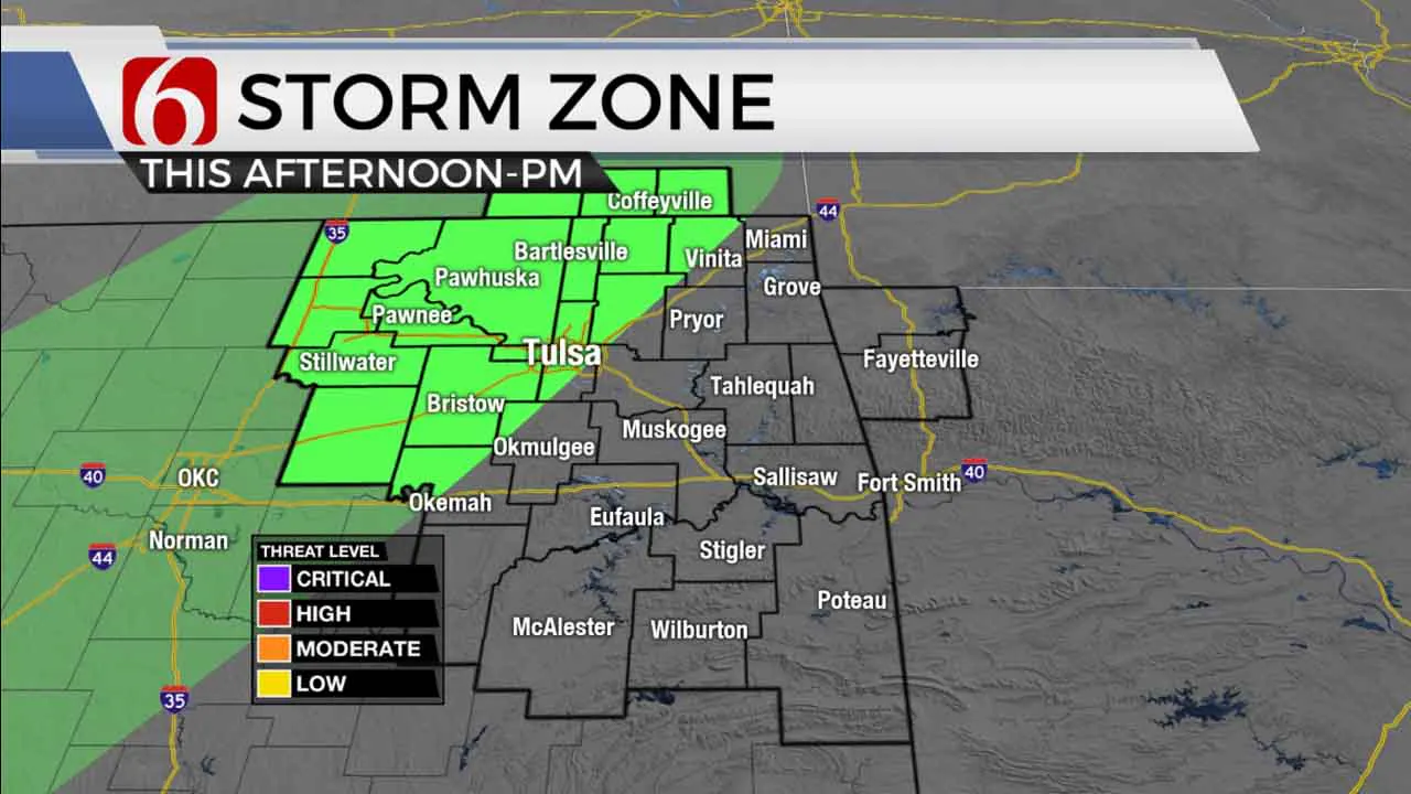
Partly to mostly cloudy sky arrives on Monday along with a few scattered showers and storms in the afternoon. The better chances for a few scattered storms will be along and west of I-44. Enough shear and instability will be present and could produce a few isolated severe storms with some quarter-inch hail and gusty winds. Temps in the upper 40s and lower 50s this morning morph into highs near the lower to mid-70s this afternoon. Highs will reach the mid to upper 70s Tuesday and Wednesday with increasingly gusty south winds with highs nearing 80 for the latter half of the week. Fire danger spread rates will become elevated by Wednesday with gusty winds and lower relative humidity across most of the area. Low-level moisture should become more notable Thursday and Friday ahead of the next stronger storm system with increasing thunder chances Friday, possibly into early Saturday morning.

The upper airflow from the north brings a disturbance across the area later in the day that will produce some scattered showers and storms. A few of these scattered storms may be marginally severe with hail and wind. The overall coverage will be limited, and many locations will remain dry. But some of us will experience a few storms north and west of the metro. Tulsa will be included in the probability for scattered storms.

The timing seems to be more this afternoon and early evening before most convection drops out with the passing of daytime heating and the passing of the upper wave to our south. This wave will become more dominant across Texas where a surface flow should develop in tandem bringing more scattered showers and storms to southeast Texas. After today, the flow of moisture into Oklahoma will be limited until later this week when south winds return as the above-mentioned features move more to the east. This will happen as a stronger trough will approach the southern plains as the upper air flow returns from the west to southwest. This pattern usually brings severe weather threats to the plains, but the return flow of deep and quality moisture is questionable currently. Regardless, we'll be looking at increasing threats for thunderstorms around Friday afternoon and evening. The data over the last few days seems to be suggesting a slightly faster progression of this system. We'll offer more suggestions regarding timing tomorrow. But for now, plan on storm chances beginning late Friday evening with a few showers or storms still possible early Saturday across far northeastern Oklahoma. This front should bring a noticeable cool-down for the weekend with highs in the 60s Sunday.
Thanks for reading the Monday morning weather discussion and blog.
Have a super great day!
Alan Crone
KOTV
More Like This
April 10th, 2023
December 14th, 2024
December 14th, 2024
Top Headlines
December 14th, 2024
December 14th, 2024
December 14th, 2024


