Tracking A Storm System Toward The End Of The Week
Another day of pleasant weather is expected on Wednesday before gusty winds, and the chance for some showers and storms, return toward the end of the week.Wednesday, April 12th 2023, 5:23 am
If you’re into podcasts or in a rush, check out my daily weather update. Search for NewsOn6 and ‘Weather Out The Door’ on most podcast providers, including Spotify, Stitcher and Tune-In, or Click Here to listen on Apple Podcasts.
TULSA, Okla. - More pleasant weather is expected on Wednesday before gusty winds, and the chance for some showers and storms, return toward the end of the week.
Here are the details from News On 6 Meteorologist Alan Crone:

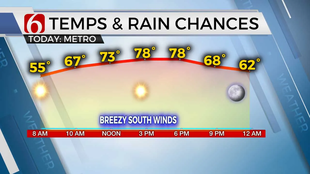
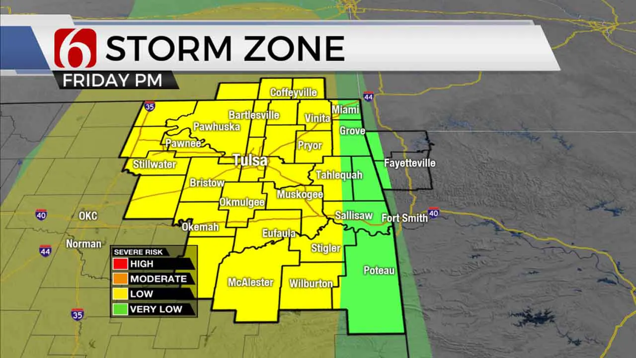
Another pleasant afternoon is likely with highs reaching the mid to upper 70s along with sunny conditions. Our next system arrives soon with a mention for storms by Friday afternoon and including the possibility of a few strong to severe storms. Storm development is highly conditional due to the expectation of a strong capping inversion.

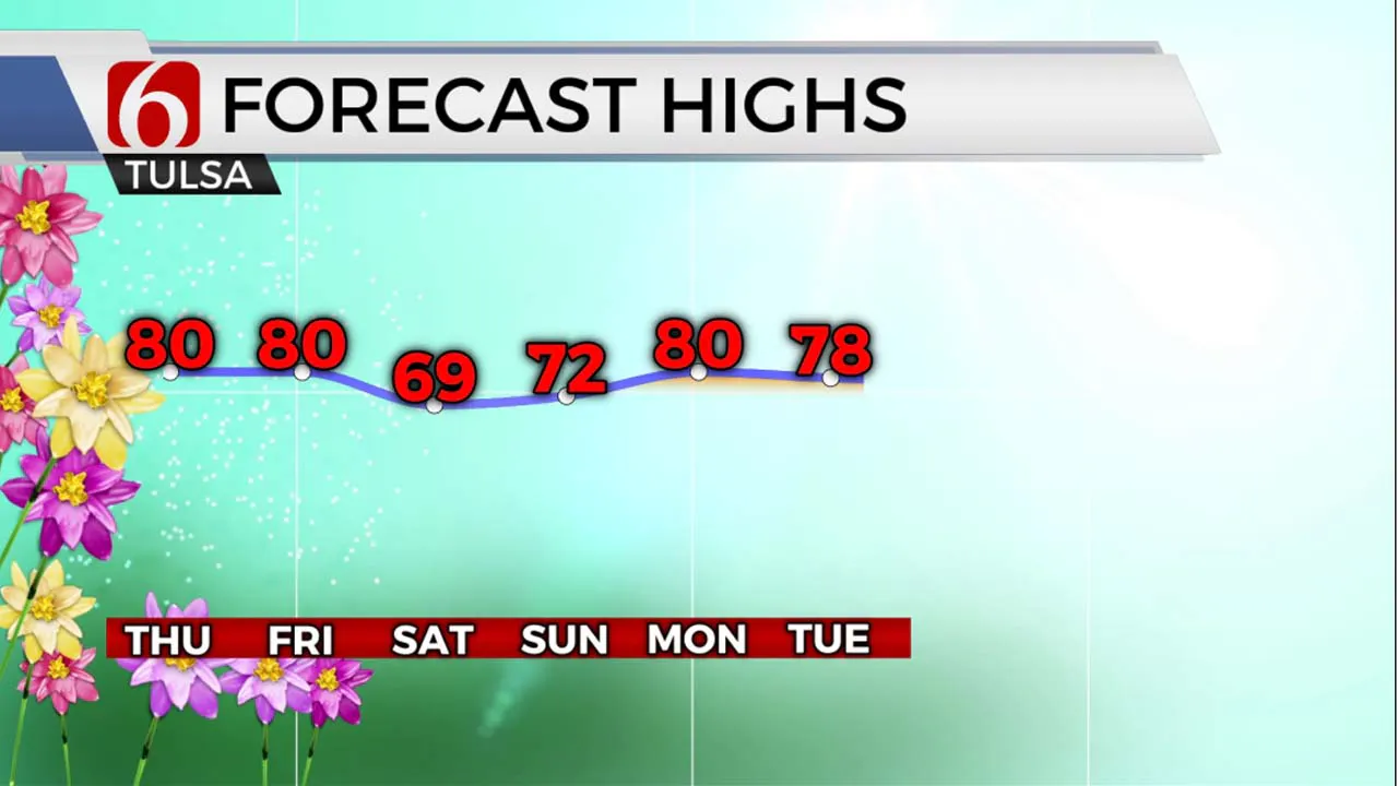
The next upper-level trough is developing well west of the area on Wednesday but will begin influencing our weather soon. South winds will increase speeds slightly Wednesday afternoon compared to previous days, but stronger south winds are likely Thursday and more noticeably Friday as the trough causes pressure to fall along the Lee of the Rockies. A system along the Texas coastal region may impede the return of deeper low-level moisture into the state before our cold front and storm system arrive Friday afternoon and evening. A layer of warm air aloft may also be present ahead of the main system that may act to CAP the atmosphere for much of the period until colder air aloft nears late Friday night into pre-dawn Saturday. Data continues to differ some on the timing of the cold front which will have impacts regarding the ending phase of the system. At this point, I still think it's prudent to keep a mention for scattered storms both Friday evening and pre-dawn Saturday to account for the difference in timing. A few showers and storms may be possible Saturday morning for a short period along the OK-Kansas state line region before moving east to Missouri. The cold front will bring gusty northwest winds from 20 to 35 mph Saturday with morning lows in the mid-50s and afternoon highs in the upper 60s. Winds will decrease speeds later in the afternoon with pleasant conditions likely through Saturday evening. Sunday afternoon highs will reach the lower 70s with a mostly light wind. Another active weather pattern returns next week with additional shower and storm chances into the following week.

Thanks for reading the Wednesday morning weather discussion and blog.
Have a super great day!
Alan Crone
KOTV
More Like This
April 12th, 2023
July 3rd, 2023
June 8th, 2023
June 6th, 2023
Top Headlines
December 14th, 2024
December 14th, 2024
December 14th, 2024
December 14th, 2024


