Day 2 Of Wet & Chilly Weather
Showers and storms continue across the state on Wednesday.Wednesday, April 26th 2023, 5:34 am
If you’re into podcasts or in a rush, check out my daily weather update. Search for NewsOn6 and ‘Weather Out The Door’ on most podcast providers, including Spotify, Stitcher and Tune-In, or Click Here to listen on Apple Podcasts.
TULSA, Okla. - Showers and storms continue across the state on Wednesday.
Here are the pieces from News On 6 Meteorologist Alan Crone:

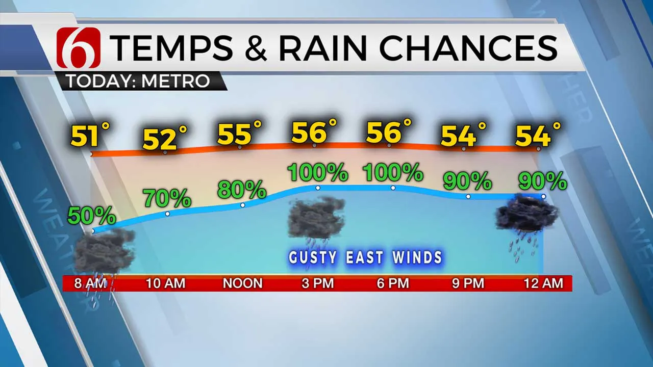
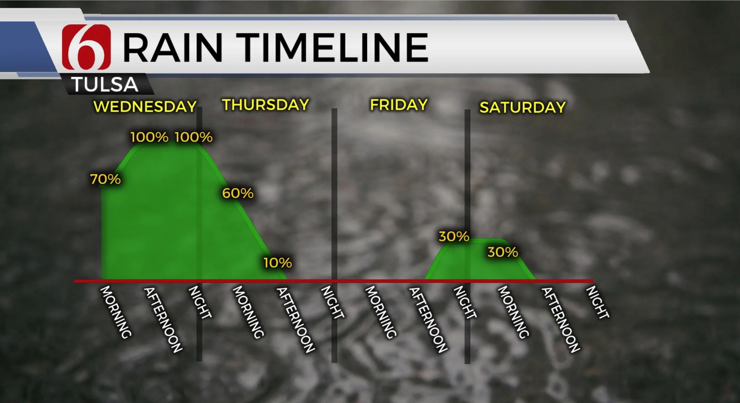
More rain is likely again today, tonight and exiting early tomorrow with a continuation of well below normal temperatures. The threat of locally heavy rainfall remains in some locations. The threat of strong and severe storms will remain south of the Tulsa metro with a few thunderstorms producing hail across southeastern Oklahoma today with more significant severe threats along the Red River Valley southward into north central Texas. The main upper-level storm system will exit the area early to mid-day tomorrow eventually taking rain and thunder out of the area by mid-day. The upper airflow transitions into a Northwest flow, bringing another fast-developing system near the area Friday night and part of Saturday. The data remains inconsistent regarding the exact outcome, but we continue with at least a low probability of showers and storms Friday evening into the first part of Saturday. Once this system moves away from our area, improving weather is likely for the second half of the weekend. A general warming trend is expected with near-normal temperatures early next week. Temperatures today will remain quite chilly. Afternoon highs are expected in the mid-50s along with gusty east winds at 15 to 25 mph. A few spots will reach the lower 60s across far NE OK.

We continue to watch the progression of a warm frontal boundary currently located across far north Texas. The eventual resting place of this boundary will mark locations for strong and severe storm development later this afternoon and tonight. Most data suggest this boundary will remain draped near the Red River valley, with an elevated zone of some instability slightly north of the front. It’s this elevated zone that supports the mention for a few strong to severe storms and far southeastern Oklahoma later today. Any mature thunderstorm activity along or south of the boundary supports a higher threat of significant severe weather including large hail, damaging winds, and even tornadoes. We think most of this weather will stay across North Central Texas.
Below-seasonal average temperatures will remain for the rest of the week, including Saturday. But sunshine returns Sunday with afternoon highs near 70. Warmer weather is expected by the mid to end of next week.
Thanks for reading the Wednesday morning weather discussion and blog.
Have a super great day!
More Like This
April 26th, 2023
July 3rd, 2023
June 8th, 2023
June 6th, 2023
Top Headlines
December 13th, 2024
December 13th, 2024
December 13th, 2024
December 13th, 2024


