Fine Weather For Veteran's Day.
<p>Not as cold tonight with patchy fog possible by morning. Lots of sunshine for the Veteran's Day parades.</p>Thursday, November 10th 2016, 8:08 pm


A number of locations did make it to the freezing mark this morning as you can see from the max/min temperature map across the state, courtesy of the OK Mesonet. Elsewhere, it was certainly cold enough for frost on the rooftops and on top of exposed vehicles.
[img]
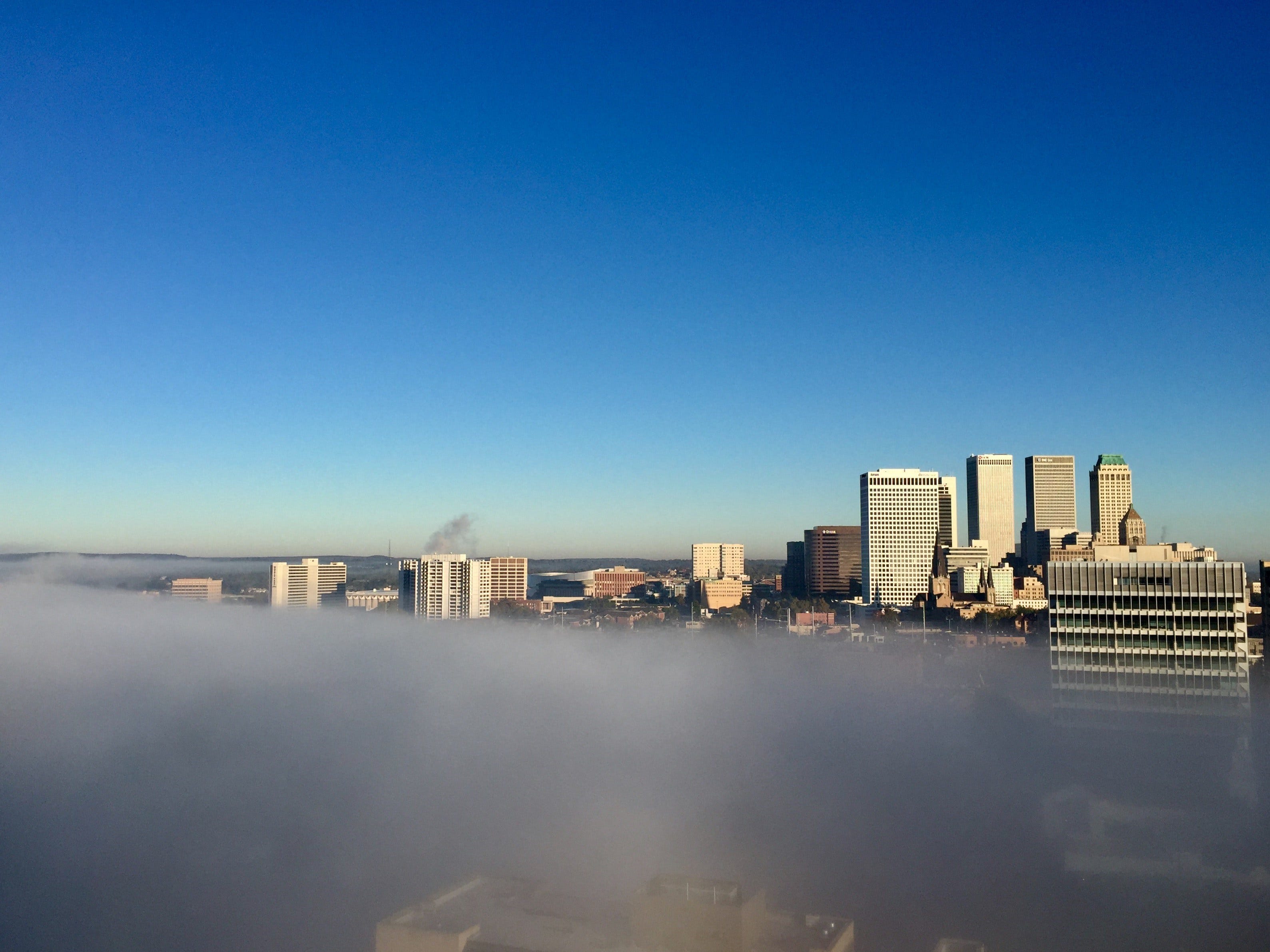
And, since this was the coldest of the season and since we have been so warm up to this point, water temperatures are still very warm. You put that together with the calm winds and clear skies and the result is fog over the lakes, rivers, and ponds around the area as you can see in this photo taken this morning.
[img]
The sunny skies and SW winds produced a nice rebound in afternoon temperatures and tonight will be much milder. We will have generally fair skies with only some high level, cirrus clouds but a light southerly breeze should hold us in the 40s to start the day Friday. By the way, those light winds could also result in patchy fog once again for the first hours of the morning but it would be quickly dissipating.
That will be followed by some fine weather for the Veteran’s Day parades during the day Friday. A weak frontal boundary will be pushing through the state during the morning and early afternoon hours, but it has no moisture to work with so only a few clouds are expected. Light southerly winds to start the day will be shifting to northerly once the front passes and those winds will be increasing to near 15 mph with higher gusts. That will tend to hold temperatures pretty steady for the afternoon hours despite full sunshine. We should be in the lower 60s prior to the wind shift and then just warming a few more degrees after that.
That will also set the stage for another cold night Friday night with the possibility of frost again Saturday morning, particularly for the normally colder valleys in NE OK. After that, sunny skies and a light easterly breeze should result in afternoon temperatures generally in the low-mid 60s.
A disturbance aloft will be moving over the state for the Sun/Mon time frame, but it still looks to be moisture starved so only some clouds are expected with that system. However, there will be another weak boundary arriving during the day Monday to bring our winds briefly back to northerly but it will not amount to much more than a wind shift.
As you can see on our forecast page, there is no mention of rain through the rest of the forecast cycle and the 7 day QPF shows no moisture of any consequence anywhere close by.
[img]
Looking further downstream, the 8-14 day outlook does hold out at least some promise of rain during that time frame.
[img]
As for temperatures, they look to be well above normal through Thursday of next week and normal for this time of year is daytime highs in the low 60s and overnight lows near 40. However, just beyond this forecast cycle the longer range guidance continues to suggest a stronger cold front arriving along about Friday followed by what will likely be the coldest air so far this season going into that weekend. But, not for long as the 8-14 day outlook continues with a signal showing above normal temperatures.
[img]
So, stay tuned and check back for updates.
Dick Faurot

Get The Daily Update!
Be among the first to get breaking news, weather, and general news updates from News on 6 delivered right to your inbox!
More Like This

November 10th, 2016

April 15th, 2024

April 12th, 2024

March 14th, 2024
Top Headlines


April 26th, 2024

April 26th, 2024

