Windy With A Chance Of Storms In Eastern Oklahoma
<p>A strong disturbance will move across the central plains this afternoon and evening bringing a mention for a few storms across eastern OK. </p>Tuesday, February 28th 2017, 4:01 am


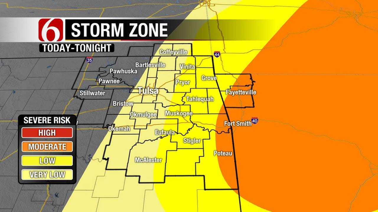
A strong disturbance will move across the central plains this afternoon and evening bringing a mention for a few storms across eastern OK. If the storms do develop, some of them could be severe with all modes of severe weather possible. But the coverage of thunderstorm activity may be limited for the metro with higher chances across the far eastern third of the state into western Arkansas. Strong south to southwest winds are likely today with highs nearing 80. A dry line will near the I-35 corridor with locations west and southwest of the area included in either Red Flag warnings or fire weather watches. A cold front will enter the state later tonight and clear southeastern OK by 3 am Wednesday morning ending the threat of any storm activity. Cool and stable air will remain Wednesday with a gradual warming trend for the rest of the week, including the weekend.
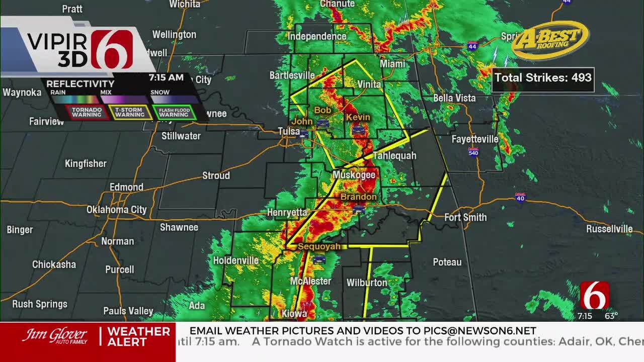
Things are quiet at this hour of posting across southeastern and eastern OK. We could have a few isolated storms but at this point the chance will remain low.
Temps will stay in the upper 50's and lower 60's this morning along with south winds and mostly cloudy conditions.
I think we’ll have two distinct windows for possible storm development today. The first would be from approx. 1 pm to 10 pm located along and east of highway 69. The 2nd would be around midnight to 3 am when the actual cold front will rapidly pass across the northeastern and eastern OK area. Any storms that do develop this afternoon and early evening across eastern OK would be super cellular in nature and have the possibility of producing all modes of severe weather. The storms along the front, if they form later tonight, would mostly be line segments of thunderstorm activity, and would be capable of hail and damaging winds. Even though the dynamics with this system will remain very high, the possibility of a layer of warm air aloft ( the cap) combined with a surface wind from the southwest acting to limit surface convergence will keep the actual chance for the metro at or less than 30%. Locations across far eastern OK will have a 40% chance while locations in western Arkansas will have a near 60% chance of development with this system.
Stay Connected With The News On 6
Once the upper level trough exits the central plains, the chance for showers and storms will remain void of the forecast through the end of the week and this weekend. Our next upper level system will not arrive until sometime either early next week or by the middle of next week.
Temps will remain warm today with highs in the upper 70s near 80 along with south to southwest winds from 15 to 30 mph.
Wednesday morning lows will be near 45 and highs in the upper 50s along with northwest winds at 10 to 20 mph. The fire danger may remain elevated tomorrow with dry air and gusty winds. After some morning clouds, we’ll experience mostly sunny conditions for the day.
Thursday morning lows will be near or slightly below freezing with highs in the mid to upper 60s along with light winds and mostly sunny conditions as a surface ridge of high pressure builds into the area.
Friday morning will start with lows near 29 and highs in the upper 60s near 70 along with south winds at 12 mph.
This weekend will feature morning lows in the 40s and 50s with Saturday highs near 70 and Sunday near the mid-70s. Strong south winds are likely this weekend from 15 to 25 mph.
Thanks for reading the Tuesday morning weather discussion and blog.
Have a super great day.
Alan Crone

Get The Daily Update!
Be among the first to get breaking news, weather, and general news updates from News on 6 delivered right to your inbox!
More Like This
February 28th, 2017

April 15th, 2024

April 12th, 2024

March 14th, 2024
Top Headlines


April 26th, 2024

