Rain Chances And Howling Winds Ahead For Eastern Oklahoma
A powerful low pressure system is about to bring more rapid weather changes to Green Country as we head into the start of our weekend.Friday, February 22nd 2019, 5:36 pm
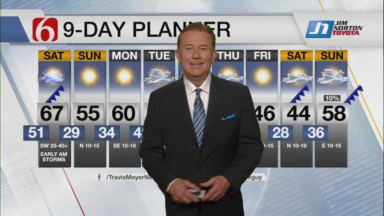
A powerful low pressure system is about to bring more rapid weather changes to Green Country as we head into the start of our weekend.
Off-and-on showers will continue across eastern Oklahoma through our Friday night and into early Saturday morning. At the same time, a very strong area of low pressure will be taking shape across the Oklahoma and Texas panhandles. Out ahead of this system, another fast-moving wave of showers and a few storms looks to sweep into Green Country Saturday morning.
Any showers and storms Saturday morning will be very fast-moving and very brief before drier air rushes into eastern Oklahoma. But a brief strong to severe storm will be possible through mid-morning Saturday. As those storm chances rapidly end, expect the winds to rapidly crank up!

By midday and into the afternoon Saturday, we’ll have southwest winds gusting over 40 miles per hour! We’ll eventually see a shift to more of a northwest breeze by early evening as a cold front arrives, but those wind gusts will remain extremely strong. This will lead to extreme fire danger Saturday afternoon and evening, so please refrain from any outdoor burning!
Winds will begin to diminish late Saturday night, with much calmer and more pleasant weather settling in on Sunday.

Get The Daily Update!
Be among the first to get breaking news, weather, and general news updates from News on 6 delivered right to your inbox!
More Like This
February 22nd, 2019

April 15th, 2024

April 12th, 2024

March 14th, 2024
Top Headlines

April 25th, 2024

April 25th, 2024


April 25th, 2024
