Early Morning Freezing Temperatures, Afternoon Highs In The Upper 50s
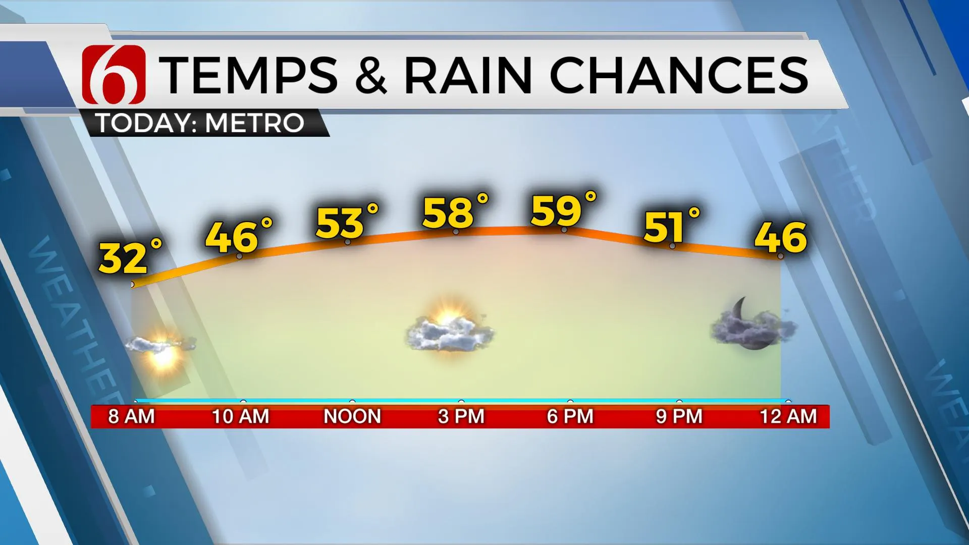
We’re dealing with temperatures well below freezing across the state through the early morning hours. The freeze warning will expire at 9 a.m. and we’ll begin the climb into the upper 50s or lower 60s this afternoon along with a sunshine-cloud mix and lighter north winds. The next upper-level storm system will quickly move across the central plains later tonight into Thursday with a stronger wave diving across the region Thursday night into Friday. Both waves will allow for a quick return of lowWednesday, April 21st 2021, 4:23 am
We’re dealing with temperatures well below freezing across the state through the early morning hours. The freeze warning will expire at 9 a.m. and we’ll begin the climb into the upper 50s or lower 60s this afternoon along with a sunshine-cloud mix and lighter north winds. The next upper-level storm system will quickly move across the central plains later tonight into Thursday with a stronger wave diving across the region Thursday night into Friday. Both waves will allow for a quick return of low-level moisture and the subsequent return of spring-like weather, including daytime highs, gusty south winds and yes, eventually warmer weather. We’ll be flirting again with lower 80s early next week. The return of spring-like conditions will also bring a return of spring-like thunderstorms, including the threats of severe weather. We’re moving into a period that is usually associated with increasing severe weather episodes across the southern plains, including Oklahoma.

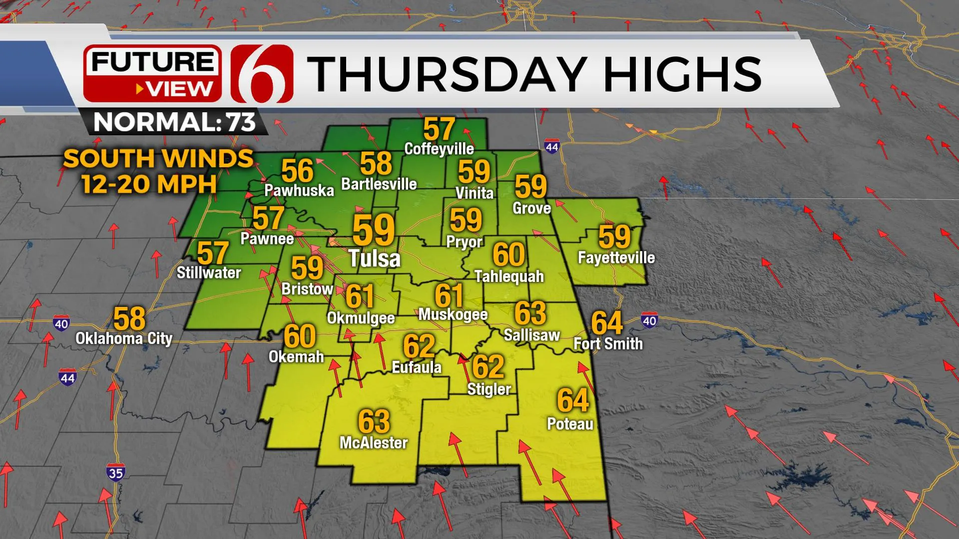
Tomorrow morning starts with lows in the mid to upper 30s and lower 40s and highs nearing the upper 50s and lower 60s. Some patchy frost will be possible, but mostly across far northeastern OK where a frost advisory will be required from 1 a.m. to 8 a.m. Thursday. The first upper-level disturbance will move from the southern California area Thursday night into Kansas early Friday while weakening. Pressure falls across the state will be underway with south winds returning low-level moisture from the south to north during this period. A few spotty showers or storms will be possible, but the sparse coverage will keep the pop low for this update.

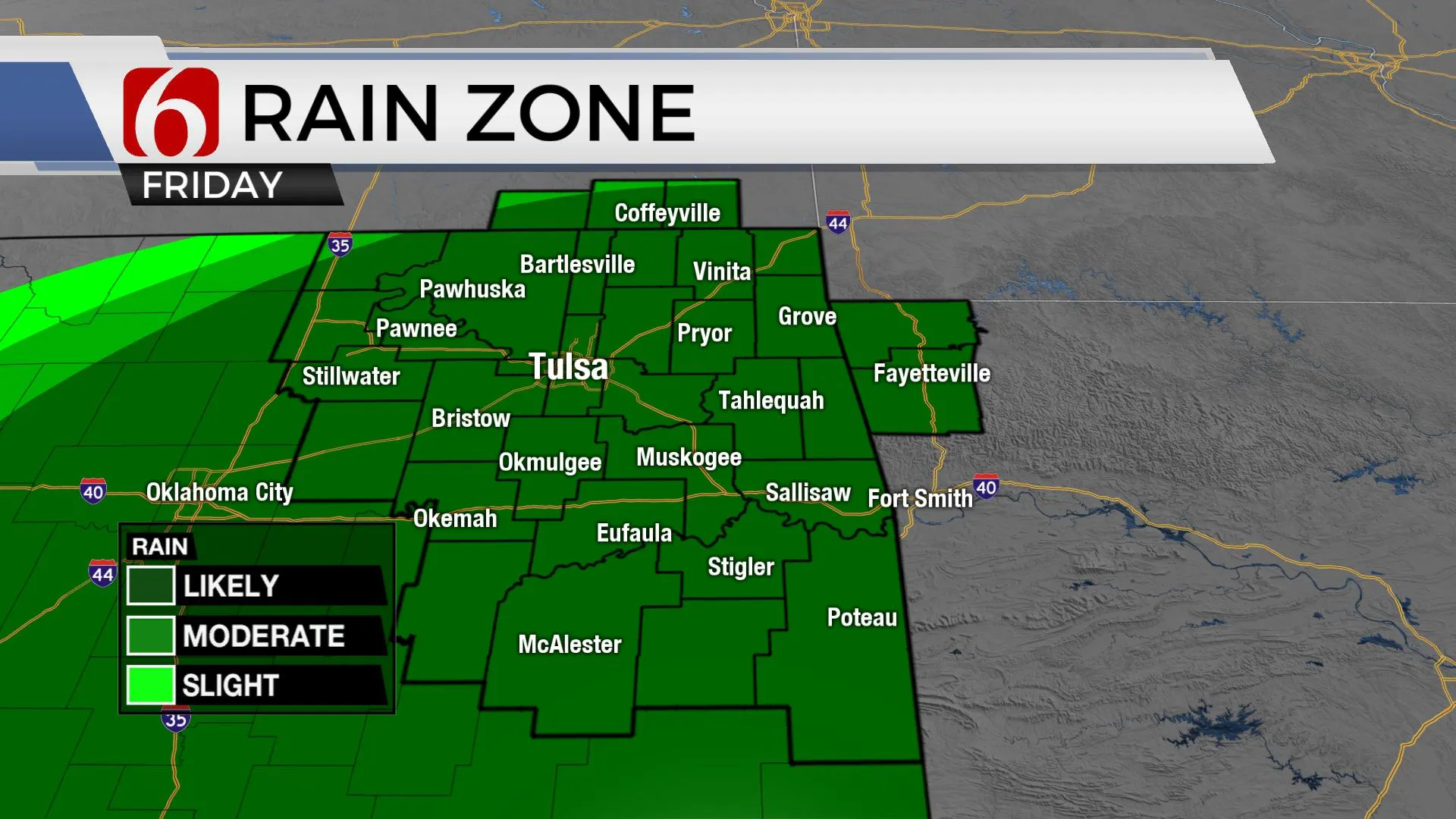
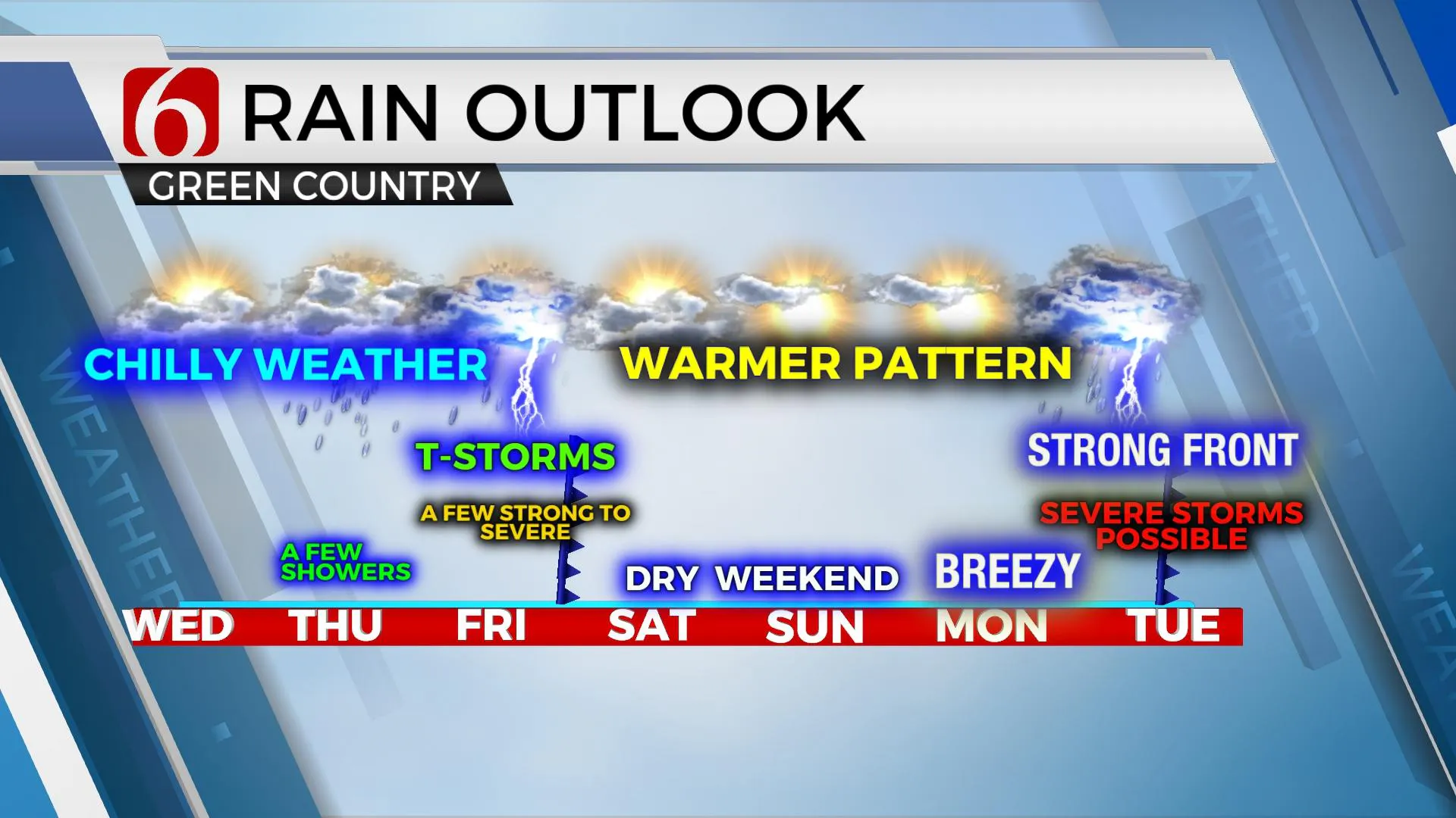
The main trough will move eastward Friday. A surface low will develop Friday near Amarillo with gusty south winds from 20 to 30 mph across eastern OK as scattered storms will become more numerous through the day. The true warm sector of this developing system more than likely remains along the Red River Valley area where a more substantial severe threat develops Friday afternoon and evening. More northward, including most of our region, elevated thunderstorms will be likely through the day and evening hours presenting the possibility of a few storms producing severe criteria hail. One of two storms may also produce some damaging wind gusts, but the higher likelihood will remain slightly to our south or southwest during this period. As the main trough ejects eastward, showers and storms will quickly end late Friday evening or early Saturday morning leaving our entire area in a favorable position for a good weekend. Morning lows this weekend will be in the 50s and highs in the near 70 Saturday and into the upper 70s Sunday.

Early next week a powerful upper-level system is likely to impact the southern and central plains Tuesday with increasing likelihoods for severe weather. It’s still too early to get into a lot of specifics with this period, but severe storm development seems likely. This system will exit our area sometime late Tuesday night or pre-dawn Wednesday while continuing to support more severe weather for states to the east and southeast of Oklahoma. We’ll have more specifics on this system as we draw closer to the event.

Thanks for reading the Wednesday morning weather discussion and blog.
Have a super great day!
Alan Crone
KOTV
If you’re into podcasts, check out my daily weather update below. Search for NewsOn6 and ‘Weather Out The Door’ on most podcast providers, including Apple, Stitcher, Tune-In and down below on Spotify.

More Like This
February 14th, 2022
January 26th, 2022
January 25th, 2022
Top Headlines
December 15th, 2024
December 15th, 2024
December 14th, 2024


