Severe Weather, Tornado Warnings, Threaten Northeastern OK
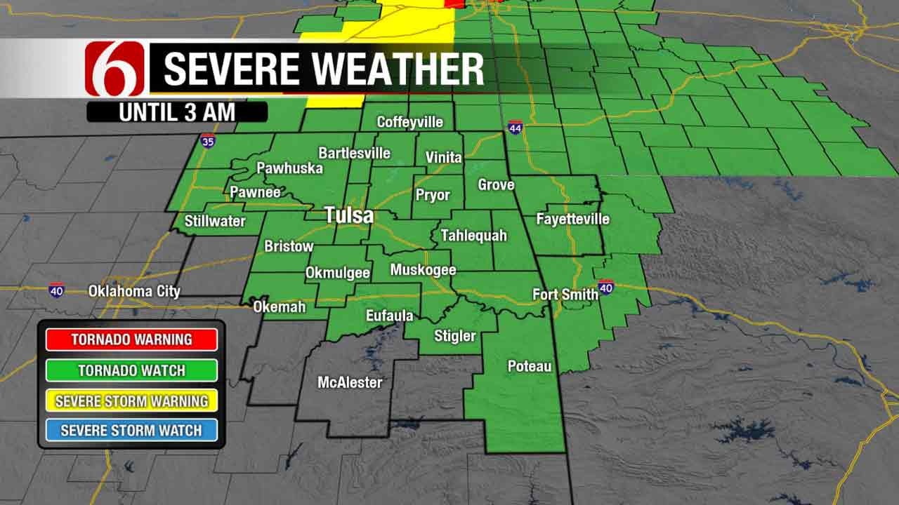
<p>A tornado watch has been issued for several counties across northeastern Oklahoma. The National Weather Service issued the watch until 3:00 a.m. Tuesday.</p>Monday, March 6th 2017, 8:44 pm


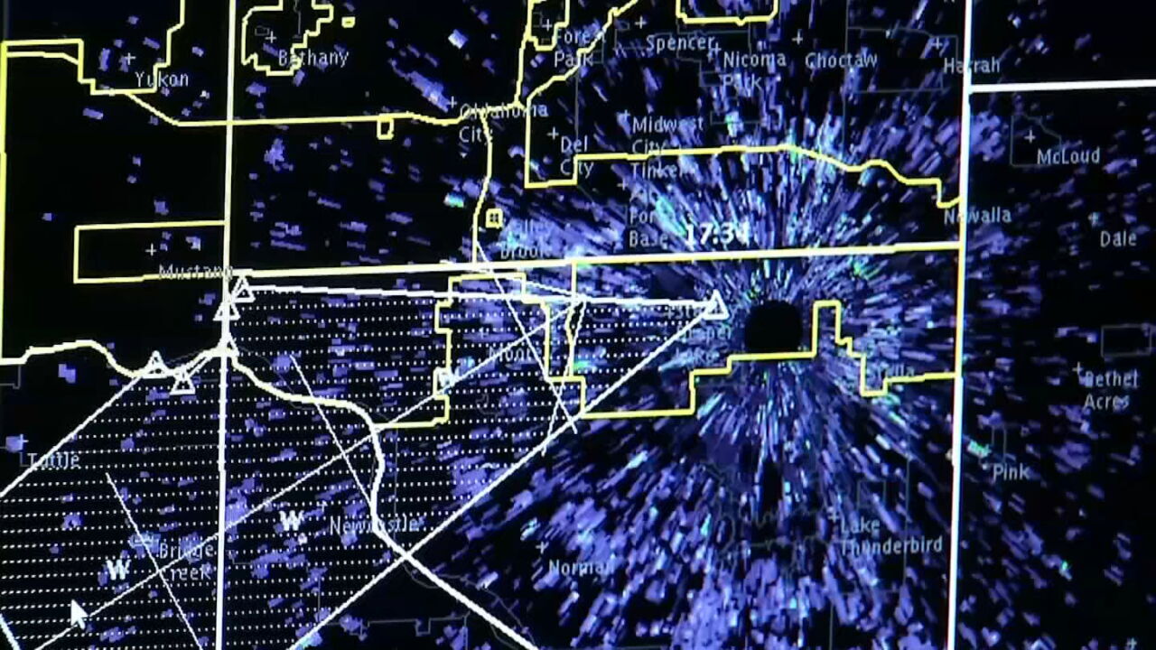
Several counties across northeastern Oklahoma were threatened by severe weather Monday night and into Tuesday morning.
A tornado watch was issued for several counties across northeastern Oklahoma. The National Weather Service issued the watch until 3:00 a.m. Tuesday.
Counties in the watch include, Adair, Cherokee, Craig, Creek, Delaware, Haskell, Kay LeFlore, Mayes, McIntosh, Muskogee, Noble, Nowata, Okfuskee, Okmulgee, Osage, Ottawa, Pawnee, Payne, Rogers, Sequoyah, Tulsa, Wagoner and Washington.
Some counties, including Adair, Sequoyah counties in Oklahoma, Washington County in Arkansas, and Chautauqua County in Kansas were under tornado warnings throughout the night.
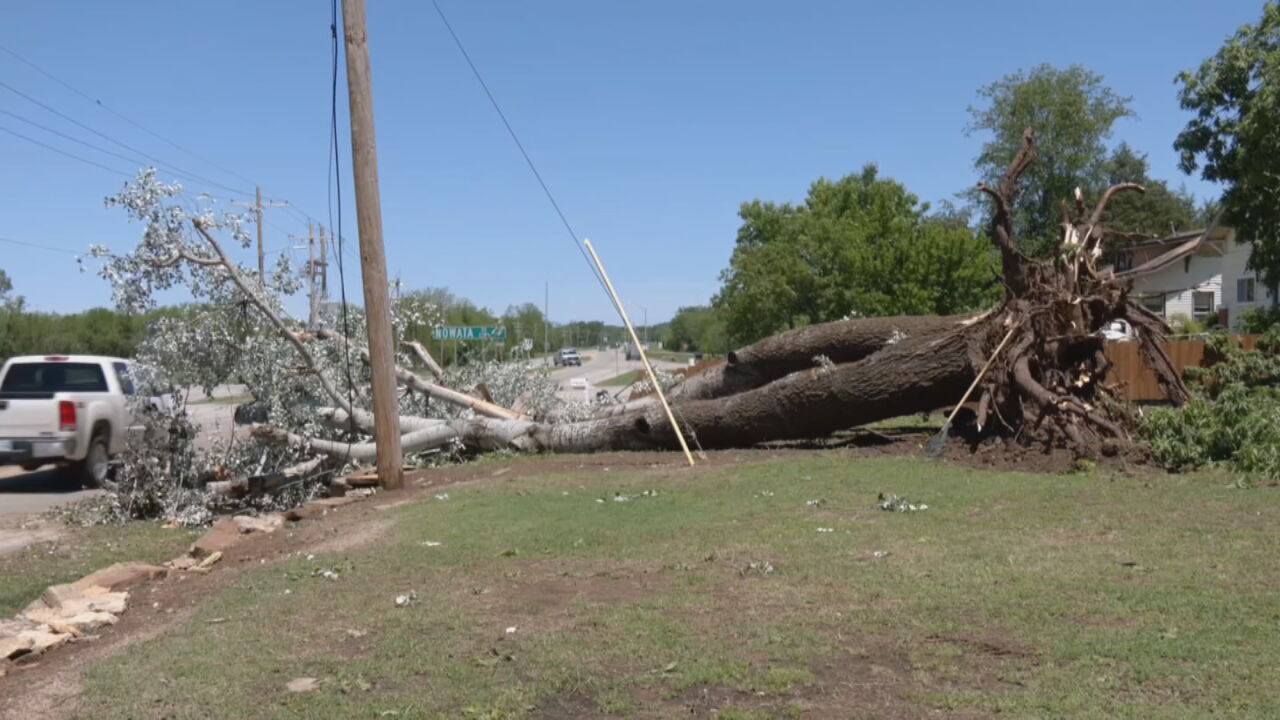
Winds across the northeastern part of the state reached upwards of 60 miles per hour. Some areas even received hail between marble and quarter size.
Some areas reported power outages; Verdigris Valley reported over 2,400 in the Skiatook/Collinsville area, PSO had 450 out near 1-44 and Harvard, OG&E had 1,700 out in Piedmont. Northeast reported 546 outages and Ozarks REC said they have about 115 out near Greasy.
11:05pm: PSO reporting ~4,000 total customers w/o power, spanning from Tulsa metro up to Grove. OG&E reporting 1,430 w/o power in Sapulpa.
— Stephen Nehrenz (@StephenNehrenz) March 7, 2017
5 power poles reportedly snapped at 121st & Memorial. Could be power outages in Bixby #okwx
— Michael Grogan KOTV (@GroganontheGO) March 7, 2017
Several power poles reported down in the area of 106th and 145th.
— Owassoisms Owasso Ok (@Owassoisms) March 7, 2017
News On 6 anchor Craig Day said 145th Street in Owasso was closed between 106th and 116th Street North due to four power lines that snapped, leaving just under 200 customers without power.
Power crews are working to get the debris clear and the road open.
News On 6 Meteorologist Dick Faurot says a dry line/cold front is moving across the state, which is increasing the chance of severe storms.
He said by Tuesday morning, everything will have moved east and we’ll have clear skies and a brisk wind with temperatures in the upper 30s to mid-40s. Tuesday afternoon those will rise to the mid to upper 60s.
","published":"2017-03-07T02:44:03.000Z","updated":"2017-03-07T06:37:53.000Z","summary":"A tornado watch has been issued for several counties across northeastern Oklahoma. The National Weather Service issued the watch until 3:00 a.m. Tuesday.
","affiliate":{"_id":"5c784a0c4961cb23ad330098","callSign":"kotv","origin":"https://www.newson6.com"},"contentClass":"news","createdAt":"2020-02-01T22:32:43.491Z","updatedAt":"2020-03-31T17:20:58.070Z","__v":1,"show":true,"link":"/story/5e35fc8b2f69d76f6202e1ee/severe-weather-tornado-warnings-threaten-northeastern-ok","hasSchedule":false,"id":"5e35fc8b2f69d76f6202e1ee"};
Get The Daily Update!
Be among the first to get breaking news, weather, and general news updates from News on 6 delivered right to your inbox!
More Like This
March 6th, 2017

April 15th, 2024

April 12th, 2024

March 14th, 2024
Top Headlines


May 8th, 2024