Another Pleasant Afternoon Before Summer Returns This Weekend
Another Pleasant Afternoon Before Summer Returns This WeekendWednesday, August 5th 2020, 6:51 am


TULSA, Okla. -
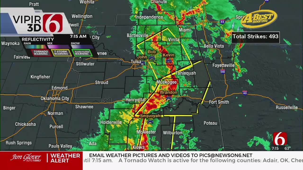
We’re tracking a complex of storms this morning very near the metro. Highest probabilities for showers and storms will remain west and south for the next few hours before quickly moving out of the area.
Tulsa could still miss out on this early morning chance. Another round of precipitation is possible early Thursday morning to midday near the metro and part of northeastern OK with slowly increasing temperature and humidity Thursday into the weekend.
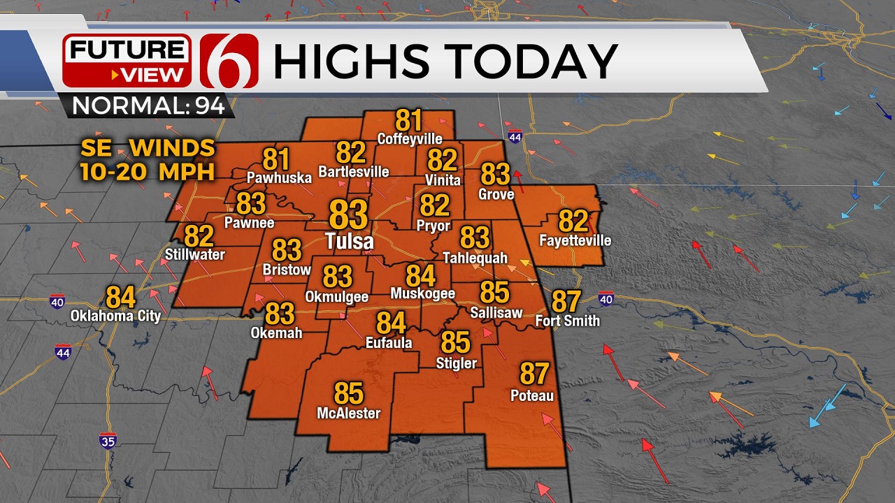
Temperatures today will remain below seasonal norms again, with highs nearing the lower 80s. Our summer-like pattern returns soon with heat index values well over 100 this weekend.
This zone of early morning showers and storms will be very close to the area this morning through the first half of the morning, but many locations along and east of Tulsa will remain dry. A few locations may experience pockets of moderate to heavy rainfall this morning, but this should be highly localized. Gusty winds and some small hail can’t be ruled out, but the probability for organized severe weather appears low, and mostly to our west. This probability for precipitation will continue for the first half of the morning before another round develops overnight into Thursday morning to midday.
The ridge of high pressure currently centered well west of the state will migrate eastward over the next 48 hours. The upper air flow currently from the northwest will become more zonal, or west to east this weekend as the ridge brings warmer weather back across the state. Any organized storm activity this weekend will remain north or east of our immediate areas. The ridge may once again flatten by the middle of next week and retro back west. This could bring additional storm chances back across part of northern OK by the middle to end of next week.
Temps today should remain in the upper 70s and lower 80s along with the return of southeast winds from 10 to 20 mph. This regime of unseasonably cool weather will come to an end soon with highs reaching the lower to mid-90s Friday into the weekend. Heat index values should reach the 100 to 106 range and may be high enough in a few locations to trigger heat advisories for part of the weekend that may be required early next week.
Thanks for reading the Wednesday morning weather discussion and blog.
Have a super great day!

Get The Daily Update!
Be among the first to get breaking news, weather, and general news updates from News on 6 delivered right to your inbox!
More Like This
August 5th, 2020

August 8th, 2023

July 4th, 2023

May 8th, 2023
Top Headlines


April 26th, 2024

