Summer Returns Soon But A Few Storm Chances Remain
Summer Returns Soon But A few Storm Chances RemainThursday, August 6th 2020, 6:49 am
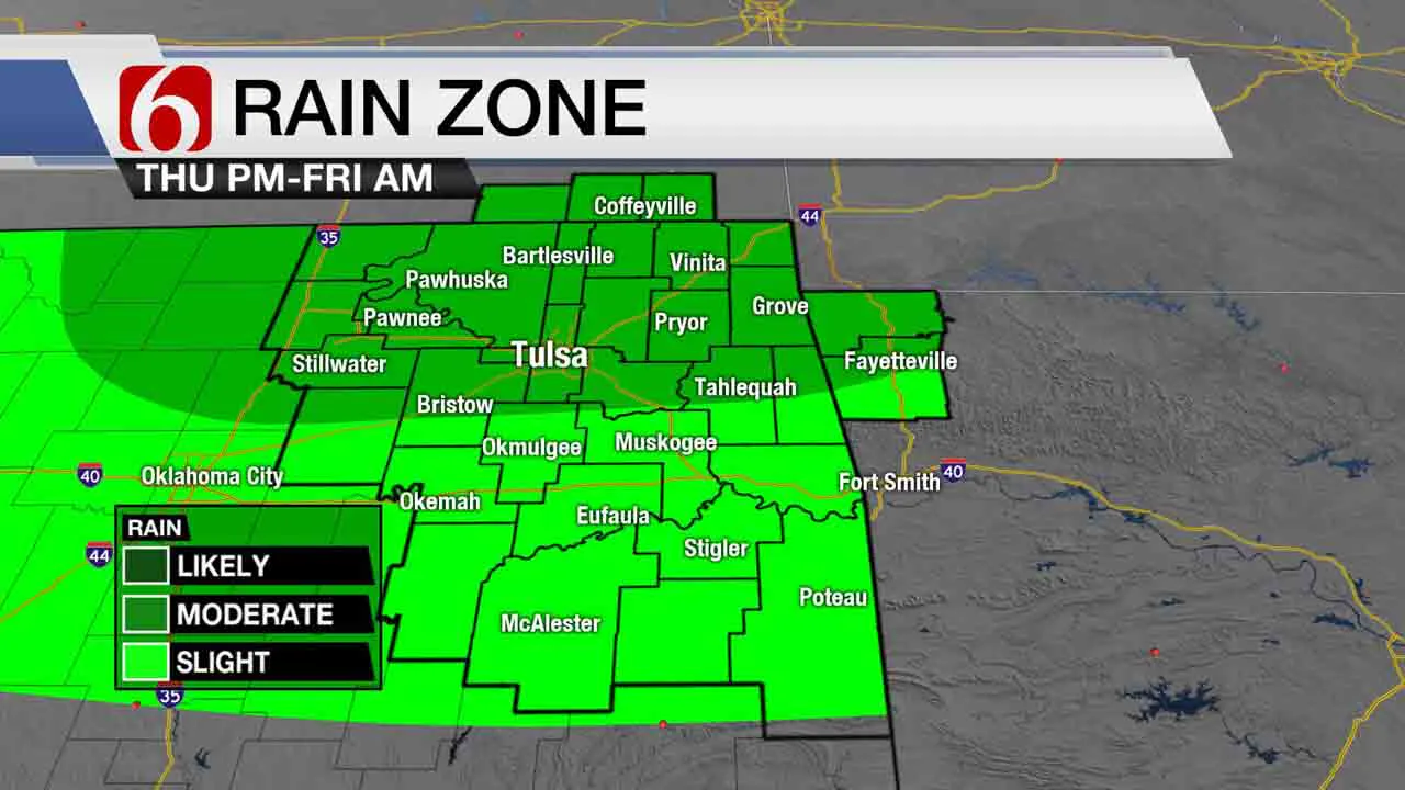
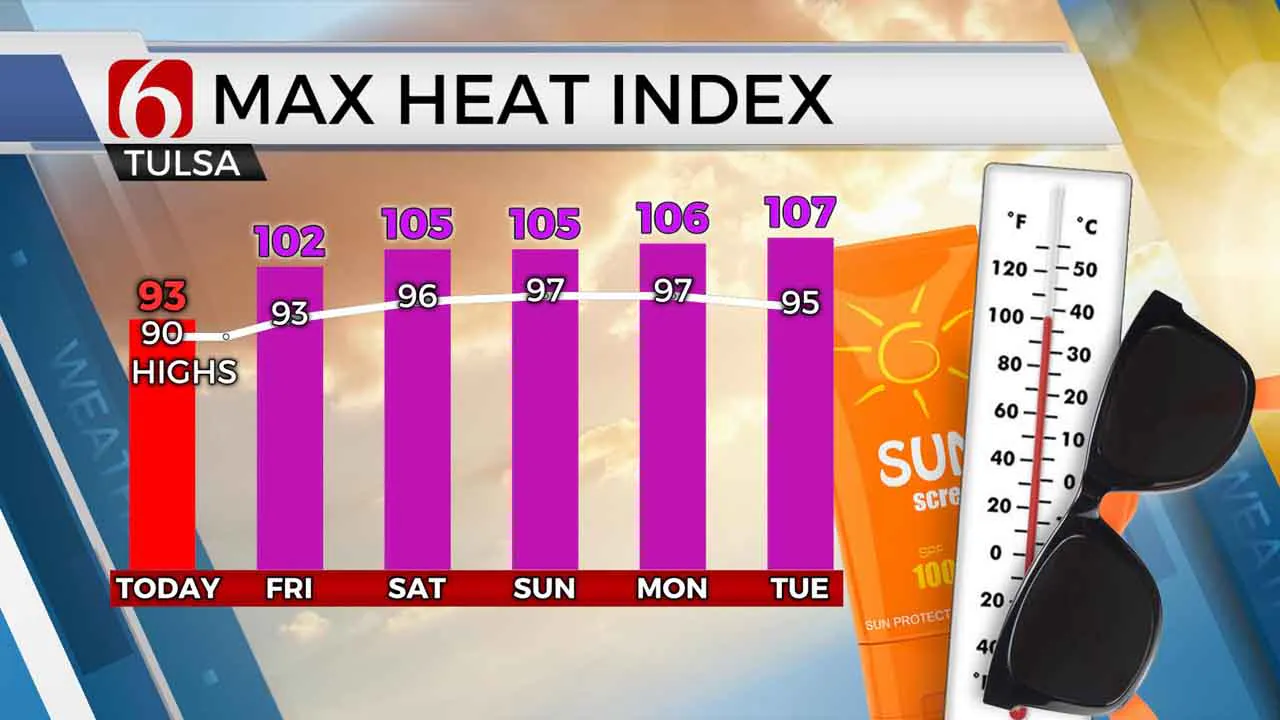
The data has taken a few twists and turns this morning compared to the last several days and this unfortunately leads to a lower confidence on the forecast. We should be dealing with a few showers and storms this morning nearby, but so far, this is not the case. Most data support a few storms developing this afternoon into the evening, but a few of the model suites depict a higher probability of a cluster of storms moving into the area tonight that could be strong to severe. We’ve had probabilities for both today and Friday, but the timelines associated with these chances will need to shift some in order to fit the latest data. And we would need to mention that potential for some severe storms. This change in the timing would also support a slightly higher temperature for this afternoon, with some locations reaching 90, which is up a few degrees from yesterday’s data for today. After early Friday morning, the rest of the forecast currently appears as previously advertised: summer returns along with increasing heat and humidity for a few days into next week.
Radar depicts a decaying complex of storms across northeastern Kansas, also southwestern Kansas and an outflow boundary surging southward into southern Kansas. Across southern OK this morning, there appears to be a developing warm front along the Red River that should lift northward thru the afternoon. A few isolated showers or storms will still be possible today, but our higher chances should be associated along northern OK later this afternoon and evening as a possible MCV from southern Kansas and the resident outflow triggers additional storms. The zone of moisture difference that’s been located slightly west of us earlier this week will be directly overhead later tonight and should aide in a few storms. After early Friday morning, any storm activity should quickly exit to the east as the mid-level ridge of high pressure expands across the state bringing a few days of summerlike weather back to the area. The ridge may once again flatten by the middle of next week and retro back west. This could bring additional storm chances back across part of northern OK by the middle to end of next week.
Thanks for reading the Thursday morning weather discussion and blog.
Additional changes to the forecast are likely later this afternoon and evening due to the variability in the data.
Have a super great day!
Alan Crone
More Like This
August 6th, 2020
August 8th, 2023
July 4th, 2023
May 8th, 2023
Top Headlines
April 25th, 2024
April 25th, 2024

