Cold And Soggy Weather For Green Country As October Winter Storm Takes Shape
Yes it’s late October, and yes a winter storm is actually taking shape across parts of Oklahoma. Now it won’t be wintry for all of Green Country, and there’s a lot to break down here, so let’s get into the details.Monday, October 26th 2020, 8:01 am
Yes it’s late October, and yes a winter storm is actually taking shape across parts of Oklahoma. Now it won’t be wintry for all of Green Country, and there’s a lot to break down here, so let’s get into the details.
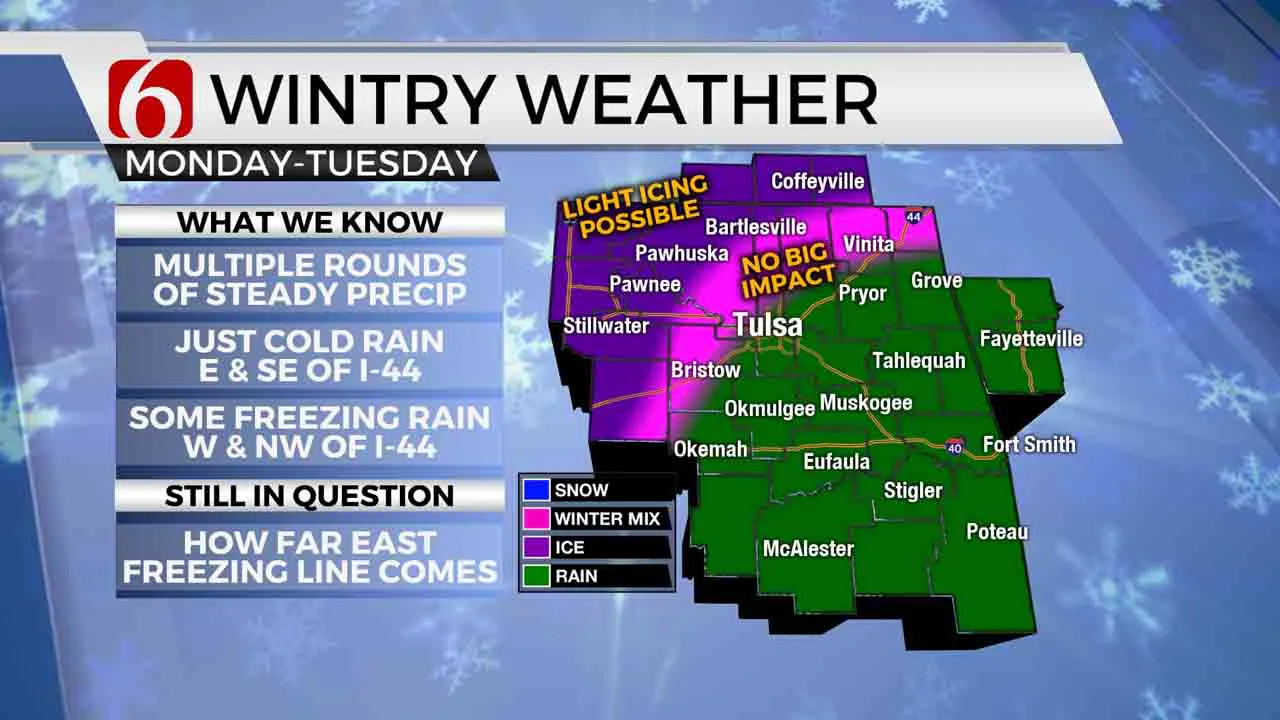
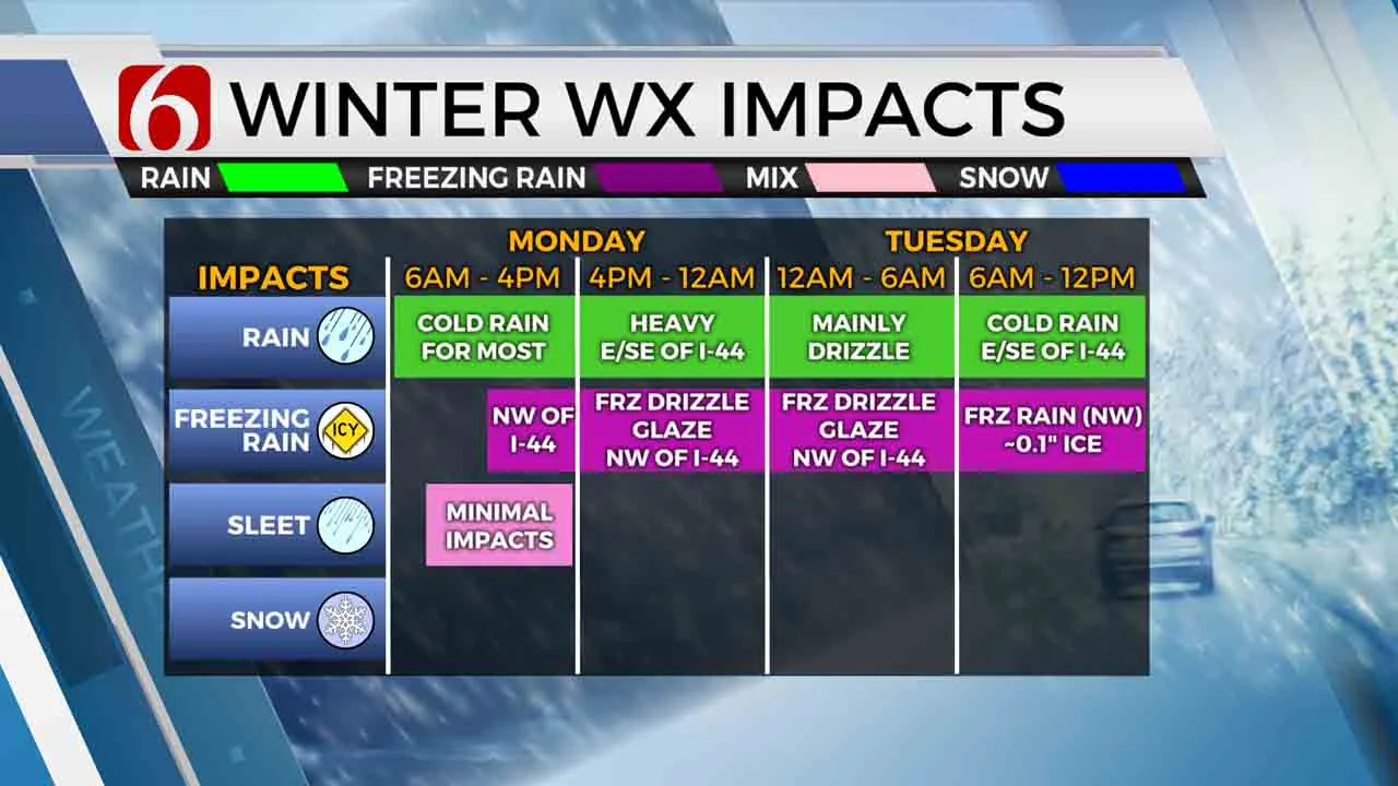
Cold air will continue to deepen across Oklahoma for our Monday as the first wave of precipitation starts to develop. The majority of eastern Oklahoma will be in for cold rain, some locally heavy, while wintry precipitation takes shape across northwestern Oklahoma. But by midday and Monday afternoon, a mix of rain and sleet will try to transition to some freezing rain in our far northwestern counties northwest of the I-44 corridor (specifically Osage County, Pawnee County, and southeastern Kansas) as the freezing line slowly creeps in. Wintry impacts should remain limited early on as ground temperatures are still fairly warm, but a first glaze of ice accumulation on elevated surfaces may start to develop in those listed counties during the day.
 By late Monday afternoon and evening, steadier rains look to shift further into southeastern Oklahoma, while areas near and northwest of I-44 transition to more drizzly conditions. We’ll have to watch closely for some of this to fall as freezing drizzle once you get just north and west of Tulsa as temperatures will likely be near or just below freezing in these areas. The freezing line looks to hold very close to Tulsa into Tuesday morning as the next heavier wave of precipitation approaches.
The second wave of moderate to occasionally heavy Tuesday morning precipitation could cause more noticeable icing issues for areas northwest of the I-44 corridor. Up to 0.25” of ice accumulation will be possible as any areas below freezing will see this fall as freezing rain. The Tulsa metro looks to be right on the 32 degree line and could see a brief icy glaze on elevated surfaces, so we’ll have to remain aware as a 1-2 degree shift could impact things greatly in the metro. Once again, areas east and southeast of Tulsa will continue with just cold rain Tuesday.

That second wave of steadier precipitation should eventually wane by Tuesday afternoon, with temperatures hopefully warming a few degrees to get our northern and western counties back just above freezing. Additional precipitation will come our way Wednesday into Thursday, but temperatures – while still cold – look to be warm enough across all of Green Country for this to fall as all rain on Wednesday and Thursday.
So, the bottom line: Expect some very soggy conditions across Green Country the next few days. If you’re east and southeast of the Tulsa metro, you’re just looking at cold rain. In the Tulsa metro, cold rain is most likely, but some ice accumulation on elevated surfaces could occur especially from Monday night into Tuesday morning. And if you’re north and especially west/northwest of Tulsa, be prepared for some ice accumulation and possible travel impacts, starting as early as midday Monday and continuing through Tuesday afternoon.
We’ll keep you updated throughout this event on News On 6! You can also follow me on Twitter @StephenNehrenz as well as my Facebook page Meteorologist Stephen Nehrenz to stay up to date with the very latest.
More Like This
October 26th, 2020
February 14th, 2022
January 26th, 2022
January 25th, 2022
Top Headlines
April 26th, 2024
April 26th, 2024
April 26th, 2024
April 26th, 2024


