A Warming Trend Underway
Northwest flow aloft will bring a few weak disturbances near the state over the next few days with no major changes in sensible weather.Monday, November 29th 2021, 1:42 pm
TULSA, Oklahoma -
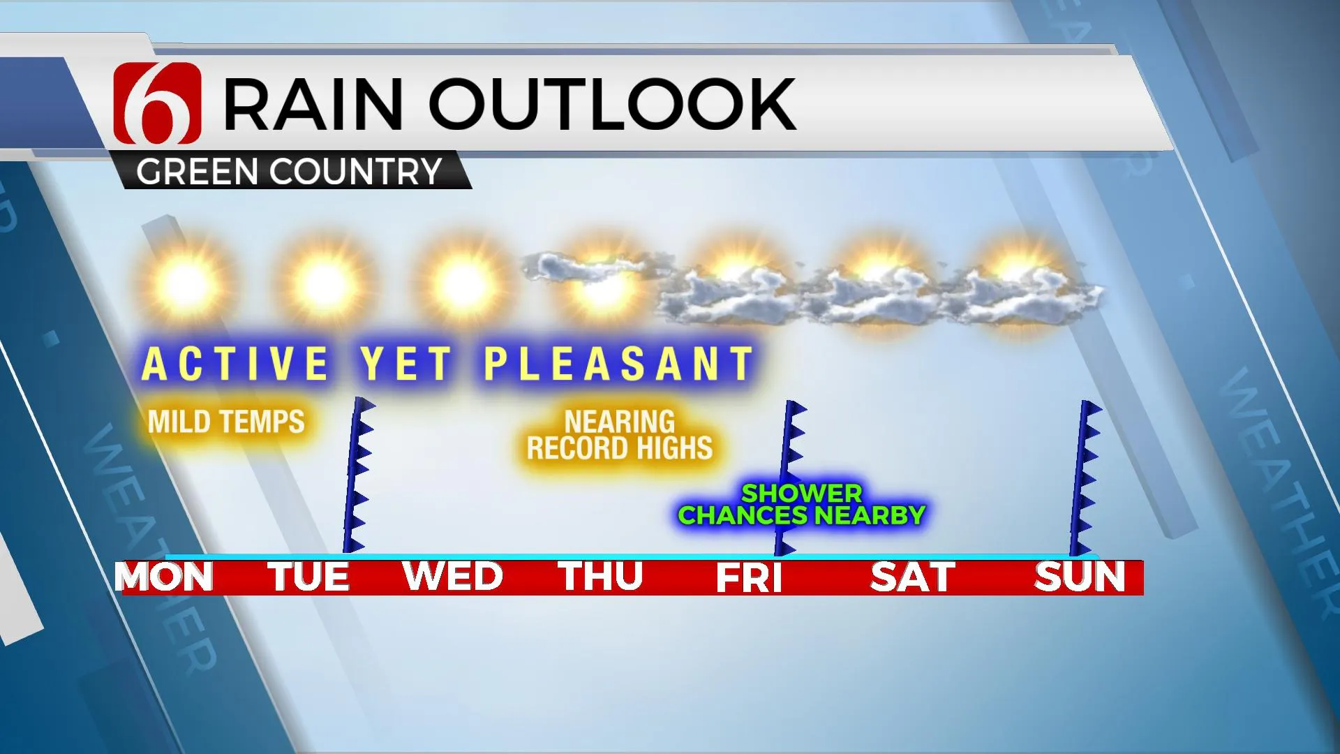
Northwest flow aloft will bring a few weak disturbances near the state over the next few days with no major changes in sensible weather. A slightly stronger system will near the state by the latter half of the week bringing some slightly cooler weather and a chance for some precipitation near and south of the area. Until this occurs, unseasonably warm weather is likely to remain in the foreseeable future with some locations nearing record highs for the middle of the week. We're 26 days from Christmas, but the current pattern will feel more like spring for most of the week.

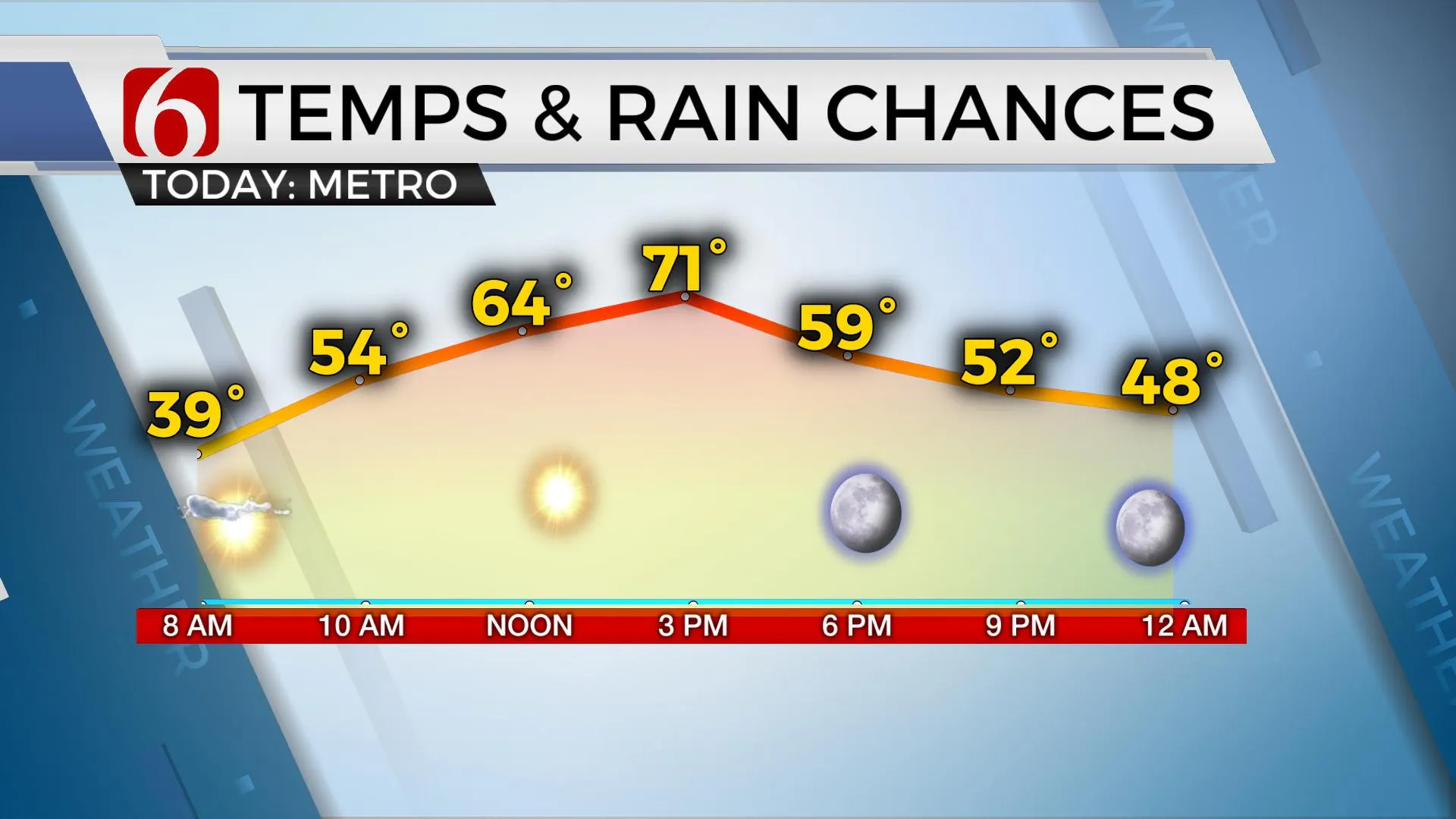
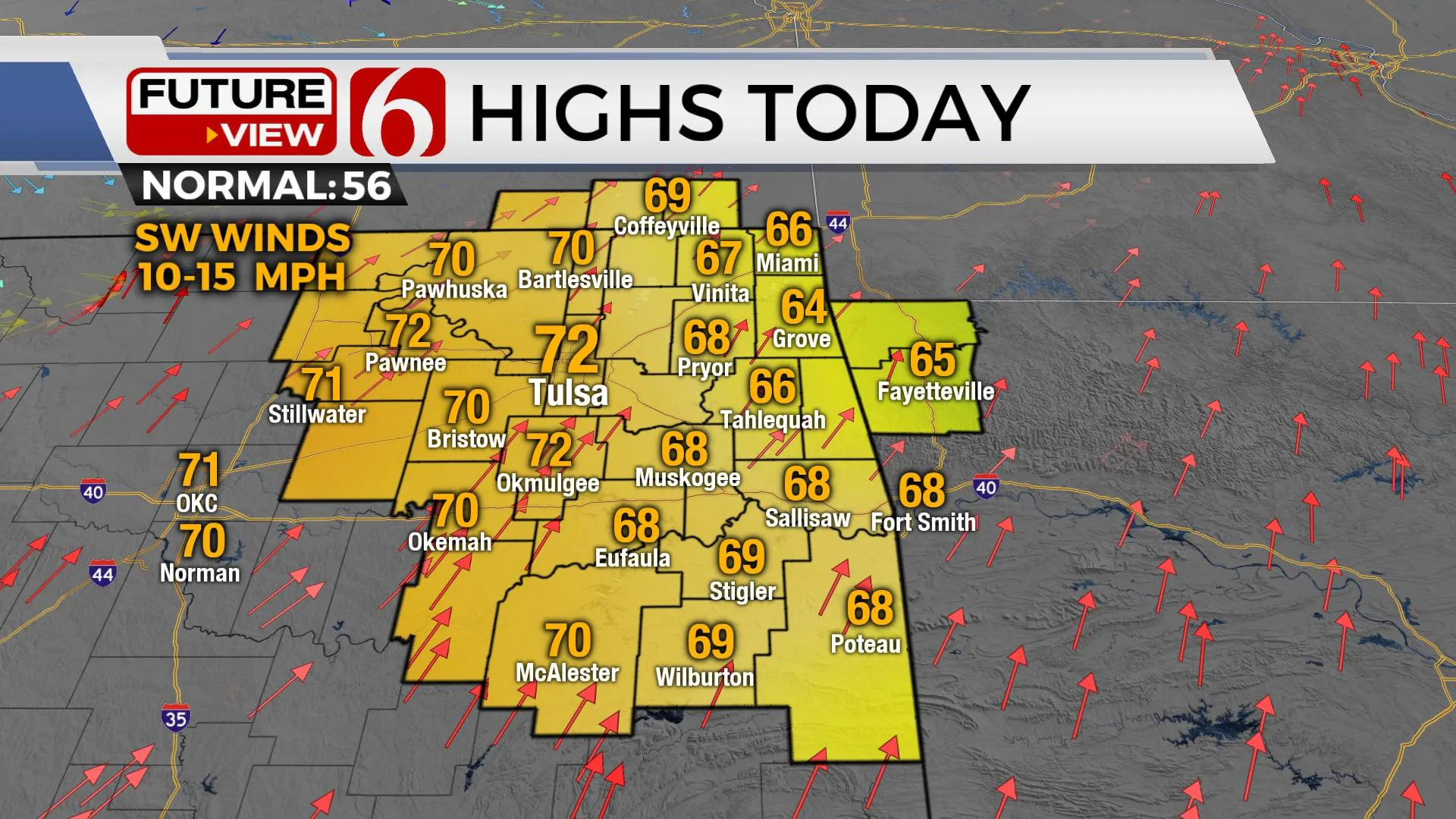
Temps both today and tomorrow will be near the lower 70s for afternoon highs, before a weak front moves across the area Tuesday with a very minor reduction in temps Wednesday. Thursday should be the warmest day of the week with southwest winds helping temps climb into the mid to upper 70s. Temps this weekend will drop into the upper 50s and lower 60s as the next front moves across the state Friday evening into early Saturday along with some mentions for showers or storms near or east of the area.

A weak disturbance in the southern stream will be nearing the state with increasing low-level moisture by the end of the week. Showers and storms are likely to occur with this feature, but the exact placement of the system will keep our mentions low for this forecast update. Some data is already suggesting higher chances for precipitation with this system for southeastern OK. Temps for the weekend will continue to be relatively mild for early December with morning lows in the lower 40s and highs in the upper 50s and lower 60s. The pattern suggests some colder weather will break loose across the northern U.S. this weekend but will remain well north of the southern plains. The southern extent of this cold air mass may sneak into the area early sometime in the next 7 to 10 days, but data remains inconsistent when compared to earlier solutions this time period from last week.

Thanks for reading the Monday morning weather discussion and blog.
Have a super great day!
Alan Crone
KOTV
More Like This
November 29th, 2021
February 14th, 2022
January 26th, 2022
January 25th, 2022
Top Headlines
April 26th, 2024


