Morning Storms Bring Heat & Humidity Soon
Early-morning storms swept across the state on Tuesday.Tuesday, July 11th 2023, 6:57 am


TULSA, Okla. -
Early-morning storms swept across the state on Tuesday.
Here are the details from News On 6 Meteorologist Alan Crone:
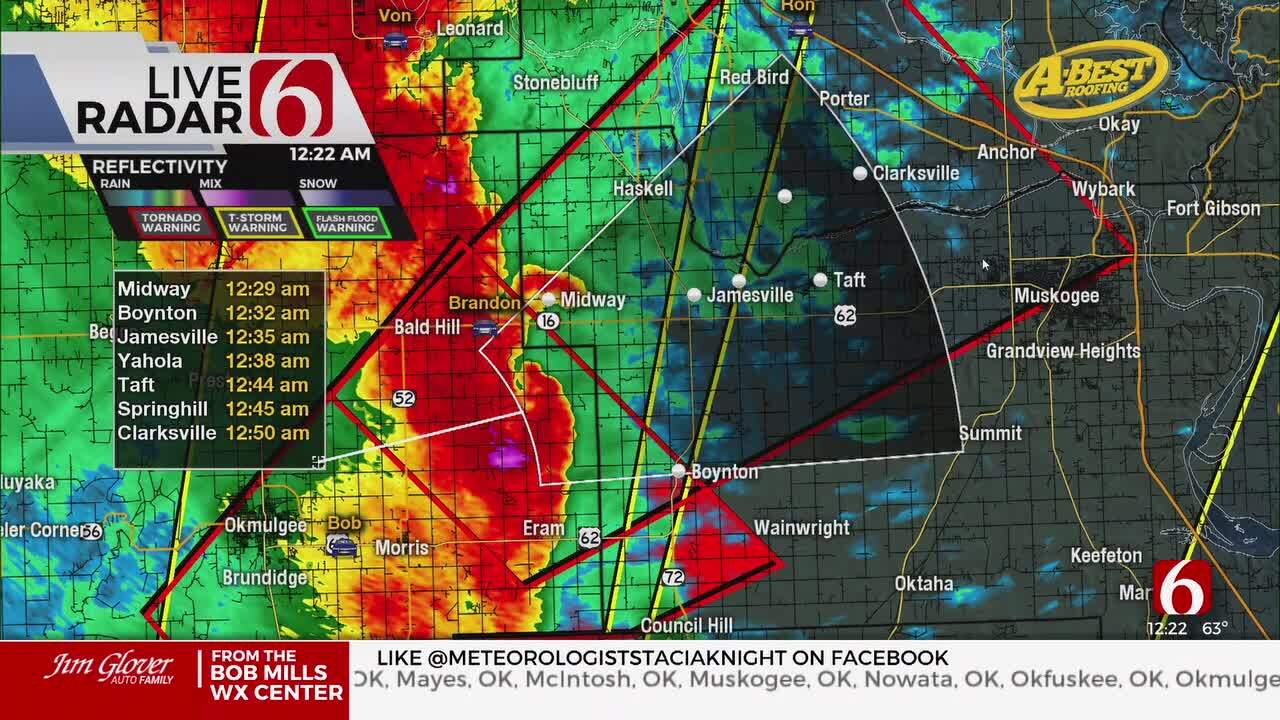
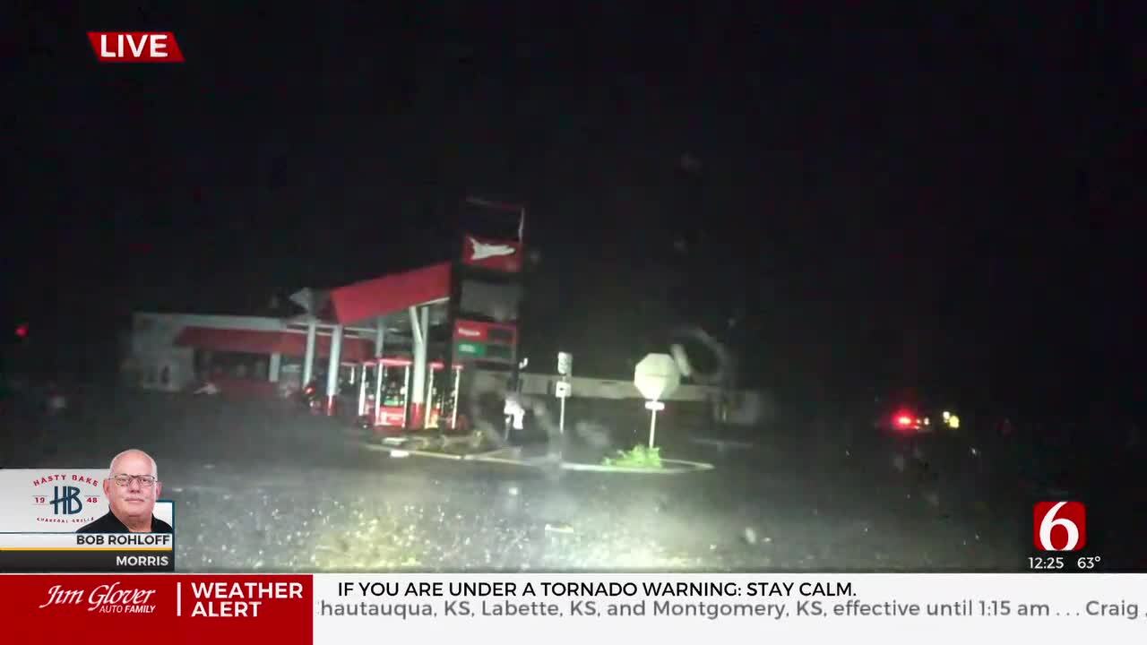
A few storms will remain nearby early Tuesday morning. The storms developed overnight along a retreating warm front across southeastern Oklahoma moving northward, and due to a short-wave in the mid-levels moving across northwestern and central sections of the state moving southeast. Severe weather has been mostly confined to central and southern Oklahoma with winds near 60 mph and quarter to half dollar sized hail. As the morning progresses, the severe threat will end as storms move away from the area and begin to weaken. We think after midday, most of the area will remain rain-free into the afternoon. A few showers may briefly populate the Tulsa metro but should quickly end this morning.
The mid-level ridge of high pressure centered to our west is expanding. The northern periphery of the ridge should encompass most of the state later in the day on Tuesday and Wednesday but will keep a very small window of northwest flow brushing far NE OK and SE Kansas. A strong disturbance will drop through the Midwest Wednesday with another complex of storms grazing far northeastern OK late Wednesday evening into early Thursday morning with higher likelihoods across the Missouri Valley.
As the warm front lifts northward on Tuesday, significant low-level moisture will stream across the state bringing tropical moisture across the area. Temperatures will rise and heat index numbers will bring heat advisories and heat warnings for a large part of the state Wednesday through Friday. The mid-level ridge will retrograde west again by the end of the week bringing yet another active northwest flow across the state this weekend.
Highs will reach the lower 90s on Tuesday with heat index values nearing 100 to 104. But the ridge is expected to bring highs in the mid and upper 90s Wednesday and Thursday. The increased moisture combined with evapotranspiration should boost heat index values between 110 to 115 degrees. You’re encouraged to begin pre-hydrating now for this potentially high-heat stress period. The ridge should be far enough west of the area this weekend to bring additional late night and early morning storm complexes into part of the area. This will result in some lower daytime highs and a reduction in heat stress. The ridge is expected to center-up over Oklahoma for most of next week with hot and humidity weather returning.
Thanks for reading the Tuesday morning weather discussion and blog.
Have a super great day!
Alan Crone
KOTV

Get The Daily Update!
Be among the first to get breaking news, weather, and general news updates from News on 6 delivered right to your inbox!
More Like This

July 11th, 2023

July 20th, 2023

July 18th, 2023

July 17th, 2023