Storms Move Out Of Eastern Oklahoma
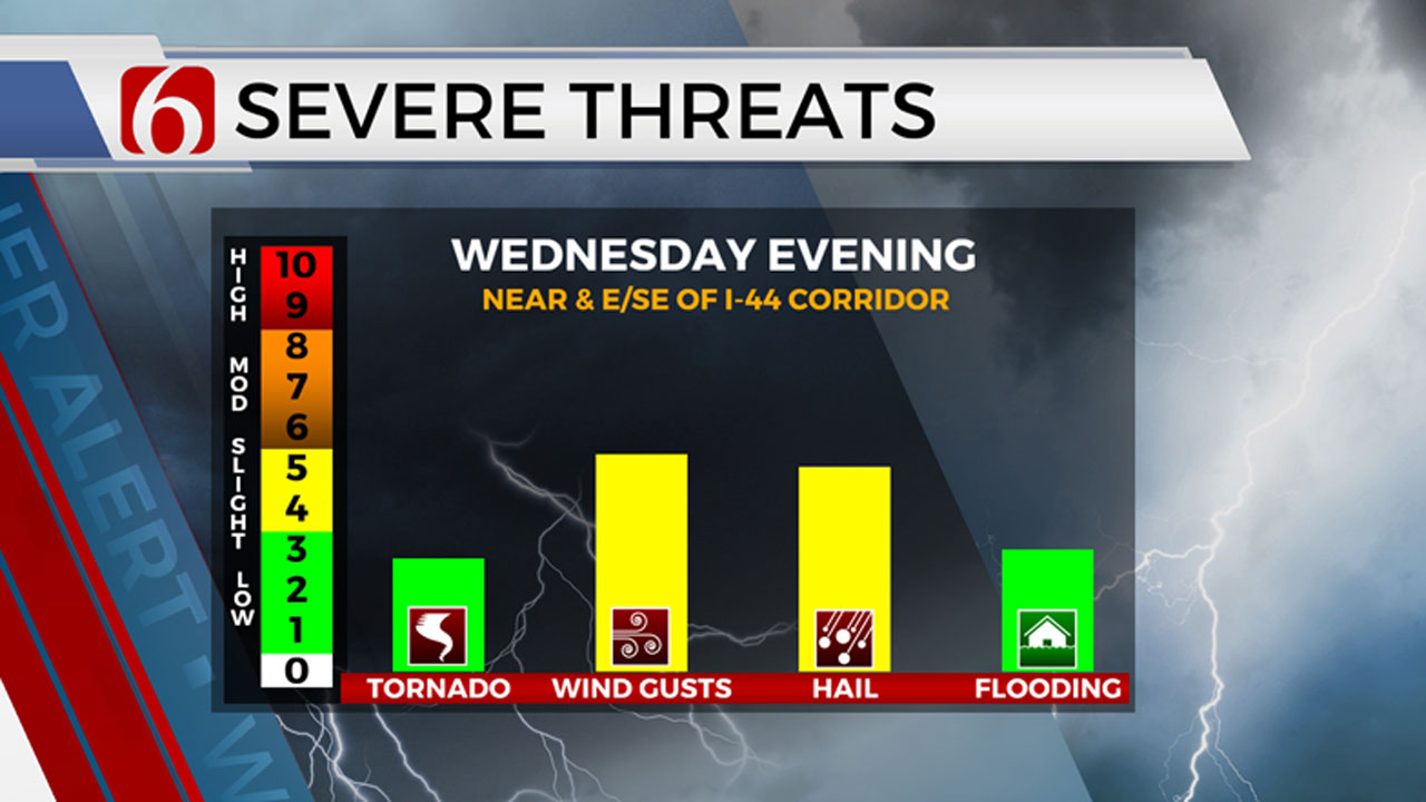
More thunderstorms will move through Oklahoma on Wednesday with the strongest chance for severe weather happening from approximately 3 pm to 11 pm. Meteorologist Alan Crone says that all modes of severe weather are possible around Eastern Oklahoma.Wednesday, August 9th 2023, 8:22 pm


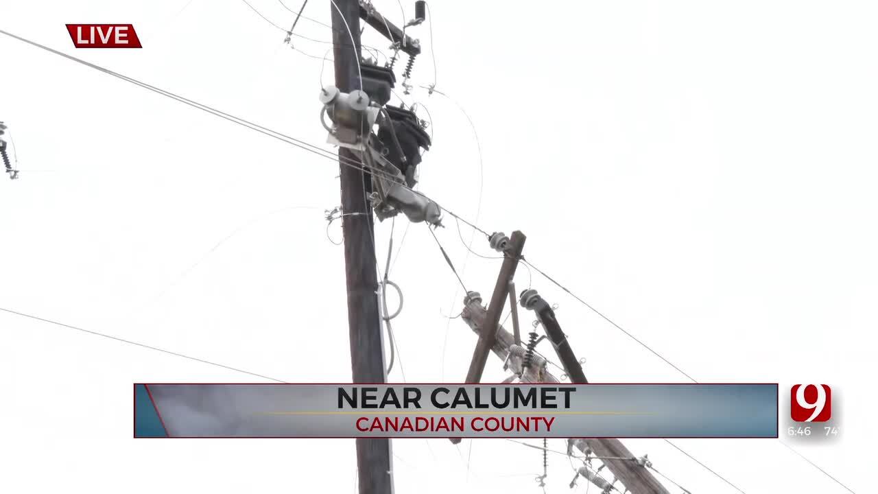
A few severe storms affected parts of eastern Oklahoma on Wednesday evening. The main threats were hail, heavy rains and winds. There was a slight tornado threat due to conditions, with a tornado watch expiring at 10 p.m. Wednesday night.
When Will Storms Start In Eastern Oklahoma?
A complex of thunderstorms located across central and eastern Kansas will continue moving eastward early this morning with the possibility of additional development on the southern flank. This may slide across the northern half of the state by midmorning. Some scattered showers and storms located near the Tulsan metro will also continue for the next few hours.
Listen To Alan Crone's Apple Podcast HERE
As this activity moves east, gusty south winds at 15 to 28 mph will be likely through the day with afternoon highs reaching the lower 90s. Heat index values from 100 to hear 105 will be possible near the metro with higher values south where heat advisories will likely be required. A strong disturbance across the Central Plains states will bring a threat of additional thunderstorms later this afternoon and early evening across Eastern Oklahoma, including the threat of severe weather. There will remain some questions regarding timing due to the morning storm, but due to the parameters expected, all modes of severe weather would be a possibility.
Please remain aware of your weather surroundings Wednesday afternoon and into the evening as this system brushes Northeastern Oklahoma. Our window of opportunity seems to be focused from approximately 3 pm to 11 pm.
Will There Be More Storms In Oklahoma On Thursday?
As the system leaves our area later tonight, a surface boundary will move across most of the area before stalling along the Red River. This will bring north winds tomorrow at 10 to 15 mph with morning lows in the 70s and daytime highs in the upper 80s and lower 90s. Heat index values tomorrow afternoon will be into the mid-90s. Late tomorrow evening, the boundary will begin moving northward as a warm front by early Friday morning.
Heat Advisories Are Likely This Weekend in Oklahoma
Another disturbance approaching from the west should trigger scattered showers and storms late overnight and early Friday morning near the I-44 corridor. As this activity wanes by mid-morning, south winds at 15 to 20 mph will return with daytime highs into the mid-90s Friday afternoon. Heat index values are expected from 105 to 110°. Heat advisories seem likely, and a few heat warnings could be required. The upper airflow will remain conducive for additional shower and storm chances into part of the weekend, including some late-night and early-morning opportunities
Temperature trends this weekend continue supporting warm and muggy weather with morning lows in the mid-70s and daytime highs in the mid-90s. Heat index values this weekend will also be near 105 to 110°. A weak boundary will approach the area Sunday bringing north breezes and slightly lower temperatures for Monday.
Thanks for reading the Wednesday morning weather discussion and blog.
Have a super great day!

Get The Daily Update!
Be among the first to get breaking news, weather, and general news updates from News on 6 delivered right to your inbox!
More Like This
August 9th, 2023

April 27th, 2024

April 27th, 2024

April 27th, 2024
Top Headlines
April 27th, 2024
April 27th, 2024
April 27th, 2024
