Sunny, Cold Start For MLK Day
A back-door shallow cold front (arctic air) has moved across OK and is located to our southeast early this morning.Monday, January 20th 2020, 6:45 am
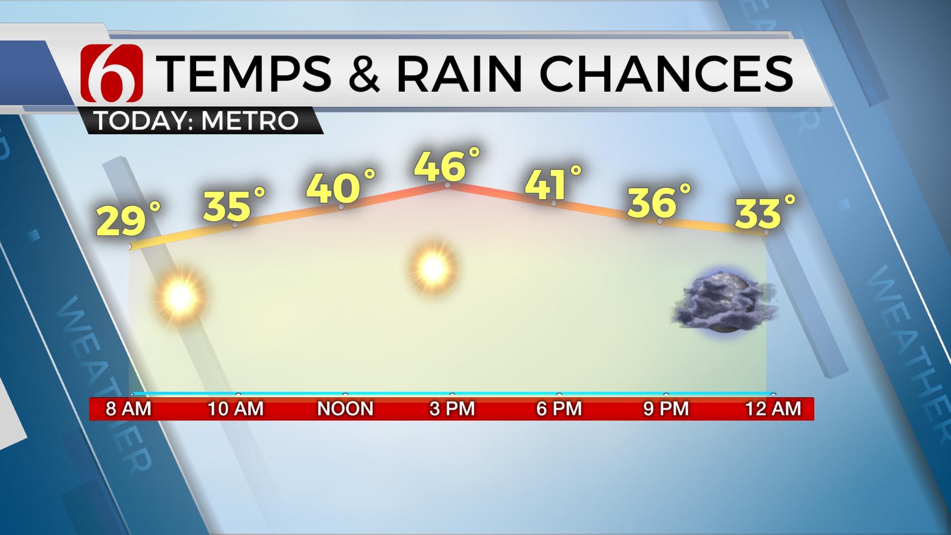
A back-door shallow cold front (arctic air) has moved across OK and is located to our southeast early this morning. Winds are mostly light but will still bring single digit to teens in the wind chills with temperatures this morning in the upper teens and lower 20s. Highs will range from the lower 30s near Miami, the upper 30s near Tulsa, and the lower 40s across southeastern OK. This surge of arctic air will quickly erode as the next series of storm systems begin impacting the area very soon.

A fast, upper level trough is diving down the plains today and will enter the Missouri Valley later tonight into Tuesday morning. This feature will spread light snow well to our east across part of Missouri with little impact for our immediate concerns. To the west, a decent upper level impulse will move eastward Tuesday into Wednesday and will provide enough lift for some showers or wintry precipitation to develop late Tuesday into pre-dawn Wednesday as this feature moves across the state. The lower levels of the atmosphere will be extremely dry, but warm and moist air is expected to move up and over the colder air at the surface. Additionally, due to the passage overnight and pre-dawn, the humidity values will be at the max and will allow the potential for some wintery mix to rain developing. At this point, any accumulation appears to be low. But the data is varied regarding the exact thermal profile for the early period of the system. The GFS (and other global models) remains warmer than the usually colder NAM products, which typically perform better with these types of cold air masses. But the complicating factor of the relatively warm-moisture incoming makes the forecast a little tricky. At this point, we’re going with a mix of snow to rain with any noticeable accumulations on the low side. Additional changes to this part of the forecast will remain possible.

Wednesday into Thursday a stronger upper level system will develop across the Pacific Northwest and send a disturbance down the plains that will also develop into a nearly closed cyclone. This process will allow gusty south winds at the surface Wednesday into Thursday which will bring higher moisture and warmer weather into the state resulting in showers and some isolated rumbles of thunder. High chances for precipitation will continue Wednesday evening into Thursday morning with rain until the system passes late Thursday night into early Friday morning. The positioning of the upper level low supports any impactful wintry weather remaining north of the state. We will watch this period carefully due to any change in trajectory of the low could bring some wrap-around snow flurries or showers across northeastern OK as the system exits the area pre-dawn Friday. As things appear now, our weekend will again be rain-free and above normal with Saturday highs in the lower 50s followed by Sunday afternoon in the upper 50s.
Thanks for reading the Monday morning weather discussion and blog.
Have a super great day!
Alan Crone
More Like This
January 20th, 2020
November 30th, 2022
November 1st, 2022
August 26th, 2022
Top Headlines
December 15th, 2024
December 15th, 2024
December 14th, 2024


