Tracking Two Systems, Severe Weather Threats For Northeastern Oklahoma
Tracking Two Systems, Severe Weather Threats For Northeastern OklahomaMonday, April 27th 2020, 7:08 am
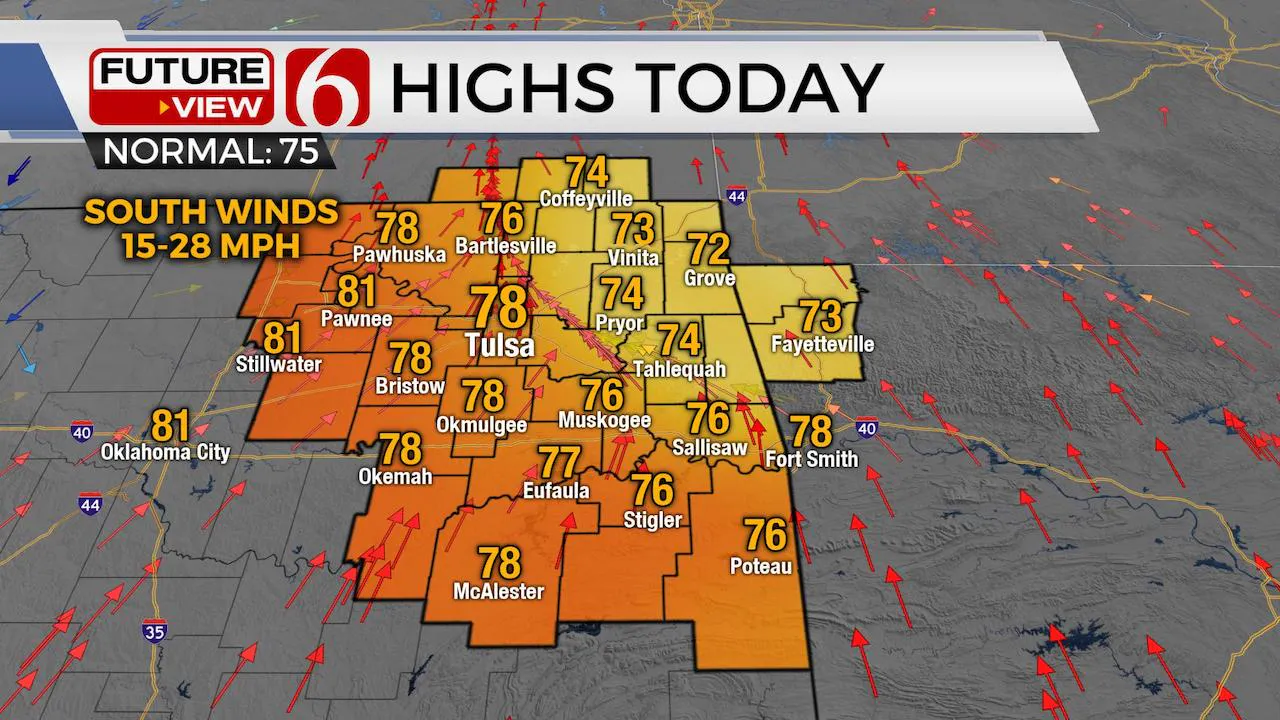
A weak upper level disturbance will move across northeastern OK early this morning aiding in a few showers and storms. These should remain below severe levels but due to the anticipated dew point depressions/spreads, there may be some gusty winds with a few showers. As the morning to afternoon arrives, low level moisture may attempt to rapidly return but the positioning of the system may be somewhat out of phase for strengthening storms. Any severe weather threat today will be highly conditional. Temps will start in the 50s this morning before moving into the upper 70s this afternoon with south winds returning ahead of a stronger system Tuesday that brings increasing thunderstorm chances, including much higher chances for severe weather threats. A mid-level ridge of high pressure quickly builds into the southern plains for the rest of the week with increasing temperatures nearing the upper 80s to lower 90s by Friday and Saturday before our next upper level system brings storm chances back for part of the weekend.

The upper air flow remains from the northwest today with a weak disturbance triggering a few showers and storms this morning through midday even though convective instability and potential remain low. A few rumbles of thunder will be possible this morning. Dew points remain mostly in the upper 40s. Some gusty winds seem possible with some of these showers. As the disturbance travel south and east, a few stronger storms could develop across southern OK later this afternoon or evening, but threats will remain mostly south of our immediate area of concern. A much stronger upper level system will move across the central to northern plains Tuesday night into Wednesday while helping to push a surface boundary southward across the state.

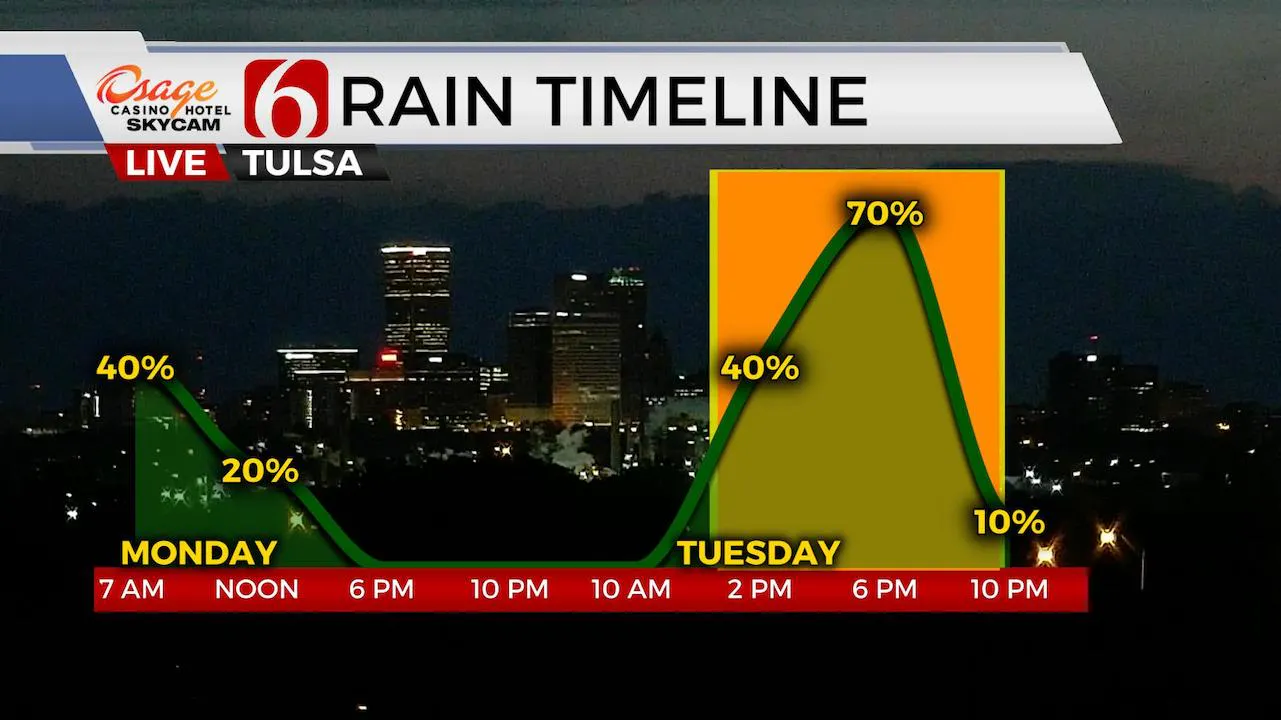
The main upper level system of interest is located across the Alaskan Peninsula this morning and will drop across the northern U.S. later today and into the Dakotas by Tuesday afternoon. This pattern is more normal for June than April but will bring strong winds aloft from the northwest Tuesday afternoon and evening across the central plains and into Oklahoma by afternoon. This disturbance will deepen to a significant low Wednesday across the Midwest with upper level northwest winds from 80 to 100 knots rounding the base of the trough. As this very strong lift enters the plains Tuesday afternoon, a surface cold front will make its way from the Missouri Valley into northern OK with storms developing along this front while it moves southward with time Tuesday evening. Our first shot at timing brings this front near northern OK between 2pm and 4pm Tuesday with storms exiting southeastern OK by 10 pm Tuesday evening. All modes of severe weather will be possible, but the main threat will continue to be damaging winds and hail along with very heavy rainfall. Storms are likely as the front pushes southward by Tuesday evening as a surface ridge of high pressure builds across northeastern OK Wednesday. Gusty south winds return Thursday and Friday as the upper air pattern begins to change and low-level moisture surges southward before our next upper disturbance arrives into the weekend. Our weather pattern next week appears quite stormy which would be a normal climate feature for early May across the state.
More Like This
December 14th, 2024
December 14th, 2024
Top Headlines
December 14th, 2024
December 14th, 2024
December 14th, 2024


