Weekend Strong To Severe Storms Possible For Northeastern Oklahoma
Toasty weather returns today with sunshine and highs approaching the mid or upper 90s. A heat advisory will be required for part of southeastern OK today and possibly a larger area tomorrow. A minor pattern change occurs soon bringing thunderstorm chances back to the state, including the mentions of a few strong to severe storms.Friday, August 28th 2020, 7:19 am
Toasty weather returns today with sunshine and highs approaching the mid or upper 90s. A heat advisory will be required for part of southeastern OK today and possibly a larger area tomorrow. A minor pattern change occurs soon bringing thunderstorm chances back to the state, including the mentions of a few strong to severe storms.

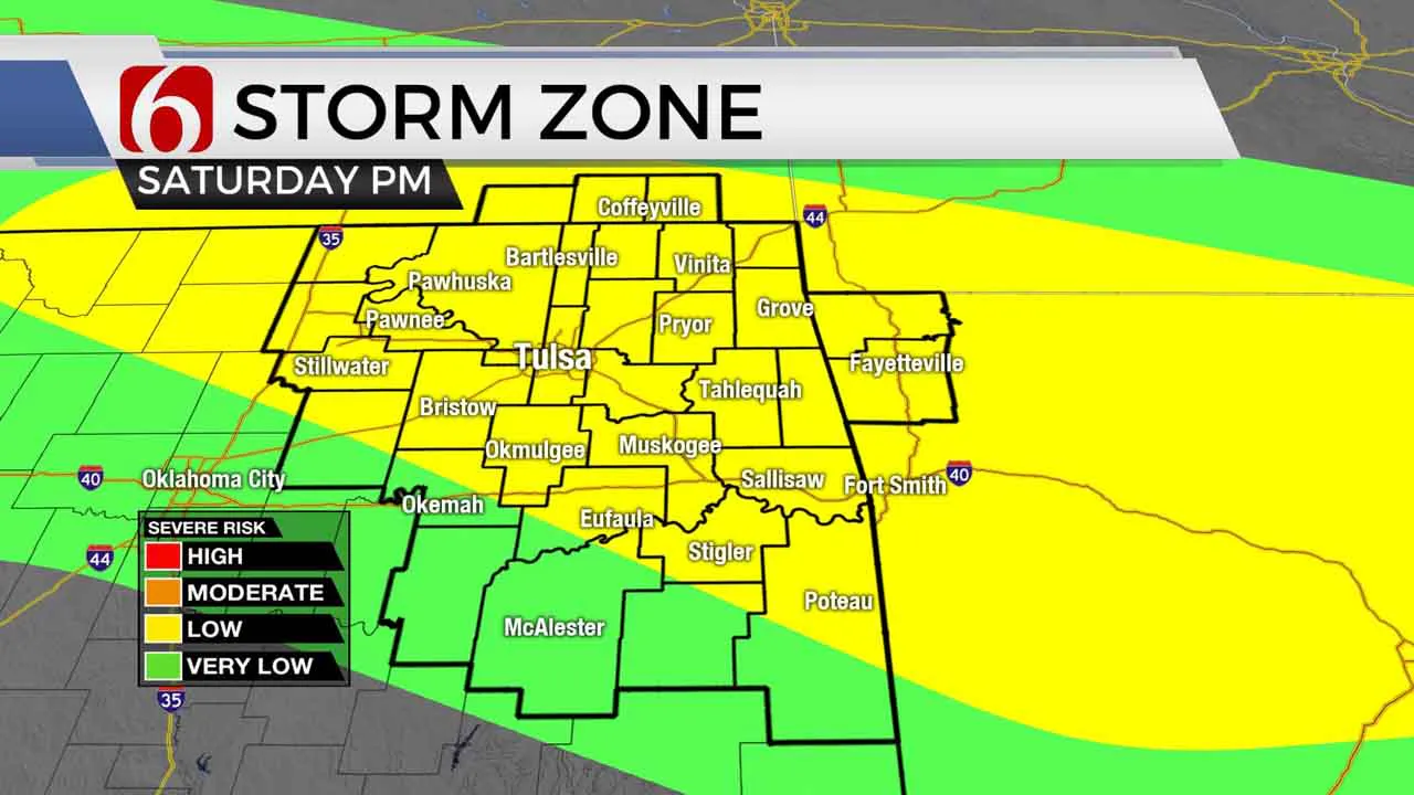
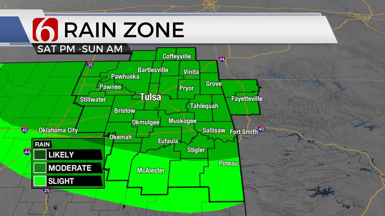
Laura is history. And now we focus on a cold front arriving Saturday that brings thunderstorm chances Saturday night into Sunday morning. Some of the storms may be strong to severe. This boundary will lift northward Sunday into Monday before a stronger surge arrives Tuesday with another chance of storms. This 2nd surge may bring much cooler weather into the state for a few days. The data has not been consistent but continues offering some suggestions of a pre-taste of fall weather Tuesday and Wednesday with rain chances. Highs this afternoon will quickly return into the mid and upper 90s with heat index values anywhere from 100 to 104 near the metro. Muggy weather is also likely Saturday despite north winds by afternoon. Highs will stay in the mid-90s Saturday with heat index numbers in the 100 to 107 range.
The upper air pattern is changing. A mid-level ridge of high pressure will flatten and allow a zonal flow across the central plains. This will help to bring the front southward before stalling Saturday evening into Sunday. As this occurs, storms will be developing near the boundary Saturday afternoon and evening and a few will be strong to severe. The primary threats should be hail and wind but a small window for a tornado would be possible with any discrete supercells ahead of a surface low transiting across northern sections of the state.

The lack of a deep western trough will keep the flow zonal for a few days early next week. But we do see a few signals for a developing western trough that may bring a much stronger upper system near by the middle of the week, including storm chances and a reduction in temps. Hard to imagine with a high today in the upper 90s that fall is less than a month away.
Thanks for reading the Friday morning weather discussion and blog.
Have a super great day!
Alan Crone
More Like This
August 28th, 2020
December 2nd, 2024
November 22nd, 2024
Top Headlines
December 15th, 2024
December 15th, 2024
December 14th, 2024


