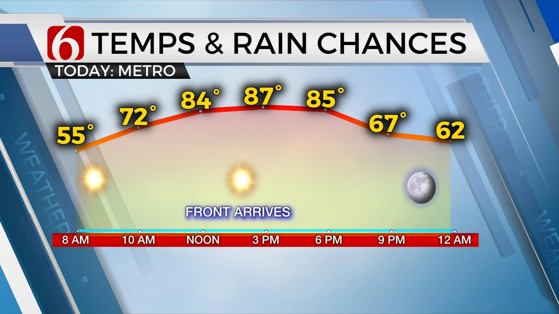
Highs In The 80s With A Cold Front Approaching In The Evening
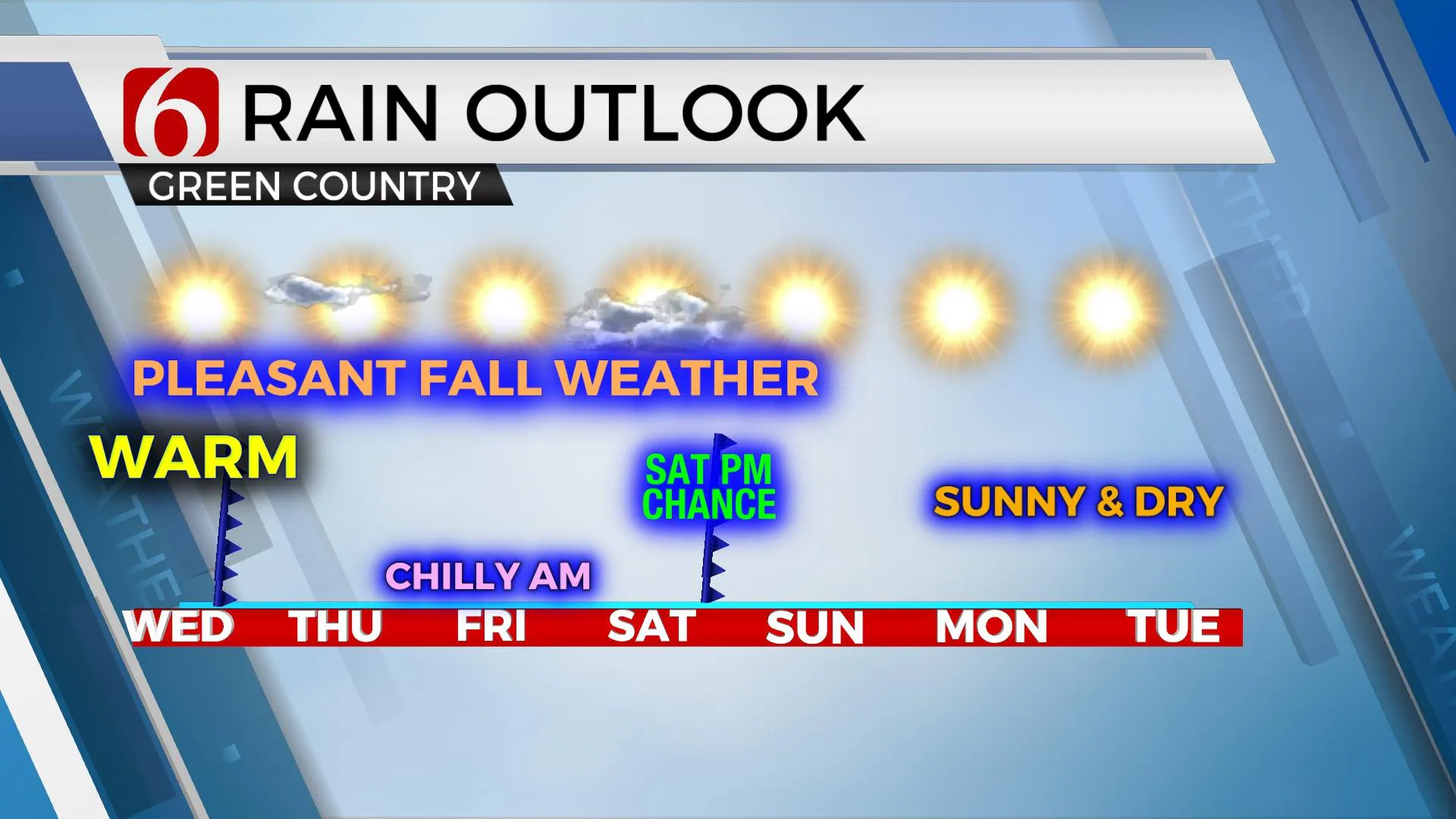
The rollercoaster ride moves up the rails today with the warmest day of the week as we move into the mid to upper 80s before our next cold front arrives this afternoon and tonight. This boundary will enforce the dry and cool weather Thursday with some chilly weather Friday morning. The 2nd front in our current stretch of weather arrives Saturday evening bringing a chance for a few showers or storms across northeastern Oklahoma.Wednesday, September 30th 2020, 6:57 am
The rollercoaster ride moves up the rails today with the warmest day of the week as we move into the mid to upper 80s before our next cold front arrives this afternoon and tonight. This boundary will enforce the dry and cool weather Thursday with some chilly weather Friday morning. The 2nd front in our current stretch of weather arrives Saturday evening bringing a chance for a few showers or storms across northeastern Oklahoma. This system does not appear to be a big severe weather system, but a few brief strong storms may occur in a few spots.
 Image Provided By: Alan Crone
The upper air flow remains with a trough of low pressure centered across the Great Lakes and a ridge of high pressure located across the western third of the nation. The plains states will remain under a northwest upper air flow for the next five to seven days before this pattern changes early next week. This pattern brings a front across the state later this afternoon and a stronger disturbance arrives Saturday evening with a chance for a few showers or storms. The low-level moisture may not be a deep or quality blend but should be enough for a few showers or storms as this front moves across the state Saturday. As low-level moisture attempts a fast comeback, a few showers may develop Saturday morning near and east of Tulsa for a short period with most of the day in good shape. Highs will reach the lower 70s Saturday. The data continue offering a slightly faster frontal intrusion and I will keep this window for a few storms from 6pm Saturday through 10pm. Sunday into Tuesday should be fine, but we may see a slow increase in daytime highs as the pattern changes from a northwest to westerly flow aloft. The data is not exactly consistent for this period and could present some forecast challenges in the days ahead regarding exact temperatures for the early part of next week. A brief look at the next two weeks is concerning as the pattern may keep deeper moisture away from the state. If we don’t pick up some showers Saturday evening, we’ll be soon moving into some elevated fire danger issues in the weeks ahead, even across central and eastern OK. The western third of the state will quickly develop elevated fire danger issues next week.
 Image Provided By: Alan Crone
Be sure and check out my new daily “Weather Out The Door” podcast. You’ll find it on SoundCloud and on most podcast providers. The feed to Apple seems to remain problematic and may not auto update in your application. Search for NewsOn6 podcasts and look for the daily updated version. Thanks for your patience as we work through these issues.
Thanks for reading the Wednesday morning weather discussion and blog.
Have a super great day!
Alan Crone
KOTV
More Like This
September 30th, 2020
February 14th, 2022
January 26th, 2022
January 25th, 2022
Top Headlines
December 14th, 2024
December 14th, 2024
December 14th, 2024


