Strong Winds With Highs In The 60s
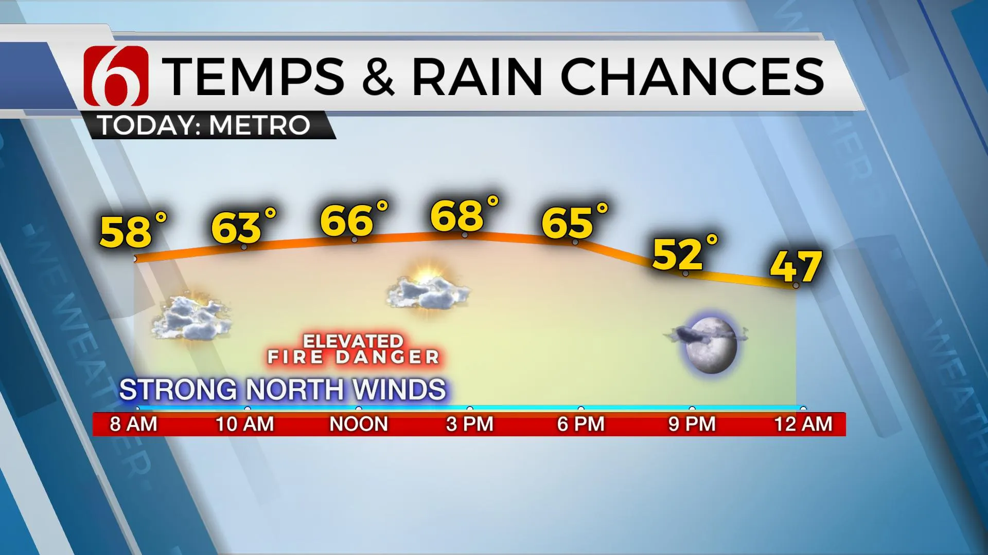
Welcome back to fall. A strong front moved across the state late last night and continues to move southeast this morning. This front is bringing strong north winds from 20 to 30 mph and highs in the 60s todayThursday, October 15th 2020, 5:49 am
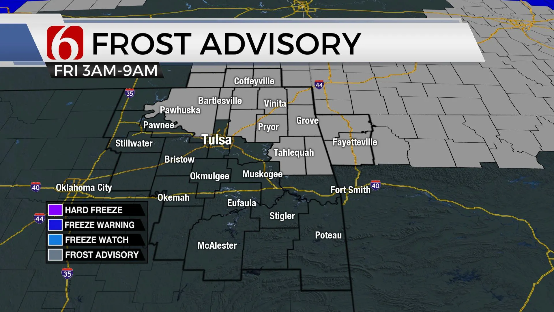
Welcome back to fall. A strong front moved across the state late last night and continues to move southeast this morning. This front is bringing strong north winds from 20 to 30 mph and highs in the 60s today. A surface ridge of high pressure builds near the area tonight and will allow mostly clear sky, light wind and dry air to bring temps down into the 30s north and lower 40s south. A few locations early tomorrow morning may experience patchy frost and a frost advisory will be underway early Friday morning for far northern OK. Friday afternoon will support some pleasant fall weather with sunshine and highs in the mid to upper 60s. Our next system will quickly develop and bring windy weather back to the state Saturday with south winds from 20 to 40 mph before our next front attempts to move across the area Sunday or Monday. As posted here the past few days, we continue to have inconsistencies in the data regarding the exact outcome of this 2nd front Sunday into early next week.

The upper air flow is different in the various data sets regarding Sunday into early next week and this brings differences with how far a cold front can travel into the state. Before this strong front arrives Sunday, the pressure will fall across the Rockies into the southern plains brining strong south winds from 20 to 40 mph Saturday with highs in the mid-70s. GFS data continues its big southward push with the cold front Sunday morning allowing temps dropping from the 50s into the 40s by afternoon along with a chance for a few showers or storms. EURO, and some additional suites, now seem to be trending toward bringing this shallow front across at least northern OK Sunday morning before stalling the boundary across southeastern sections of the state by Sunday afternoon, which is very typical for shallow cold fronts. I’ve elected to lower our Sunday highs across northern OK into the mid and upper 50s while keeping the southern sections in the 60s. The forecast for Sunday remains a low confidence forecast, and additional changes remain likely.

Early next week, this boundary is expected to retreat north as a warm front and bring us back into the lower 70s Monday and near 80 Tue and Wed. Due to the proximity of the boundary across northern OK early next week, there will be a chance for a few showers or storms, mostly north.
Thanks for reading the Thursday morning weather discussion and blog.
Have a super great day!
Alan Crone
KOTV
If you’re into podcast, check out my daily “Weather Out The Door” on your podcast provider. Just search for NewsOn6 and load the latest updated file. Or you can find it on Soundcloud here.
More Like This
October 15th, 2020
February 14th, 2022
January 26th, 2022
January 25th, 2022
Top Headlines
December 12th, 2024
December 12th, 2024
December 12th, 2024
December 12th, 2024


