Summerlike Weather Returns For Wednesday And Thursday
We’re tracking scattered showers this morning along and north of the southern Kansas state line region, well north of a retreating warm front that will bring summerlike weather into the region for the next 48s hoursWednesday, October 21st 2020, 7:18 am
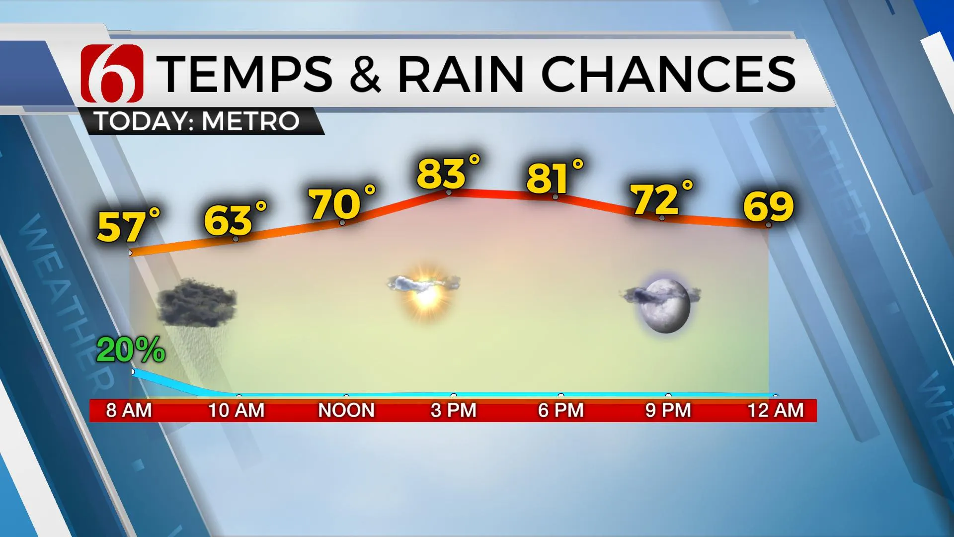
We’re tracking scattered showers this morning along and north of the southern Kansas state line region, well north of a retreating warm front that will bring summerlike weather into the region for the next 48s hours. Highs this afternoon will range from the upper 70s north to lower 80s south along with a return of southerly winds. These same conditions will remain Thursday with slightly stronger afternoon wind gusts before the first of two strong cold fronts will plow over the area bringing a taste of winterlike temps to the state.

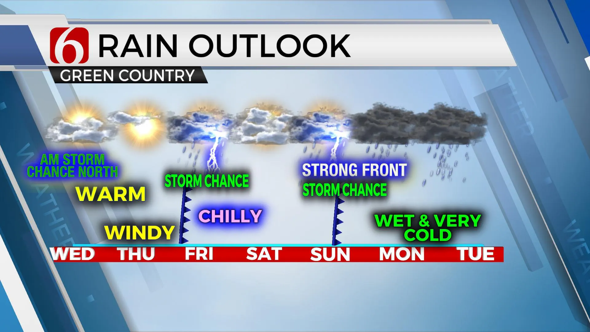
The early morning shower activity has been very disappointing compared to our previous forecast. It appears the low-level jet shifted more north than forecast and kept most of the activity across southern Kansas this morning. Most of us will be dry across northern sections of the state, but I’ll keep a low chance through the next hour or so. We’ll have another chance for rain and storms early Friday morning.
I anticipate a warming trend today along with mostly sunny conditions by afternoon into Thursday before the next system moves across the state. Thursday may be the best weather today this week even though we’ll be tracking some strong and gusty south winds. By late Thursday evening the first front arrives across northwestern OK and should be passing the metro region Friday morning with a few showers and storms along with falling temperatures behind the boundary. We should start Friday morning in the 60s but quickly experience dropping temps into the 40s through the day along with mostly to partly cloudy sky and strong north winds. Saturday will feature morning lows in the 40s and highs only in the mid to upper 50s as north winds will remain for most of the day.

Sunday a much stronger storm system dives down the Rockies into the plains and unleashes arctic air across the northern plains states. The leading edge of this shallow airmass will enter Northern OK Sunday morning to midday. We may start Sunday in the 60s or even lower 70s before temps dive into the lower 40s by afternoon with another gusty wind from the north and a few morning to midday showers or storms. Even colder air arrives Sunday night into Monday morning with many locations near freezing or slightly above it for the morning hours. A disturbance will be positioned to our southwest early next week that should bring moisture up and over the shallow cold air entrenched across northern OK and southern KS. The result may be a mixed bag of wintry precipitation across part of the state and a cold rain across far southeastern OK. It’s too early to know for sure as these data could and probably will change some into early next week. But the trend of colder and wet weather seems to be consistent early next week. Some data suggest upper to mid-20s will be possible for morning lows Tuesday with other data still in the 30s. We’ve not dropped into the 20s for now, but I want you to know that’s a possibility for early next week.
I’m having problems accessing my podcast provider this morning. So, my “Weather Out The Door” may be either delayed or missing for today.
Thanks for reading the Wednesday morning weather discussion and blog.
Have a super great day!
Alan Crone
KOTV
More Like This
October 21st, 2020
February 14th, 2022
January 26th, 2022
January 25th, 2022
Top Headlines
December 12th, 2024
December 12th, 2024
December 12th, 2024
December 12th, 2024


