Summerlike Weather Before Cold-Front Moves In Late Thursday
If you like summer weather, get out and enjoy the weather today because a strong cold front will drop southward into the state late tonight into Friday morning bringing another round of chilly weather to northeastern Oklahoma.Thursday, October 22nd 2020, 5:46 am
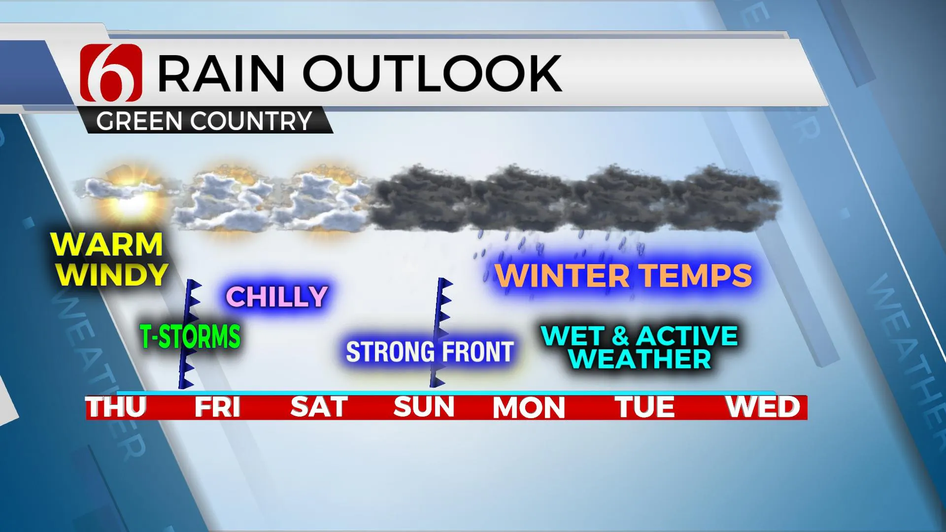
If you like summer weather, get out and enjoy the weather today because a strong cold front will drop southward into the state late tonight into Friday morning bringing another round of chilly weather to northeastern Oklahoma. Showers and storms will also be likely near this boundary overnight into pre-dawn Friday. A few marginally strong to severe storms producing nickel hail can’t be ruled out. Temps will drop from the 60s pre-dawn into the 40s midday to afternoon along with a strong north breeze at 15 to 30 mph. After a mostly cloudy and chilly Saturday, another strong cold front arrives Sunday afternoon with even colder weather across the state, including some mentions for wintry mix early next week and near record low temperatures.

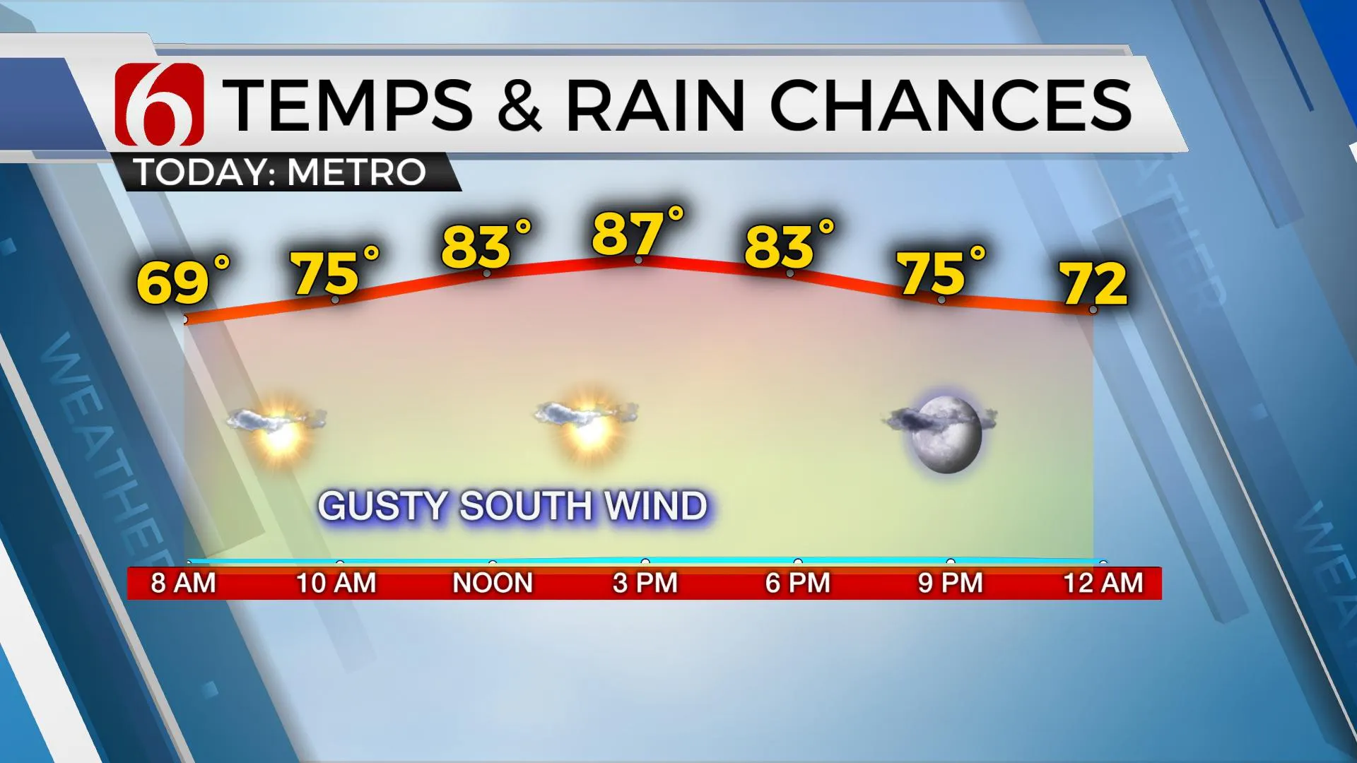
The pressure gradient and mixing will allow strong and gusty south winds from 20 to 30 mph across the state. Top end wind gusts may require a wind advisory later today near and west of the metro. Daytime highs will reach the mid-80s, nearing record highs for some locations, along with sunshine and a few high clouds. Despite the windy weather, this will be the best weather day of the week. The first front comes crashing through the area as a strong upper level wave moves across the central plains with temps falling into the 40s Friday afternoon. This cold air will reside over the area through Saturday along with north winds Saturday afternoon around 10 to 15 mph. The 2nd and stronger front arrives early Sunday midday, but temps along and south of this boundary will be quite warm early Sunday before also falling from the 60s- and 70s into the 40s by afternoon.

The data continue suggesting a surge of shallow cold air (arctic air) arriving Sunday night into early next week supporting a southwestern upper air system bringing moisture up and over the shallow dome of cold air Monday and Tuesday. This is a classic signature that may result in some wintry precipitation, but only if the truly cold air is in place before the moisture arrives. We’ll have more regarding this scenario tomorrow.
Thanks for reading the Thursday morning weather discussion and blog.
Have a super great day
Alan Crone
KOTVC
If you are into podcasts, please check out my daily, mini-podcast “Weather Out The Door”. You’ll find it on Apple, Spotify, TuneIn Radio, and Soundcloud. We hope to add Google podcast soon. You can also ask Alexa to play the latest NewsOn6 podcast. You’ll find the link to today’s briefing on SoundCloud here.
More Like This
October 22nd, 2020
February 14th, 2022
January 26th, 2022
January 25th, 2022
Top Headlines
December 11th, 2024
December 11th, 2024
December 11th, 2024


