Another Cold, Cloudy Day Ahead
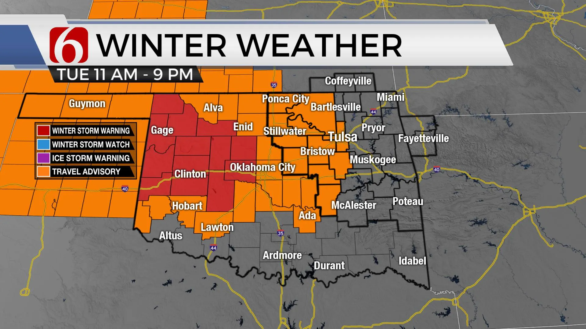
Another cold day is ahead before some light snow nears part of the area later this afternoon before exiting quickly tonight. This does not appear to be a major system for Eastern OK, but some light snow may move across part of the area later this afternoon and evening before exiting quickly tonight into Western Arkansas. Locations near and west of the Tulsa metro will be included in a winter weather advisory for this event. Counties east will not be included. Additional snowfall accumulations frTuesday, December 15th 2020, 6:05 am
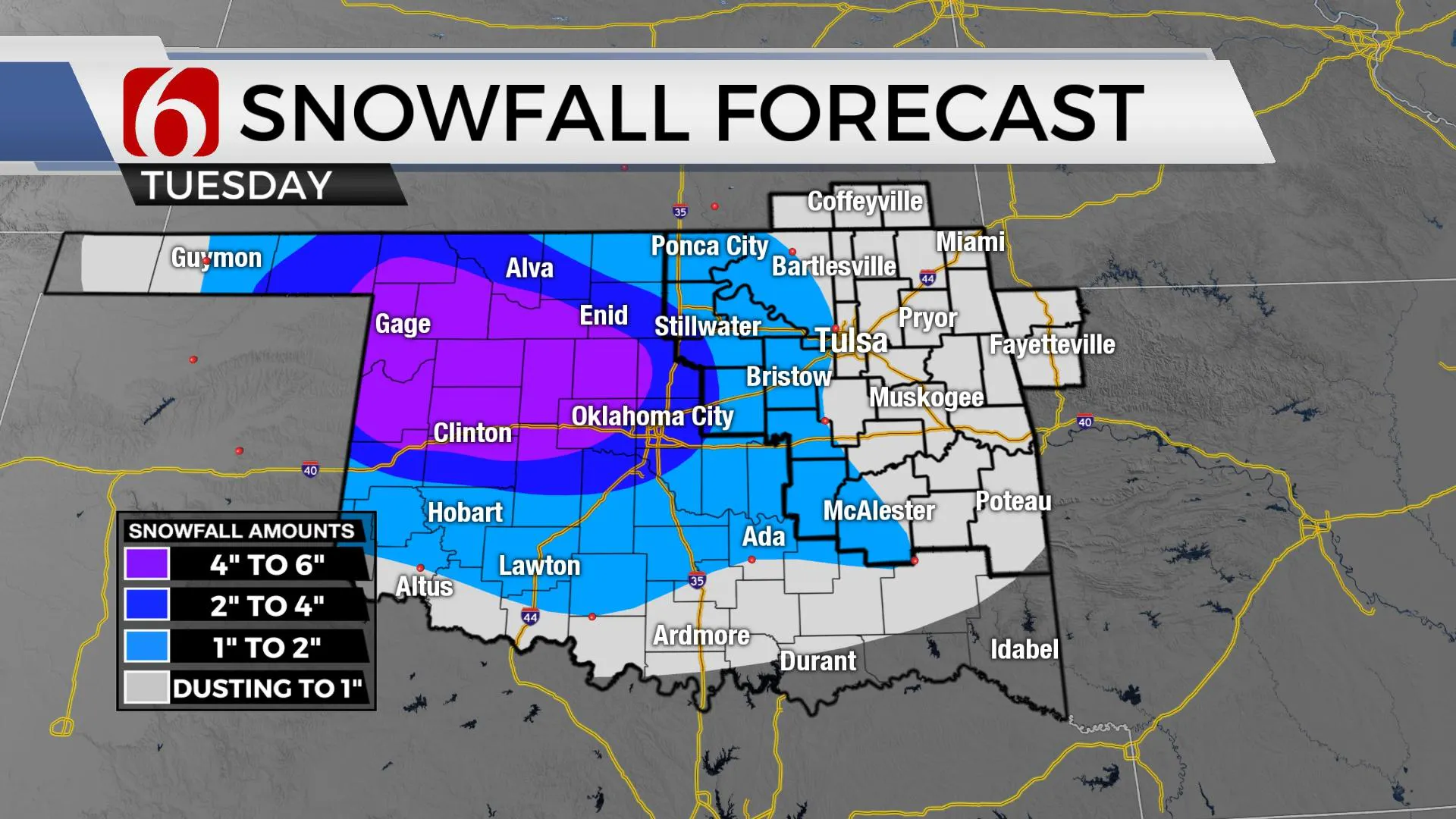
Another cold day is ahead before some light snow nears part of the area later this afternoon before exiting quickly tonight. This does not appear to be a major system for Eastern OK, but some light snow may move across part of the area later this afternoon and evening before exiting quickly tonight into Western Arkansas. Locations near and west of the Tulsa metro will be included in a winter weather advisory for this event. Counties east will not be included. Additional snowfall accumulations from a dusting to near an inch or so will be possible, including the metro. Higher localized amounts are possible to the west, where one to two inches will be possible across western sections of Osage, Pawnee or Creek Co. The greater accumulations with this event will remain and west of I-35 from central to western OK.
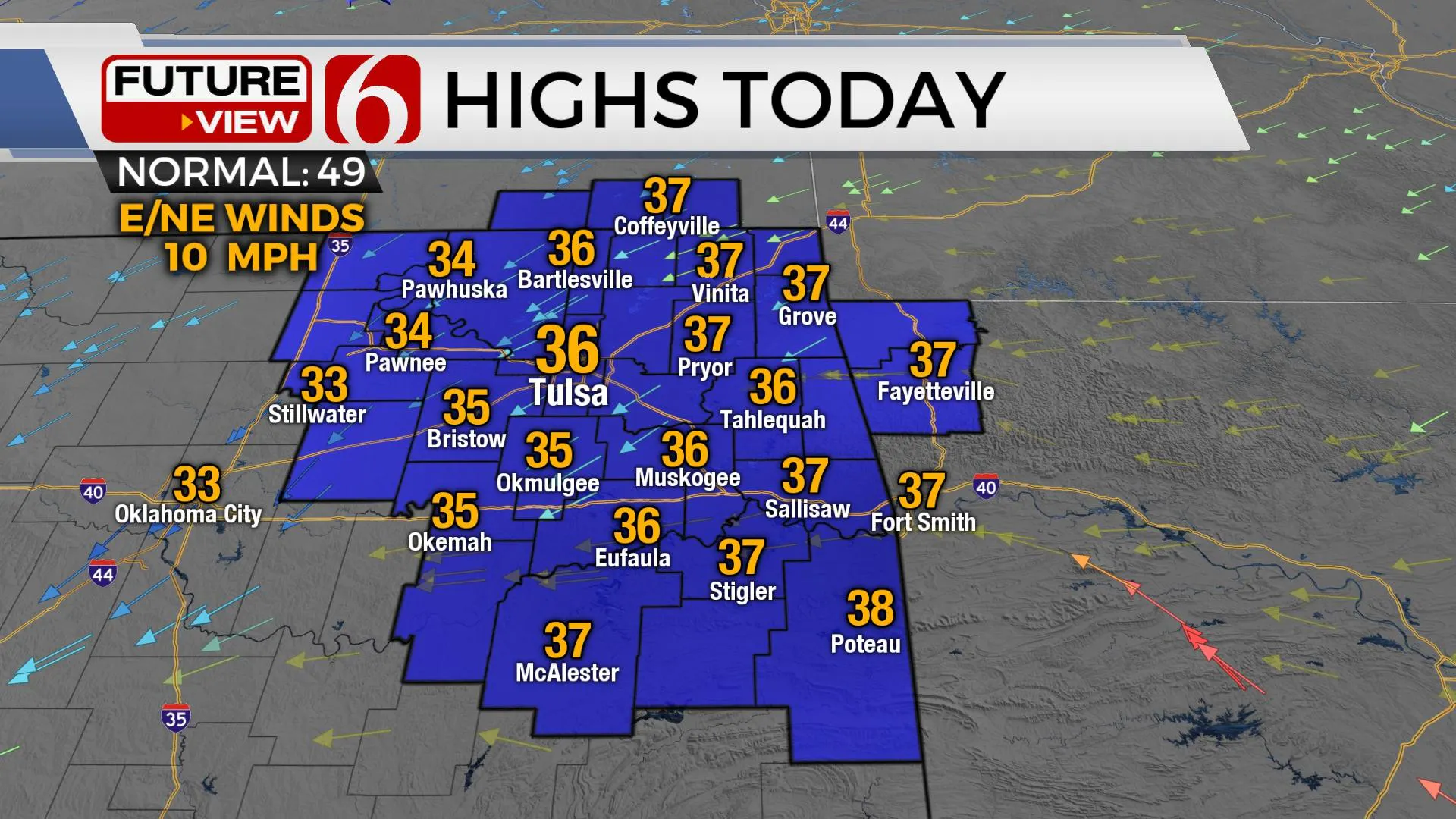
 The timeline for the metro begins this afternoon as the upper air trough begins nearing the region and will end tonight around 9 p.m. to midnight. Temps will start in the 20s this morning with cloudy conditions and reach the mid-30s by noon before falling into the lower 30s during the afternoon as scattered snow showers begin entering the region. The commute this morning will still present a few icy and slick spots, but no falling precipitation is expected this morning. As the storm quickly exits the area tonight, cold weather will remain over the snowpack regions of northeastern OK. Wednesday morning lows will be in the upper teens and lower 20s with afternoon highs only reaching the mid to upper 30s with a partly sunny sky and light winds. Our next system nears the state late Friday night with a chance for a few showers east of the metro, but the thermal profile does not currently support wintry weather. The weekend appears seasonally cool with lows in the 30s and highs in the lower 50s.

Latest and greatest data takes the surface low more southward today compare to Sunday’s system and the upper-level trough slightly more north compared to Sunday’s storm. The upper trough is currently strong to our west but will be weakening or opening with time as it progresses to the east this afternoon. This is not favorable for bringing big snows across northeastern OK. Bottom line: this should not be a big snow maker for northeastern OK, but some light snow will be possible. More to our south, later this afternoon, rain will develop across southern sections of our area and may flip to some snow early evening, including Pittsburg and Latimer Counties. These areas are currently not included in any winter weather advisory but could be added later today.

Before the Friday evening system nears the state, gusty south winds return during the afternoon with wind speeds increasing from 15 to 30 mph gusts. Moisture will be limited, and our probability remains low for the metro but slightly higher to the east late Friday night and early Saturday morning.
Thanks for reading the Tuesday morning weather discussion and blog.
Have a super great day!
Alan Crone
KOTV
If you would rather listen, check out my daily ‘ Weather Out The Door’ mini-podcast briefing.
You’ll find it on most podcast providers, including here on Spotify.
More Like This
December 15th, 2020
February 14th, 2022
January 26th, 2022
January 25th, 2022
Top Headlines
December 15th, 2024
December 15th, 2024
December 15th, 2024
December 15th, 2024


