Green Country Set To Experience Picture Perfect Christmas Day
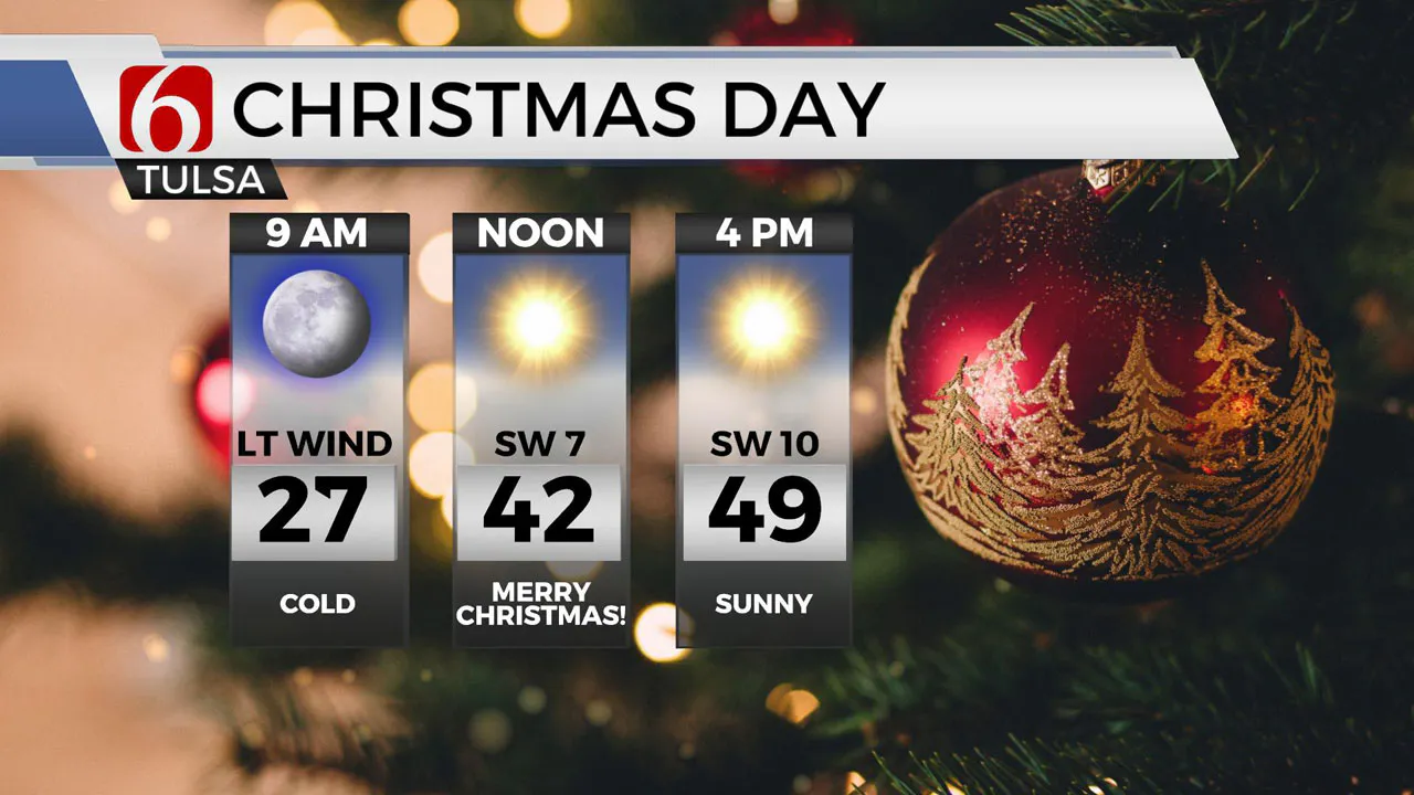
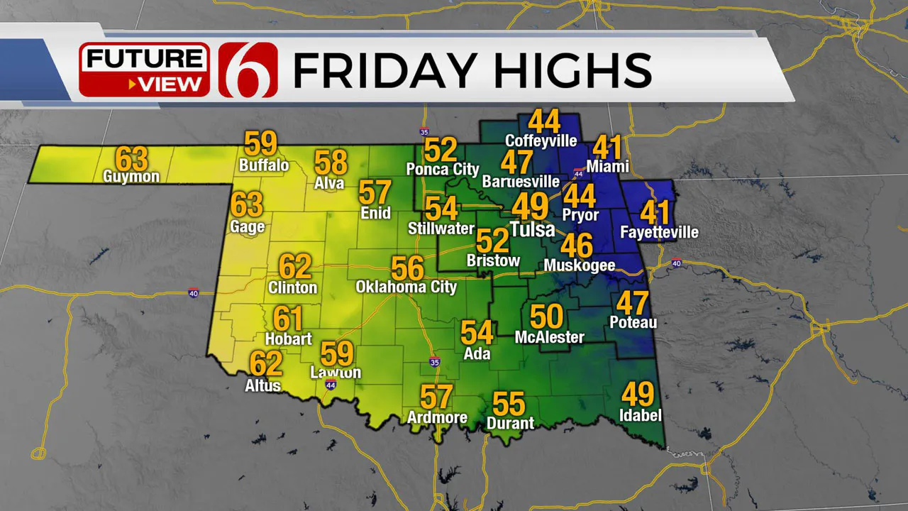
A great Christmas Day is ahead of us with plenty of sunshine and seasonably cool temperatures. Highs this afternoon will reach the upper 40s near the metro and lower-to-mid-40s across far east central portions of the state with southwest winds near 10 miles per hour.Friday, December 25th 2020, 7:35 am
TULSA, Okla. -
All is calm. All is bright.
A great Christmas Day is ahead of us with plenty of sunshine and seasonably cool temperatures. Highs this afternoon will reach the upper 40s near the metro and lower-to-mid-40s across far east central portions of the state with southwest winds near 10 miles per hour.

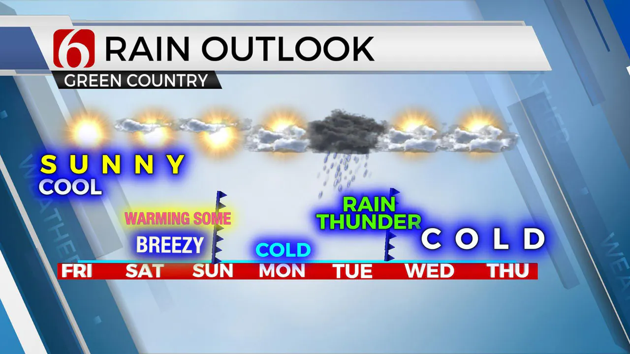
A mini-warming trend is likely this weekend despite a weak front clearing the area Sunday morning. Colder weather is expected to return Monday before another system brings temps and rain chances back up on Tuesday. It’s another famous roller coaster ride in the weather pattern for Oklahoma.
We’ll continue tracking a progressive pattern and this will bring a storm system near the area about every two to four days.

The first one of note brings a wind shift into the Sunday morning. There still may be a few sprinkles with this frontal passage early Sunday morning, but if so, only along the far eastern Oklahoma-western Arkansas region. The downslope wind flow Sunday should keep us into the lower and mid-60s for highs, but colder air will follow Sunday night and bring our highs back into the lower 40s Monday.
The next system rapidly nears Tuesday with gusty south winds and moisture quickly returning. We may have a few Tuesday morning showers or sprinkles, but the main chance for rain and possibly some thunder will arrive Tuesday evening from the west. Most of the moisture will quickly end late Tuesday night before the colder air arrives. We will not include any mention of wintry weather on the departing back side Tuesday night for this update, but this is something we’ll watch for far northeastern Oklahoma or southeastern Kansas pre-dawn Wednesday. Colder weather follows this system with Wednesday and Thursday high temps only in the lower 40s.

Another system may near the area Friday, but the data remains highly inconsistent at this point. We’ll keep you posted.
Thanks for reading the Christmas Morning forecast discussion and blog.
Have a super great day and Merry Christmas!
Check out my mini-podcast, weather briefing.
Search for NewsOn6 ‘Weather Out The Door’ on most podcast providers, including here on Spotify.
More Like This
December 25th, 2020
December 14th, 2024
December 14th, 2024
Top Headlines
December 14th, 2024
December 14th, 2024
December 14th, 2024
December 14th, 2024


