Chilly Monday With Active Weather Ahead For The Last Week Of 2020
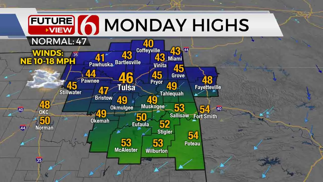
A return to much more December-like temperatures today is just the start of a very active weather week across Green Country to wrap up 2020! It is back to coat weather today with partly to mostly cloudy skies taking over and a brisk north breeze. After highs in the 60s to near 70 over the weekend, we will stay mostly in the 40s across northeastern Oklahoma this afternoon, a little warmer in southeastern Oklahoma. Dry weather is also expected today, but that is also about to change.Monday, December 28th 2020, 6:20 am
A return to much more December-like temperatures today is just the start of a very active weather week across Green Country to wrap up 2020!
It is back to coat weather today with partly to mostly cloudy skies taking over and a brisk north breeze. After highs in the 60s to near 70 over the weekend, we will stay mostly in the 40s across northeastern Oklahoma this afternoon, a little warmer in southeastern Oklahoma. Dry weather is also expected today, but that is also about to change.

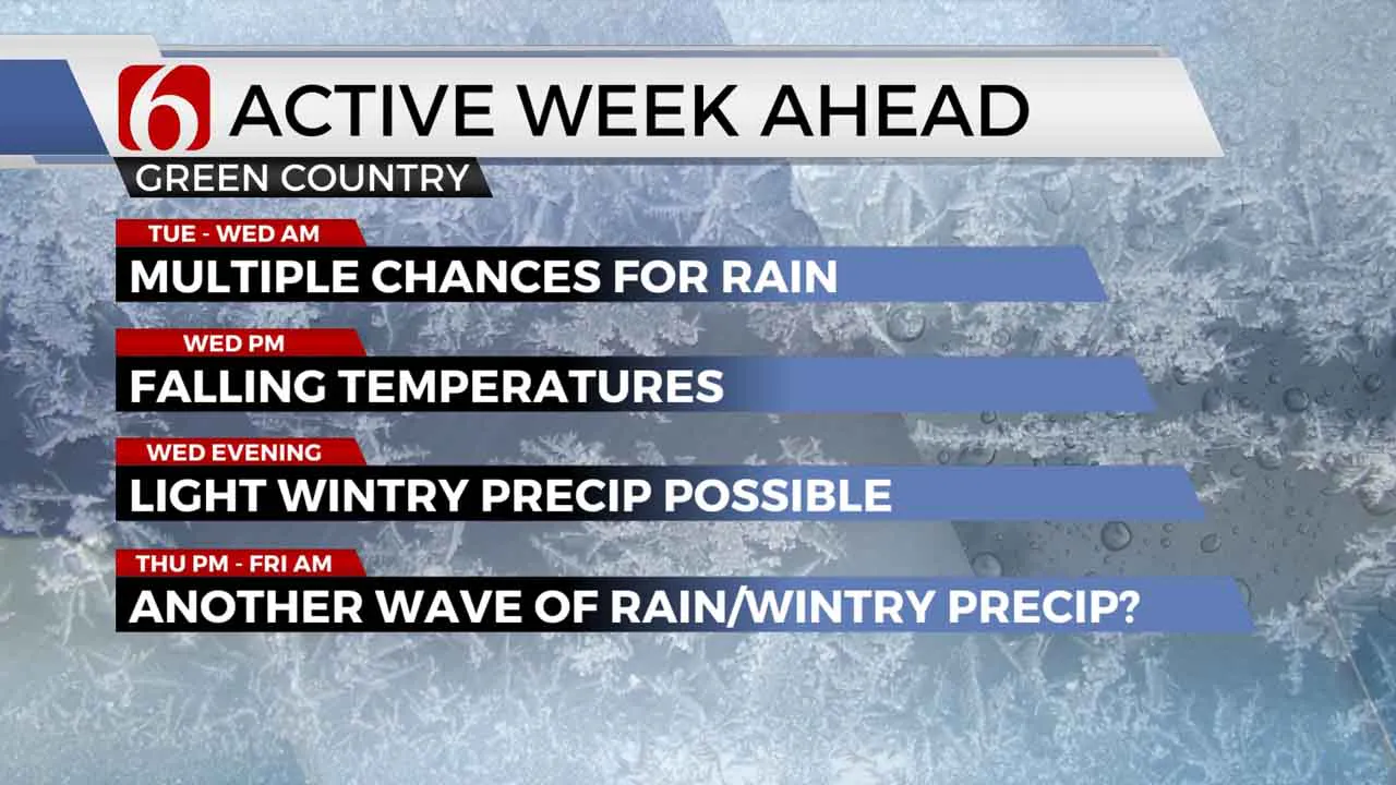
A surge of moisture begins tonight as a powerful upper-level storm system begins to take shape well off to our west. This first wave of moisture will come in the form of drizzle or some light showers early Tuesday morning. As of now, it appears the large majority of Green Country will be above freezing as this occurs, but there may be a brief window for some light freezing rain in far northern Osage County and into southeastern Kansas before sunrise Tuesday. If this does occur though, impacts would be minimal.
A break in steady rain is expected Tuesday afternoon before rain fills in and becomes more widespread across eastern Oklahoma from late Tuesday overnight into Wednesday morning. Some embedded heavy thunderstorms will be possible as well.
From Wednesday afternoon on, however, is where things get pretty tricky. Another cold front will send colder air surging into Green Country by Wednesday afternoon and evening. And if the system slows down enough and that colder air “catches up” to the ongoing rain, there may be a window for a changeover to a wintry mix or some snow by Wednesday night, primarily east of Tulsa. Accumulations in this timeframe appear minor, but that will bear watching.

And the wintry changes do not end there. As colder air becomes entrenched over Green Country on New Year’s Eve on Thursday, the main upper-level low is setting up to track across Texas and potentially lift northeast into Arkansas. This is an upper-level track that could lend itself to more wintry precipitation for at least parts of eastern Oklahoma from New Year’s Eve afternoon into early New Year’s Day morning, with the potential for enough accumulation to cause some travel issues.
However, as we often note with wintry systems that are several days away: There is still a lot of room for things to change! A slight nudge to the east in the track of this system, which is very much still possible, would result in much less impactful weather for us. And unlike the snowstorm we experienced back in the middle of December that had a quick rain-to-snow transition, this system appears it would be much “messier”, with more of a muddled mix of rain, freezing rain, sleet, and snow depending on the exact track. All of that is to say: There is a possibility of wintry weather right around the new year! But it’s still too early for specifics, so stick with us through the week as details become more clear.
I hope you have a great Monday, Green Country! You can also follow me on Twitter @StephenNehrenz as well as my Facebook page Meteorologist Stephen Nehrenz to stay up to date with the very latest.
More Like This
December 28th, 2020
February 14th, 2022
January 26th, 2022
January 25th, 2022
Top Headlines
December 14th, 2024
December 14th, 2024
December 14th, 2024
December 14th, 2024


