Cold, Soggy Wednesday, Wintry Mix Possible In Some Spots
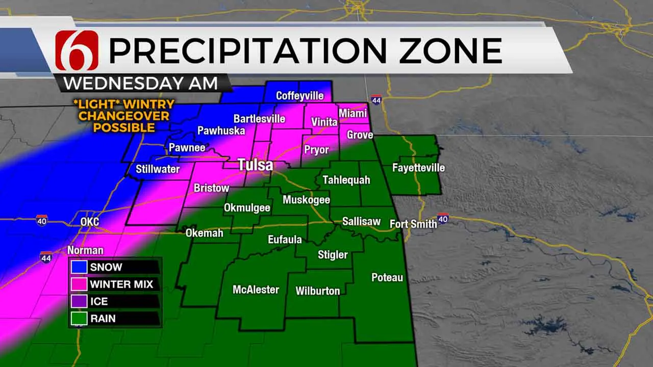
Cold and soggy weather is the name of the game for Green Country in these final couple days of 2020, and we’re continuing to monitor a few potential windows for some minor wintry weather. Widespread rains will continue this morning, gradually shifting further southeast with time. Temperatures will also continue to fall sharply behind a cold front, with most of us in the 30s by midday with wind chills in the 20s. All in all, just not a great day to be outside!Wednesday, December 30th 2020, 7:06 am
Cold and soggy weather is the name of the game for Green Country in these final couple days of 2020, and we’re continuing to monitor a few potential windows for some minor wintry weather.
Widespread rains will continue this morning, gradually shifting further southeast with time. Temperatures will also continue to fall sharply behind a cold front, with most of us in the 30s by midday with wind chills in the 20s. All in all, just not a great day to be outside!

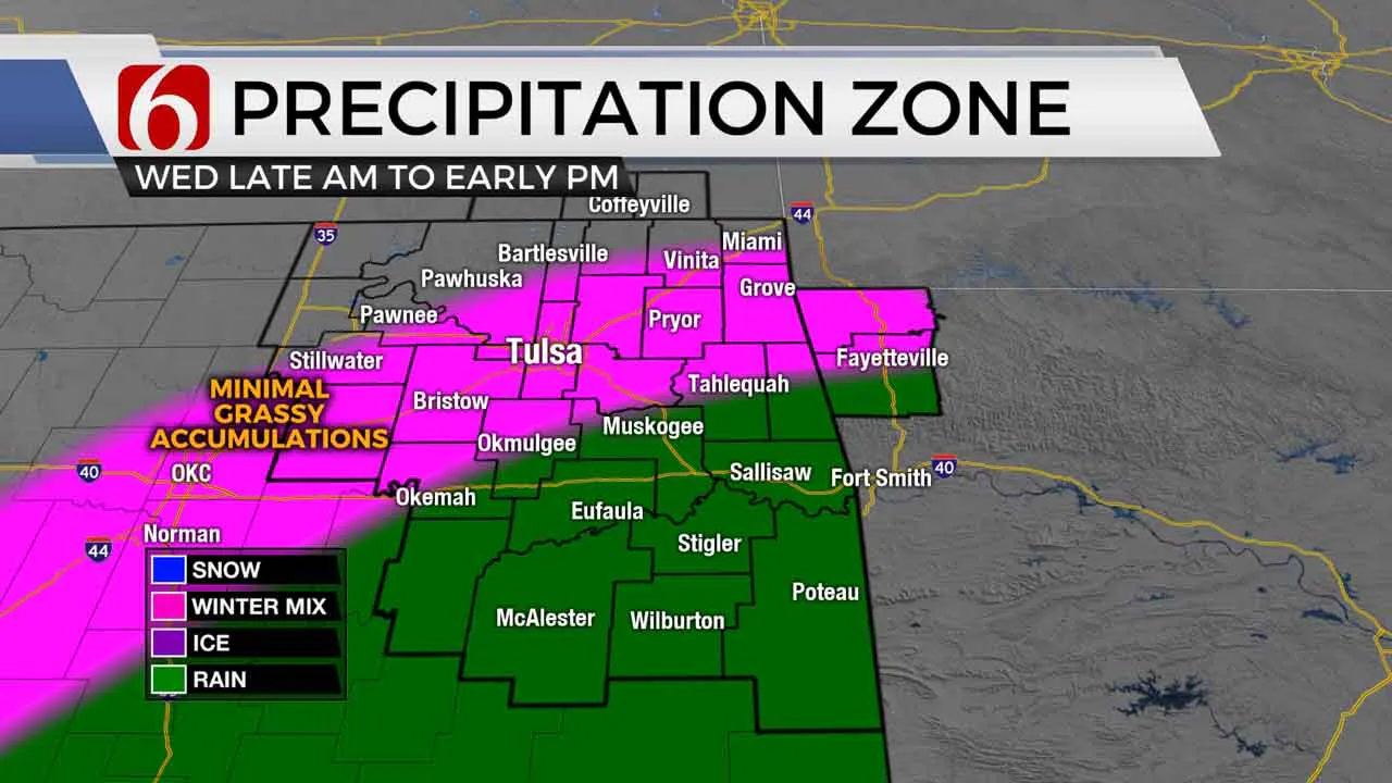
From mid-late morning into early afternoon, some sleet or snow could mix in with the rain generally around and north of the I-44 corridor. Accumulation will likely be hard to come by with ground temperatures still warm and air temperatures still above freezing, but some spots near I-44 could get a quick coating of snow on grassy surfaces today.
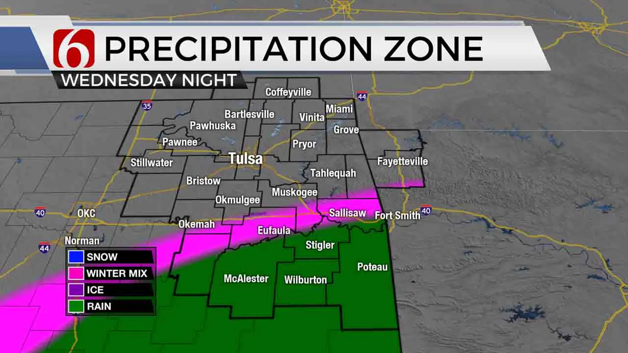
Steadier rains and precipitation will gradually diminish across northeastern Oklahoma this afternoon, with the heavier rainfall moving into far southeastern Oklahoma tonight. Temperatures from Tulsa to the north will fall below freezing overnight into early Thursday (New Year’s Eve) morning, so we’ll have to watch out for some slick spots on elevated surfaces.
Another round of widespread rain will lift north out of Texas during the day Thursday, associated with a strong area of low pressure. By later in the day Thursday into Thursday night, rain will again be widespread across pretty much all of Green Country, and as we hit midnight Thursday night to ring in 2021, it looks very soggy. Temperatures just west and northwest of Tulsa look to hold right at or just below freezing through much of Thursday, so some freezing rain will be possible Thursday with minor ice accumulations on elevated surfaces.

As this strong area of low pressure starts to surge more quickly north, a changeover to snow will occur on the backside of the system Thursday night. The current projection of the track of this low-pressure system still suggests that the best opportunity for snow from late Thursday night into early Friday (New Year’s Day) morning will be west of Tulsa, and closer to the I-35 corridor. Meanwhile, cold rain will once again continue into early Friday morning across the rest of northeastern Oklahoma.
In addition to these wintry windows for parts of Green Country, flooding will also be a concern across southeastern Oklahoma, where 3”-4”+ of rain is a strong possibility from Wednesday through New Year’s. By midday New Year’s Day, precipitation will be dwindling as drier air moves in behind the departing storm system. We may have one additional opportunity for a brief swath of light snow across northeastern Oklahoma early Saturday morning that could produce some minor accumulations.

I hope you have a great Wednesday, Green Country! You can also follow me on Twitter @StephenNehrenz as well as my Facebook page Meteorologist Stephen Nehrenz to stay up to date with the very latest.
More Like This
December 30th, 2020
February 14th, 2022
January 26th, 2022
January 25th, 2022
Top Headlines
December 14th, 2024
December 14th, 2024
December 14th, 2024


