2020 Ends Cold, More Rain, Wintry Precipitation On The Way
The last day of 2020 is finally here! And we’re ending the year on a cold note while tracking more rain and wintry weather headed to Green Country to kick off the new year. We’ll have drier weather for our New Year’s Eve morning and for most of the daylight hours too, as rain holds closer to the Red River until later in the day. But we’ll stay cold with northerly winds and highs only in the upper 30s to around 40 degrees. During the afternoon, rain will start spreading north into southeastern OkThursday, December 31st 2020, 8:37 am
The last day of 2020 is finally here! And we’re ending the year on a cold note while tracking more rain and wintry weather headed to Green Country to kick off the new year.
We’ll have drier weather for our New Year’s Eve morning and for most of the daylight hours too, as rain holds closer to the Red River until later in the day. But we’ll stay cold with northerly winds and highs only in the upper 30s to around 40 degrees. During the afternoon, rain will start spreading north into southeastern Oklahoma, and by late afternoon into this evening that rain will move back into Tulsa and northeastern Oklahoma. Expect very soggy and cold weather at midnight as we ring in 2021!

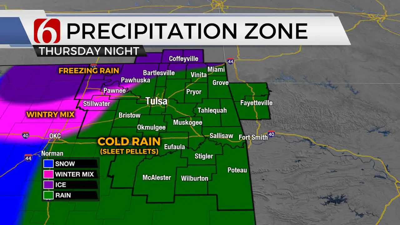
Much of eastern Oklahoma will experience primarily cold rain with from this afternoon into tonight, but west and northwest of Tulsa, some freezing rain or a wintry mix will be possible, especially after about 8 PM into the overnight hours. Some minor ice accumulation could occur late tonight on elevated surfaces in western Pawnee County, western Osage County, northern Washington County, and into southeastern Kansas.
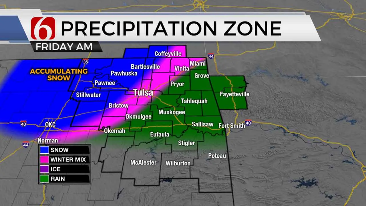
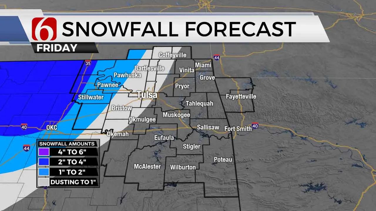
As the steady precipitation continues early New Year’s Day morning, temperatures above the ground will quickly cool, leading to a changeover to snow especially west and north of Tulsa. A couple of inches of snow accumulation are a possibility on the morning of New Year’s Day in parts of Pawnee and Osage Counties and into southeastern Kansas. The snow changeover may also make it to the Tulsa metro as well, but any accumulation in the metro will be highly dependent on the snow transition happening before precipitation rates diminish. Once again, surface temperatures are expected to hold just above freezing, so some melting may also occur.
Rain and snow look to quickly taper off New Year’s Day afternoon, but we’ll stay cold and breezy with yet another day in the 30s to kick-off 2021. But the active weather isn’t totally over from there!

Believe it or not, we’ll have another chance for a swath of light to moderate snow Saturday morning across northeastern Oklahoma, that could produce another quick 1” or so of accumulation in spots on Saturday. We’ll keep you updated!

I hope you have a great New Year’s Eve, Green Country! Stay safe! You can also follow me on Twitter @StephenNehrenz as well as my Facebook page Meteorologist Stephen Nehrenz to stay up to date with the very latest.
More Like This
December 31st, 2020
February 14th, 2022
January 26th, 2022
January 25th, 2022
Top Headlines
December 15th, 2024
December 15th, 2024
December 15th, 2024
December 15th, 2024


