Cold Weather Sticks Around Into The Weekend
Cold weather sticks around through the weekend before some moderating temperatures arrive by the middle of next week. But the progressive pattern will bring systems near the region about every two to four days, including this weekend. The first passes our area to the northeast this evening and the second mostly south of the state for the weekend. But this system will have a chance to bring some snow to at least western and southern OK. Highs this afternoon should stay in the upper 30s and lowerFriday, January 8th 2021, 5:39 am
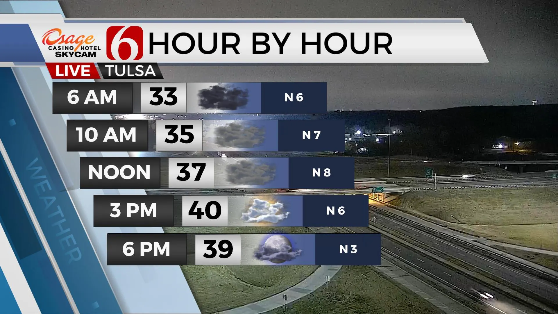
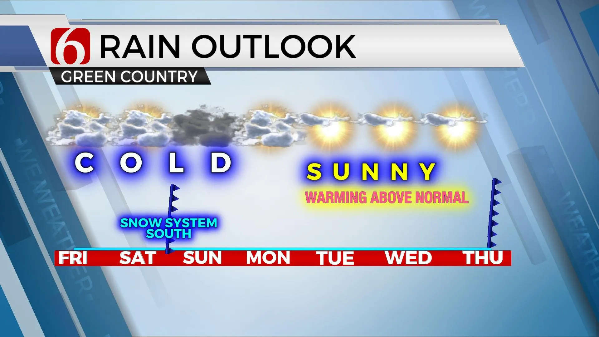
Cold weather sticks around through the weekend before some moderating temperatures arrive by the middle of next week. But the progressive pattern will bring systems near the region about every two to four days, including this weekend. The first passes our area to the northeast this evening and the second mostly south of the state for the weekend. But this system will have a chance to bring some snow to at least western and southern OK. Highs this afternoon should stay in the upper 30s and lower 40s with mostly cloudy skies this morning and north winds near 10 to 15 mph. Some partial thinning of the deck may occur later this afternoon and evening for a few hours but should quickly become mostly cloudy again overnight. We could get a surprise snow flurry or two late tonight into pre-dawn Saturday with this first, weak wave across far northeastern OK or southern Kansas, but this is highly unlikely. Saturday will also be cold with morning lows in the upper 20s and afternoon highs in the lower 40s. The weekend system arriving Saturday evening into Sunday should remain south of our immediate area, but any additional track northward could bring snow chances more north than currently advertised.

The last few runs of most model data have shifted the track of the upper-level system slightly north as it ejects from the west and moves across central or north Texas Sunday evening. Snow will be likely from parts of New Mexico, West Texas, and part of North Texas with this system and may also bring some snow across far western OK and southwestern OK. I will include some low chances for the Arbuckles Sunday morning and extending into far southern OK along the Red River Valley region Sunday evening that could extend northward into part of southeastern OK early Monday morning. Currently, this system should remain too far west or south of the metro for any impacts for northeastern sections. But any additional change to the north in the system could bring some low chances nearby Sunday.
Cold weather remains for a while before moderating temps reach the mid-50s Tuesday and upper 50s Wednesday.

Thanks for reading the Friday morning weather discussion and blog.
Have a super great day!
Alan Crone
KOTV
Check out my daily weather update podcast. Search for NewsOn6 and ‘Weather Out The Door’ on most podcast providers, including here on Spotify.
More Like This
January 8th, 2021
February 14th, 2022
January 26th, 2022
January 25th, 2022
Top Headlines
December 15th, 2024
December 15th, 2024
December 15th, 2024
December 15th, 2024


